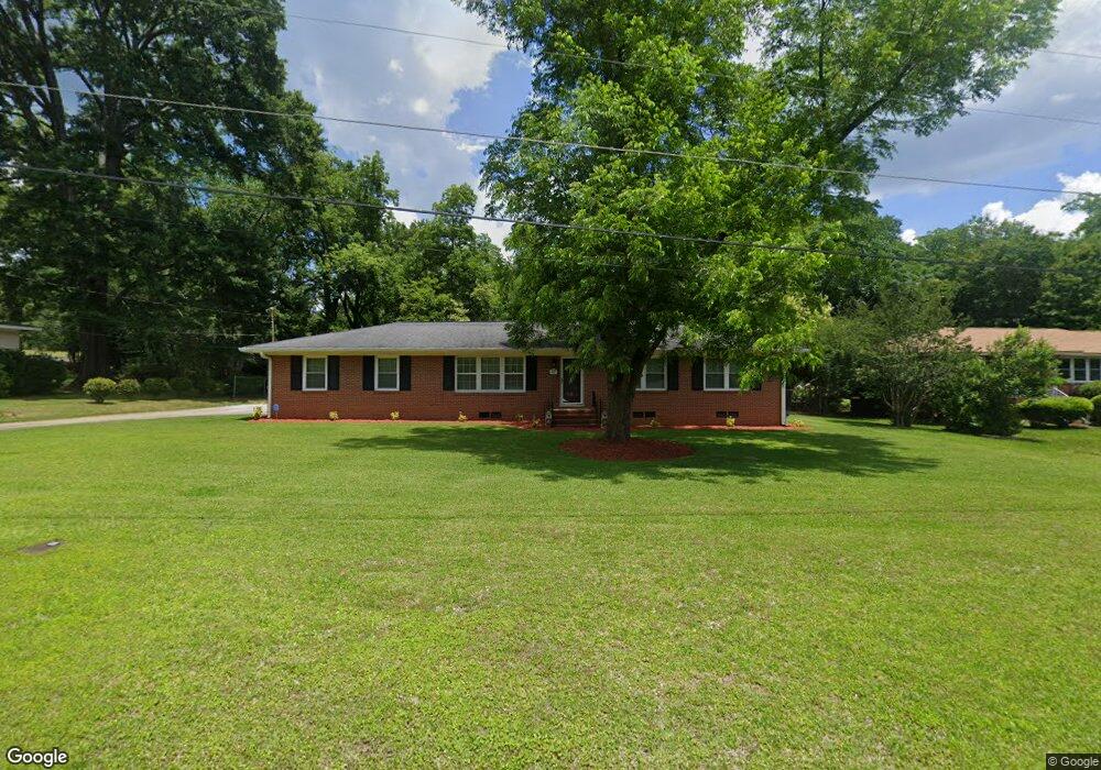
1037 Glenbrook Rd Macon, GA 31210
Estimated Value: $216,895 - $242,000
3
Beds
2
Baths
2,150
Sq Ft
$109/Sq Ft
Est. Value
About This Home
This home is located at 1037 Glenbrook Rd, Macon, GA 31210 and is currently estimated at $234,224, approximately $108 per square foot. 1037 Glenbrook Rd is a home located in Bibb County with nearby schools including Lane Elementary School, Howard Middle School, and Howard High School.
Ownership History
Date
Name
Owned For
Owner Type
Purchase Details
Closed on
Apr 1, 2024
Sold by
Walker Iris
Bought by
Thompson Michael
Current Estimated Value
Purchase Details
Closed on
Aug 7, 2006
Sold by
Tarver Mary
Bought by
Walker Iris
Purchase Details
Closed on
May 13, 2006
Home Financials for this Owner
Home Financials are based on the most recent Mortgage that was taken out on this home.
Original Mortgage
$92,000
Interest Rate
6.41%
Mortgage Type
New Conventional
Purchase Details
Closed on
May 26, 2004
Purchase Details
Closed on
Sep 5, 2003
Create a Home Valuation Report for This Property
The Home Valuation Report is an in-depth analysis detailing your home's value as well as a comparison with similar homes in the area
Home Values in the Area
Average Home Value in this Area
Purchase History
| Date | Buyer | Sale Price | Title Company |
|---|---|---|---|
| Thompson Michael | -- | None Listed On Document | |
| Walker Iris | -- | None Avelable | |
| -- | $100 | -- | |
| Tarver Mary | -- | None Avilebel | |
| -- | $100 | -- | |
| -- | $88,000 | -- |
Source: Public Records
Mortgage History
| Date | Status | Borrower | Loan Amount |
|---|---|---|---|
| Previous Owner | Tarver Mary | $92,000 |
Source: Public Records
Tax History Compared to Growth
Tax History
| Year | Tax Paid | Tax Assessment Tax Assessment Total Assessment is a certain percentage of the fair market value that is determined by local assessors to be the total taxable value of land and additions on the property. | Land | Improvement |
|---|---|---|---|---|
| 2025 | $1,922 | $78,219 | $12,875 | $65,344 |
| 2024 | $1,987 | $78,219 | $12,875 | $65,344 |
| 2023 | $1,491 | $58,703 | $10,300 | $48,403 |
| 2022 | $2,103 | $60,750 | $10,564 | $50,186 |
| 2021 | $2,374 | $62,480 | $10,564 | $51,916 |
| 2020 | $1,900 | $48,946 | $8,451 | $40,495 |
| 2019 | $1,916 | $48,946 | $8,451 | $40,495 |
| 2018 | $3,114 | $48,946 | $8,451 | $40,495 |
| 2017 | $1,792 | $47,832 | $8,029 | $39,803 |
| 2016 | $1,461 | $42,217 | $7,606 | $34,611 |
| 2015 | $1,941 | $39,641 | $6,761 | $32,880 |
| 2014 | $2,233 | $39,641 | $6,761 | $32,880 |
Source: Public Records
Map
Nearby Homes
- 938 Lundy Terrace
- 1161 Ousley Place
- 859 Forest Lake Dr S
- 1197 Matthews Place
- 870 Glen Hill Ct
- 753 Lokchapee Dr
- 825 Forest Lake Dr S
- 731 Lokchapee Dr
- 1246 Newport Rd
- 636 Lokchapee Ridge
- 3678 Northside Dr
- 3640 Northside Dr
- 3622 Northside Dr
- 3602 Northside Dr
- 627 Lokchapee Ridge
- 1270 Lake Valley Rd
- 673 Commanche Dr
- 1344 Lake Valley Rd
- 3500 Northside Dr
- 1224 Timberlane Dr
- 1049 Glenbrook Rd
- 1027 Glenbrook Rd
- 1009 Normandy Rd
- 971 Lockwood Place
- 1017 Normandy Rd
- 1005 Newport Rd
- 1019 Glenbrook Rd
- 1048 Glenbrook Rd
- 1015 Newport Rd
- 1024 Glenbrook Rd
- 963 Lockwood Place
- 1060 Glenbrook Rd
- 1025 Normandy Rd
- 962 Lockwood Place
- 1009 Glenbrook Rd
- 1012 Glenbrook Rd
- 0 Normandy Rd Unit 8533885
- 0 Normandy Rd Unit 8980775
- 0 Normandy Rd Unit 8917101
- 0 Normandy Rd Unit 3180161