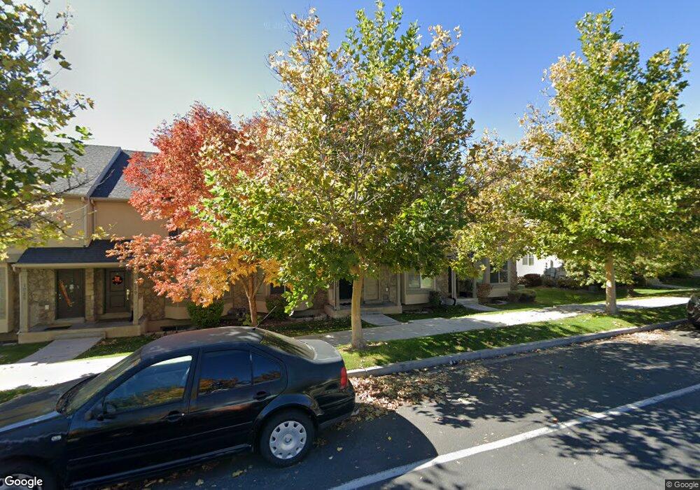
1037 Independence Ave Unit 49 Provo, UT 84604
Rivergrove NeighborhoodEstimated Value: $382,000 - $397,000
3
Beds
3
Baths
1,732
Sq Ft
$226/Sq Ft
Est. Value
About This Home
This home is located at 1037 Independence Ave Unit 49, Provo, UT 84604 and is currently estimated at $392,098, approximately $226 per square foot. 1037 Independence Ave Unit 49 is a home located in Utah County with nearby schools including Westridge Elementary School, Dixon Middle School, and Provo High School.
Ownership History
Date
Name
Owned For
Owner Type
Purchase Details
Closed on
Jan 1, 2018
Sold by
Larson Aaron and Larson Sandra
Bought by
Sl 0007 Llc
Current Estimated Value
Purchase Details
Closed on
Jan 26, 2016
Sold by
Drury Construction Inc
Bought by
Larson Aaron and Larson Sandra
Purchase Details
Closed on
Nov 20, 2015
Sold by
Spencer Trent and Spencer Amber
Bought by
Drury Construction Co Inc
Purchase Details
Closed on
Dec 26, 2012
Sold by
Clifton Norman L and Clifton Donna Lorraine Harris Jex
Bought by
Spencer Trent and Spencer Amber
Purchase Details
Closed on
Apr 26, 2010
Sold by
Clifton Norman and Clifton Lorraine
Bought by
Clifton Norman L and Clifton Donna Lorraine Harris Jex Sage
Purchase Details
Closed on
Apr 20, 2010
Sold by
Independence Avenue Llc
Bought by
Clifton Norman and Clifton Lorraine
Create a Home Valuation Report for This Property
The Home Valuation Report is an in-depth analysis detailing your home's value as well as a comparison with similar homes in the area
Home Values in the Area
Average Home Value in this Area
Purchase History
| Date | Buyer | Sale Price | Title Company |
|---|---|---|---|
| Sl 0007 Llc | -- | None Available | |
| Larson Aaron | -- | None Available | |
| Drury Construction Co Inc | -- | Charger Title | |
| Spencer Trent | -- | None Available | |
| Clifton Norman L | -- | First American Orem | |
| Clifton Norman | -- | First American Orem |
Source: Public Records
Tax History Compared to Growth
Tax History
| Year | Tax Paid | Tax Assessment Tax Assessment Total Assessment is a certain percentage of the fair market value that is determined by local assessors to be the total taxable value of land and additions on the property. | Land | Improvement |
|---|---|---|---|---|
| 2025 | $2,046 | $373,300 | $54,900 | $318,400 |
| 2024 | $2,046 | $201,410 | $0 | $0 |
| 2023 | $1,958 | $190,025 | $0 | $0 |
| 2022 | $1,955 | $191,290 | $0 | $0 |
| 2021 | $1,532 | $261,500 | $39,200 | $222,300 |
| 2020 | $1,616 | $258,500 | $33,600 | $224,900 |
| 2019 | $1,554 | $258,500 | $33,600 | $224,900 |
| 2018 | $1,393 | $235,000 | $29,000 | $206,000 |
| 2017 | $1,233 | $114,345 | $0 | $0 |
| 2016 | $1,203 | $103,950 | $0 | $0 |
| 2015 | $1,133 | $99,000 | $0 | $0 |
| 2014 | $1,069 | $97,350 | $0 | $0 |
Source: Public Records
Map
Nearby Homes
- 2075 W 1080 N
- 2043 W 1100 N
- 962 Independence Ave
- 1127 Independence Ave
- 932 N 1760 W
- 2397 W 1160 N
- 1503 N 1980 W
- 1451 Arthur Dr
- 1454 Lancelot Dr Unit 6F
- 2132 W 450 N
- 1471 W 1460 N
- 1616 N 2100 W
- 871 N 2550 W
- 1662 N 2250 W
- 1375 W 1460 N
- 1682 N 2250 W
- 1679 N 2250 W
- 1383 N 1220 W
- 255 N 1600 W Unit 52
- 255 N 1600 W Unit 148
- 1037 Independence Ave
- 1033 Independence Ave
- 1033 Independence Ave Unit 48
- 1041 Independence Ave
- 1041 Independence Ave Unit 50
- 1029 Independence Ave Unit 47
- 1025 Independence Ave
- 1025 Independence Ave Unit 46
- 1053 Independence Ave
- 1053 Independence Ave Unit 51
- 1021 Independence Ave Unit 45
- 1057 Independence Ave
- 1057 Independence Ave Unit 52
- 1884 W 1020 N
- 1884 W 1020 N Unit 39
- 1061 Independence Ave
- 1061 Independence Ave Unit 53
- 1888 W 1020 N
- 1888 W 1020 N Unit 38
- 1065 Independence Ave