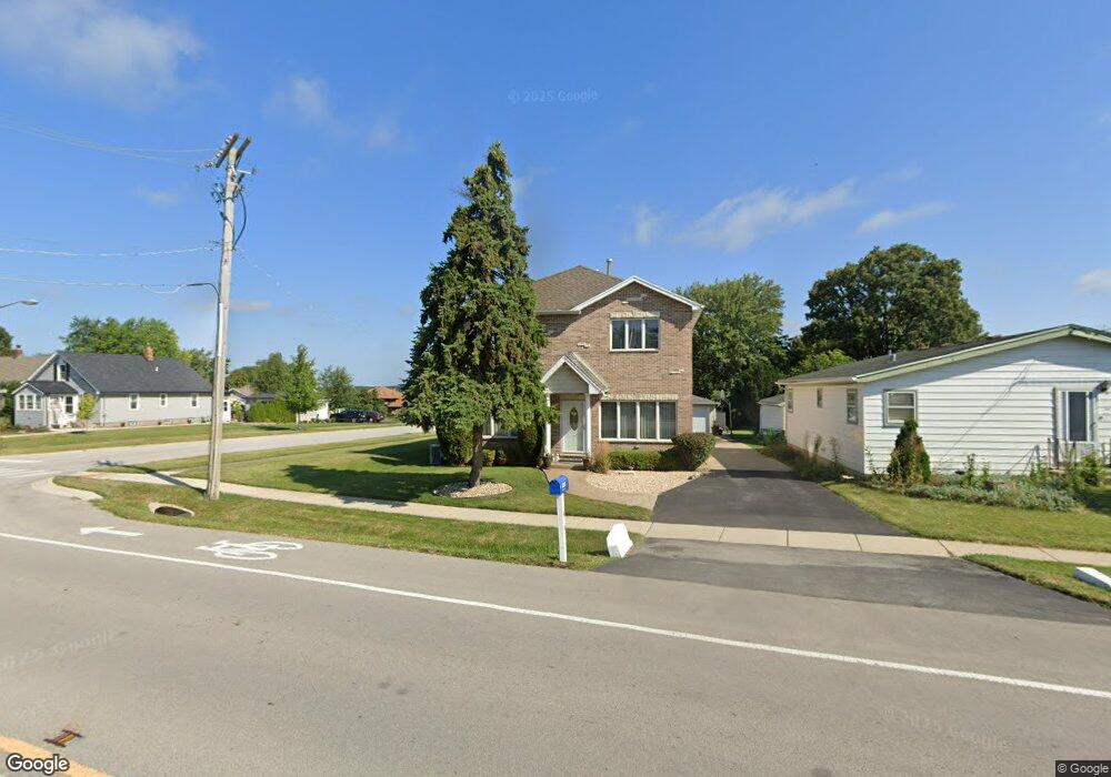
1037 Mccarthy Rd Lemont, IL 60439
Northeast Lemont NeighborhoodEstimated Value: $424,000 - $507,000
4
Beds
2
Baths
2,361
Sq Ft
$195/Sq Ft
Est. Value
About This Home
This home is located at 1037 Mccarthy Rd, Lemont, IL 60439 and is currently estimated at $460,043, approximately $194 per square foot. 1037 Mccarthy Rd is a home located in Cook County with nearby schools including Oakwood School, River Valley School, and Old Quarry Middle School.
Ownership History
Date
Name
Owned For
Owner Type
Purchase Details
Closed on
Jan 25, 2006
Sold by
Schmitt Edward
Bought by
Schmitt Edward A and Velez Sylvia
Current Estimated Value
Home Financials for this Owner
Home Financials are based on the most recent Mortgage that was taken out on this home.
Original Mortgage
$199,500
Interest Rate
6.37%
Mortgage Type
New Conventional
Purchase Details
Closed on
Apr 26, 2001
Sold by
Olinger Barbara A
Bought by
Schmitt Edward A
Home Financials for this Owner
Home Financials are based on the most recent Mortgage that was taken out on this home.
Original Mortgage
$134,598
Interest Rate
7.03%
Mortgage Type
FHA
Create a Home Valuation Report for This Property
The Home Valuation Report is an in-depth analysis detailing your home's value as well as a comparison with similar homes in the area
Home Values in the Area
Average Home Value in this Area
Purchase History
| Date | Buyer | Sale Price | Title Company |
|---|---|---|---|
| Schmitt Edward A | -- | Ticor Title Ins Co 2002 | |
| Schmitt Edward A | $136,500 | Ticor Title |
Source: Public Records
Mortgage History
| Date | Status | Borrower | Loan Amount |
|---|---|---|---|
| Closed | Schmitt Edward A | $199,500 | |
| Closed | Schmitt Edward A | $134,598 |
Source: Public Records
Tax History
| Year | Tax Paid | Tax Assessment Tax Assessment Total Assessment is a certain percentage of the fair market value that is determined by local assessors to be the total taxable value of land and additions on the property. | Land | Improvement |
|---|---|---|---|---|
| 2025 | $5,839 | $31,410 | $7,605 | $23,805 |
| 2024 | $5,839 | $31,410 | $7,605 | $23,805 |
| 2023 | $4,331 | $31,410 | $7,605 | $23,805 |
| 2022 | $4,331 | $21,262 | $6,728 | $14,534 |
| 2021 | $4,220 | $21,260 | $6,727 | $14,533 |
| 2020 | $4,318 | $21,260 | $6,727 | $14,533 |
| 2019 | $5,282 | $26,266 | $6,727 | $19,539 |
| 2018 | $5,194 | $26,266 | $6,727 | $19,539 |
| 2017 | $5,130 | $26,266 | $6,727 | $19,539 |
| 2016 | $4,394 | $21,110 | $5,557 | $15,553 |
| 2015 | $4,430 | $21,110 | $5,557 | $15,553 |
| 2014 | $4,486 | $21,110 | $5,557 | $15,553 |
| 2013 | $4,050 | $20,447 | $5,557 | $14,890 |
Source: Public Records
Map
Nearby Homes
- 441 Wheeler Dr
- 525 Senon Dr
- 11174 Tuscany Ln
- 1004 Saddle Ln
- 614 Czacki St
- 700 Czacki St
- 1268 Durham Ln
- 400 Mccarthy Rd Unit 419
- 400 Mccarthy Rd Unit 421
- 402 Stephen St
- 523 Talcott Ave
- 14517 Albany Ave
- 302 Freehauf St
- 12183 Morandi Ct
- 12185 Morandi Ct
- 12444 Killarney Dr
- 351 Front St Unit 2212
- 1297 Mccarthy Rd
- 342 River St Unit 3402
- 332 River St Unit 4504
- 1041 Mccarthy Rd
- 1027 Mccarthy Rd
- 1023 Mccarthy Rd
- 1023 Mccarthy Rd
- 1023 Mccarthy Rd Unit A
- 2 Wexford Ct
- 1100 Mccarthy Rd
- 2 Lindsay Ct
- 1108 Mccarthy Rd
- 1108 Mccarthy Rd
- 1019 Mccarthy Rd
- 4 Wexford Ct
- 504 2nd St
- 641 Harasek St
- 1017 Mccarthy Rd
- 4 Lindsay Ct
- 1114 Mccarthy Rd
- 651 Harasek St
- 512 2nd St
- 661 Harasek St
Your Personal Tour Guide
Ask me questions while you tour the home.