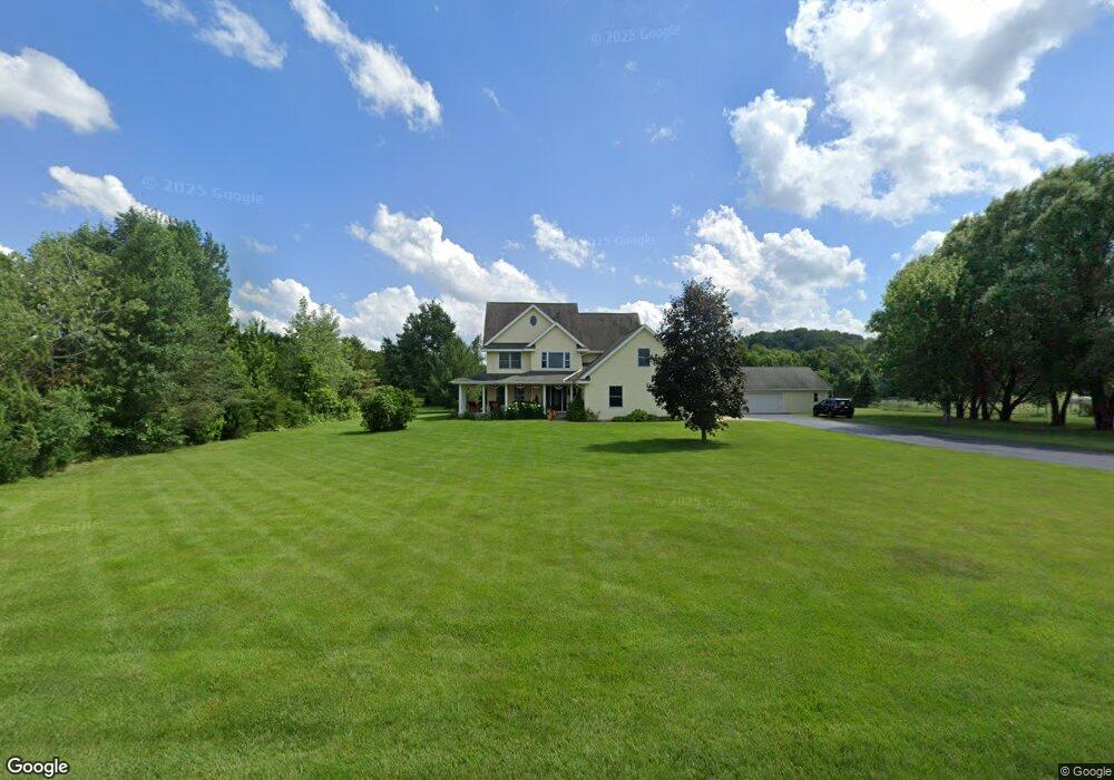
10371 Hudson Rd Mazomanie, WI 53560
Estimated Value: $547,000 - $615,480
4
Beds
2
Baths
--
Sq Ft
2.17
Acres
About This Home
This home is located at 10371 Hudson Rd, Mazomanie, WI 53560 and is currently estimated at $587,370. 10371 Hudson Rd is a home located in Dane County with nearby schools including Wisconsin Heights Elementary School, Mazomanie Elementary School, and Wisconsin Heights Middle School.
Ownership History
Date
Name
Owned For
Owner Type
Purchase Details
Closed on
Mar 18, 2022
Sold by
Gullickson Bruce A and Gullickson Cora A
Bought by
Gullickson Revocable Living Trust
Current Estimated Value
Purchase Details
Closed on
Feb 25, 2005
Sold by
Hosking David J and Hosking Laura L
Bought by
Gullickson Bruce A and Peters Gullickson Cora A
Home Financials for this Owner
Home Financials are based on the most recent Mortgage that was taken out on this home.
Original Mortgage
$248,000
Interest Rate
5.71%
Mortgage Type
New Conventional
Create a Home Valuation Report for This Property
The Home Valuation Report is an in-depth analysis detailing your home's value as well as a comparison with similar homes in the area
Home Values in the Area
Average Home Value in this Area
Purchase History
| Date | Buyer | Sale Price | Title Company |
|---|---|---|---|
| Gullickson Revocable Living Trust | -- | None Listed On Document | |
| Gullickson Revocable Living Trust | -- | None Listed On Document | |
| Gullickson Bruce A | $310,000 | None Available |
Source: Public Records
Mortgage History
| Date | Status | Borrower | Loan Amount |
|---|---|---|---|
| Previous Owner | Gullickson Bruce A | $248,000 |
Source: Public Records
Tax History Compared to Growth
Tax History
| Year | Tax Paid | Tax Assessment Tax Assessment Total Assessment is a certain percentage of the fair market value that is determined by local assessors to be the total taxable value of land and additions on the property. | Land | Improvement |
|---|---|---|---|---|
| 2024 | $6,453 | $509,500 | $90,000 | $419,500 |
| 2023 | $6,451 | $509,500 | $90,000 | $419,500 |
| 2021 | $5,896 | $330,400 | $71,700 | $258,700 |
| 2020 | $5,869 | $330,400 | $71,700 | $258,700 |
| 2019 | $5,219 | $330,400 | $71,700 | $258,700 |
| 2018 | $5,174 | $330,400 | $71,700 | $258,700 |
| 2017 | $5,320 | $330,400 | $71,700 | $258,700 |
| 2016 | $5,431 | $330,400 | $71,700 | $258,700 |
| 2015 | $5,371 | $330,400 | $71,700 | $258,700 |
| 2014 | $5,197 | $330,400 | $71,700 | $258,700 |
| 2013 | $4,840 | $330,400 | $71,700 | $258,700 |
Source: Public Records
Map
Nearby Homes
- 410 University Ln
- 107-109 E North St
- Lot 18 Ridge Run
- 450 Bridge St
- 409 Bridge St
- 0 Scara Brea Ln Unit 2008245
- 14 N John St
- 325 W Division St
- Lot 2 Csm 12049 Highway 14
- 9.9 acres Hwy 14 & Hwy 78 19
- 706 Reeve Rd
- 708 Reeve Rd
- 429 Emily Rd
- 710 Reeve Rd
- 714 Reeve Rd
- 603 Prairie Ln
- 501 Emily Rd
- 505 Emily Rd
- 709 Prairie Ln
- 508 Prairie Ln
- 10367 Hudson Rd
- 10381 Hudson Rd
- 10384 Hudson Rd
- 10370 Hudson Rd
- 10387 E Hudson
- 10387 Hudson Rd
- 10363 Hudson Rd
- 10391 Hudson Rd
- 5868 S Mathewson Rd
- 7.99 ACRES Hwy 78 Lot 2
- Outlot 4 Carter Rd
- 15 ACRES Racek Rd 78
- 50.3 ACRES Dunlap Hollow Rd
- 7.5 ACRES Dunlap Hollow Rd
- Outlot 3 Carter Rd
- 10348 Hudson Rd
- 10385 Curtis Rd
- 10393 Curtis Rd
- 10365 Curtis Rd
- 10359 Curtis Rd