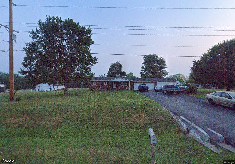
10377 State Route 28 New Vienna, OH 45159
Estimated Value: $279,055 - $394,000
3
Beds
2
Baths
1,624
Sq Ft
$200/Sq Ft
Est. Value
About This Home
This home is located at 10377 State Route 28, New Vienna, OH 45159 and is currently estimated at $324,514, approximately $199 per square foot. 10377 State Route 28 is a home located in Clinton County with nearby schools including East Clinton High School.
Ownership History
Date
Name
Owned For
Owner Type
Purchase Details
Closed on
May 6, 2024
Sold by
Nelson Wendy D
Bought by
Nelson Richard A
Current Estimated Value
Purchase Details
Closed on
Jul 13, 2017
Sold by
Caplinger Madelyn S and Caplinger Richard L
Bought by
Nelson Wendy D and Nelson Richard A
Home Financials for this Owner
Home Financials are based on the most recent Mortgage that was taken out on this home.
Original Mortgage
$151,515
Interest Rate
3.89%
Mortgage Type
FHA
Purchase Details
Closed on
Nov 25, 2013
Sold by
Cochran Robert A and Cochran Barbara Joan
Bought by
Caplinger Richard L and Caplinger Madelyn S
Purchase Details
Closed on
Sep 23, 2005
Sold by
Cochran Robert A and Cochran Barbara Joan
Bought by
Cochran Robert A and Cochran Barbara Joan
Purchase Details
Closed on
Jan 1, 1990
Bought by
Cochran Robert A
Create a Home Valuation Report for This Property
The Home Valuation Report is an in-depth analysis detailing your home's value as well as a comparison with similar homes in the area
Home Values in the Area
Average Home Value in this Area
Purchase History
| Date | Buyer | Sale Price | Title Company |
|---|---|---|---|
| Nelson Richard A | -- | None Listed On Document | |
| Nelson Wendy D | $150,000 | Attorney | |
| Caplinger Richard L | -- | -- | |
| Cochran Robert A | -- | -- | |
| Cochran Robert A | -- | -- |
Source: Public Records
Mortgage History
| Date | Status | Borrower | Loan Amount |
|---|---|---|---|
| Previous Owner | Nelson Wendy D | $151,515 |
Source: Public Records
Tax History Compared to Growth
Tax History
| Year | Tax Paid | Tax Assessment Tax Assessment Total Assessment is a certain percentage of the fair market value that is determined by local assessors to be the total taxable value of land and additions on the property. | Land | Improvement |
|---|---|---|---|---|
| 2024 | $2,707 | $68,220 | $12,990 | $55,230 |
| 2023 | $2,707 | $68,220 | $12,990 | $55,230 |
| 2022 | $2,549 | $55,660 | $6,460 | $49,200 |
| 2021 | $2,573 | $55,660 | $6,460 | $49,200 |
| 2020 | $2,541 | $55,660 | $6,460 | $49,200 |
| 2019 | $2,030 | $43,200 | $6,460 | $36,740 |
| 2018 | $1,922 | $43,200 | $6,460 | $36,740 |
| 2017 | $1,284 | $43,200 | $6,460 | $36,740 |
| 2016 | $1,084 | $37,900 | $5,870 | $32,030 |
| 2015 | $1,079 | $37,900 | $5,870 | $32,030 |
| 2013 | $1,145 | $39,370 | $7,340 | $32,030 |
Source: Public Records
Map
Nearby Homes
- 0 E Fork Rd Unit 1842519
- 0 E Fork Rd Unit 1829555
- 62 Kings Ct
- 208 Dorothy Ln
- 392 Romans Rd
- 1529 Hildebrant Rd
- 0 Hildebrant Rd Unit 1856809
- 5891 Farmers Rd
- 13287 State Route 729
- 57 Kings Ct
- 1056 West Rd
- 429 Cumberland Rd
- 822 Bernard Rd
- 10035 Wolfe Rd
- 3657 Farmers Rd
- 6081 Panhandle Rd
- 89 E Main St
- 67 Sweet St
- 13 S High St
- 13279 Ohio 729
- 10329 State Route 28
- 10350 State Route 28
- 10259 State Route 28
- 10473 St Rt 28
- 10473 State Route 28
- 10404 State Route 28
- 10516 State Route 28
- 173 Lacy Rd
- 10677 Ohio 28
- 10677 State Route 28
- 10004 State Route 28
- 2000 E Fork Rd
- 10004 St Rt 28
- 10004 Sr 28
- 695 E Fork Rd
- 390 Lacy Rd
- 1038 E Fork Rd
- 908 E Fork Rd
- 4.2ac E Fork Rd
- 5.323ac E Fork Rd