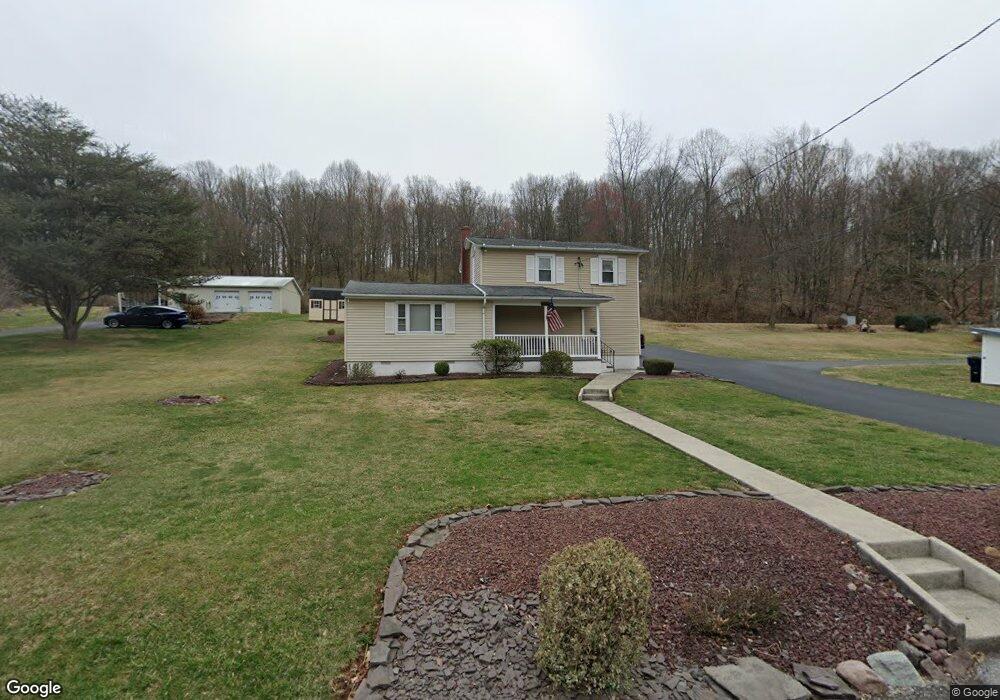
1038 Baker Rd Reading, PA 19608
Estimated Value: $198,000 - $315,000
2
Beds
1
Bath
1,578
Sq Ft
$160/Sq Ft
Est. Value
About This Home
This home is located at 1038 Baker Rd, Reading, PA 19608 and is currently estimated at $252,222, approximately $159 per square foot. 1038 Baker Rd is a home located in Berks County with nearby schools including Shiloh Hills Elementary School, Wilson Southern Middle School, and Wilson High School.
Ownership History
Date
Name
Owned For
Owner Type
Purchase Details
Closed on
May 30, 2003
Sold by
Trusty Rodney K
Bought by
Lightner Stephen E
Current Estimated Value
Home Financials for this Owner
Home Financials are based on the most recent Mortgage that was taken out on this home.
Original Mortgage
$84,000
Outstanding Balance
$35,941
Interest Rate
5.46%
Mortgage Type
Purchase Money Mortgage
Estimated Equity
$216,281
Purchase Details
Closed on
Jan 4, 2002
Sold by
Boyer Gladys Mae and Lebo Gladys Mae
Bought by
Trusty Rodney K
Create a Home Valuation Report for This Property
The Home Valuation Report is an in-depth analysis detailing your home's value as well as a comparison with similar homes in the area
Home Values in the Area
Average Home Value in this Area
Purchase History
| Date | Buyer | Sale Price | Title Company |
|---|---|---|---|
| Lightner Stephen E | $105,000 | -- | |
| Trusty Rodney K | $45,000 | -- |
Source: Public Records
Mortgage History
| Date | Status | Borrower | Loan Amount |
|---|---|---|---|
| Open | Lightner Stephen E | $84,000 |
Source: Public Records
Tax History
| Year | Tax Paid | Tax Assessment Tax Assessment Total Assessment is a certain percentage of the fair market value that is determined by local assessors to be the total taxable value of land and additions on the property. | Land | Improvement |
|---|---|---|---|---|
| 2025 | $1,503 | $69,300 | $35,600 | $33,700 |
| 2024 | $2,965 | $69,300 | $35,600 | $33,700 |
| 2023 | $2,825 | $69,300 | $35,600 | $33,700 |
| 2022 | $2,756 | $69,300 | $35,600 | $33,700 |
| 2021 | $2,659 | $69,300 | $35,600 | $33,700 |
| 2020 | $2,659 | $69,300 | $35,600 | $33,700 |
| 2019 | $2,583 | $69,300 | $35,600 | $33,700 |
| 2018 | $2,561 | $69,300 | $35,600 | $33,700 |
| 2017 | $2,518 | $69,300 | $35,600 | $33,700 |
| 2016 | $761 | $69,300 | $35,600 | $33,700 |
| 2015 | $761 | $69,300 | $35,600 | $33,700 |
| 2014 | $761 | $69,300 | $35,600 | $33,700 |
Source: Public Records
Map
Nearby Homes
- 63 Preston Rd
- 90 Preston Rd
- 110 S Cacoosing Dr
- 1181 LOT 3 Fritztown Rd
- 1185 Fritztown Rd
- 1192 Fritztown Rd
- 0 Cushion Peak Rd
- 3137 E Galen Hall Rd
- 13 Eagles Ln
- 0 Preston Rd
- 20 Mellowbrook Dr
- 457 Epsilon Dr Unit 45
- 447 Epsilon Dr
- 310 Mail Route Rd
- 3 James Rd
- 555 Lincoln Dr
- 13 Ligaro Way
- 119 Carriage Dr
- 120 Great Bend Way
- 300 Beckley St
- 1034 Baker Rd
- 988 Fritztown Rd
- 1032 Baker Rd
- 1040 Baker Rd
- 990 Fritztown Rd
- 1030 Baker Rd
- 0 Fritztown Rd Unit 1007370522
- 0 Fritztown Rd Unit 2 1002769983
- 0 Fritztown Rd Unit 2 1002769965
- 0 Fritztown Rd Unit 2 1002731701
- 0 Fritztown Rd Unit 235321
- 0 Fritztown Rd Unit 236962
- 0 Fritztown Rd Unit 238529
- 0 Fritztown Rd Unit 5544907
- 0 Fritztown Rd Unit 5544896
- 0 Fritztown Rd Unit 5681453
- 0 Fritztown Rd Unit 5681505
- 0 Fritztown Rd Unit 5859220
- 0 Fritztown Rd Unit 5859212
- 0 Fritztown Rd Unit 5859206
Your Personal Tour Guide
Ask me questions while you tour the home.