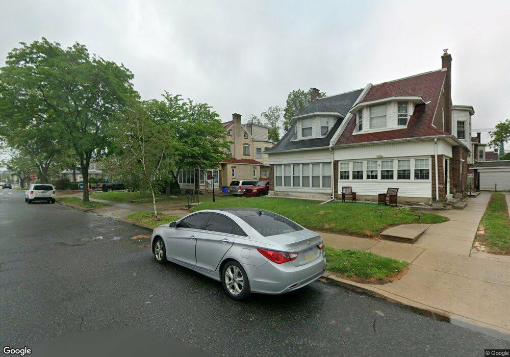
1038 Bridge St Philadelphia, PA 19124
Frankford NeighborhoodEstimated Value: $255,000 - $335,000
4
Beds
1
Bath
1,828
Sq Ft
$162/Sq Ft
Est. Value
About This Home
This home is located at 1038 Bridge St, Philadelphia, PA 19124 and is currently estimated at $295,436, approximately $161 per square foot. 1038 Bridge St is a home located in Philadelphia County with nearby schools including Frankford High School, The Philadelphia Charter School for the Arts & Sciences, and Northwood Academy Charter School.
Ownership History
Date
Name
Owned For
Owner Type
Purchase Details
Closed on
Jul 29, 2008
Sold by
Pierce Donald
Bought by
Pierce Donald and Pierce Joann C
Current Estimated Value
Purchase Details
Closed on
May 6, 2005
Sold by
Pierce Donald and Pierce Dawn Lynn
Bought by
Pierce Donald
Home Financials for this Owner
Home Financials are based on the most recent Mortgage that was taken out on this home.
Original Mortgage
$94,000
Outstanding Balance
$48,539
Interest Rate
5.79%
Mortgage Type
New Conventional
Estimated Equity
$246,897
Purchase Details
Closed on
Jan 8, 1999
Sold by
Pierce Donald and Pierce Dawn Lynn
Bought by
Pierce Donald and Pierce Dawn Lynn
Purchase Details
Closed on
May 27, 1994
Sold by
Kelly James C and Kelly Marion Jane
Bought by
Pierce Donald and Pierce Dawn Lynn
Create a Home Valuation Report for This Property
The Home Valuation Report is an in-depth analysis detailing your home's value as well as a comparison with similar homes in the area
Home Values in the Area
Average Home Value in this Area
Purchase History
| Date | Buyer | Sale Price | Title Company |
|---|---|---|---|
| Pierce Donald | -- | None Available | |
| Pierce Donald | -- | -- | |
| Pierce Donald | -- | -- | |
| Pierce Donald | $82,000 | -- |
Source: Public Records
Mortgage History
| Date | Status | Borrower | Loan Amount |
|---|---|---|---|
| Open | Pierce Donald | $94,000 |
Source: Public Records
Tax History Compared to Growth
Tax History
| Year | Tax Paid | Tax Assessment Tax Assessment Total Assessment is a certain percentage of the fair market value that is determined by local assessors to be the total taxable value of land and additions on the property. | Land | Improvement |
|---|---|---|---|---|
| 2026 | $3,112 | $277,300 | $55,460 | $221,840 |
| 2025 | $3,112 | $277,300 | $55,460 | $221,840 |
| 2024 | $3,112 | $277,300 | $55,460 | $221,840 |
| 2023 | $3,112 | $222,300 | $44,460 | $177,840 |
| 2022 | $1,767 | $177,300 | $44,460 | $132,840 |
| 2021 | $2,396 | $0 | $0 | $0 |
| 2020 | $2,396 | $0 | $0 | $0 |
| 2019 | $2,300 | $0 | $0 | $0 |
| 2018 | $1,786 | $0 | $0 | $0 |
| 2017 | $2,206 | $0 | $0 | $0 |
| 2016 | $1,786 | $0 | $0 | $0 |
| 2015 | $1,710 | $0 | $0 | $0 |
| 2014 | -- | $157,600 | $61,250 | $96,350 |
| 2012 | -- | $22,784 | $3,902 | $18,882 |
Source: Public Records
Map
Nearby Homes
- 1048 Bridge St
- 1137 Bridge St
- 5659 Miriam Rd
- 5661 Miriam Rd
- 5640 Miriam Rd
- 972 Bridge St
- 1204 Pratt St
- 5505 Loretto Ave
- 996 Anchor St
- 991 Carver St
- 1218 Pratt St
- 1220 Pratt St
- 5347 Sylvester St
- 934 Brill St
- 1244 E Sanger St
- 1431 Rosalie St
- 934 E Sanger St
- 1225 E Cheltenham Ave
- 5118 Oakland St
- 925 E Sanger St
- 1032 Bridge St
- 1030 Bridge St
- 1040 Bridge St
- 1046 Bridge St
- 1039 Granite St
- 1033 Granite St
- 1041 Granite St
- 1031 Granite St
- 1047 Granite St
- 5243 Castor Ave
- 5237 Castor Ave
- 5245 Castor Ave
- 5235 Castor Ave
- 1021 Bridge St
- 1023 Bridge St
- 1019 Bridge St
- 1017 Bridge St
- 1025 Bridge St
- 5229 Castor Ave
- 1015 Bridge St