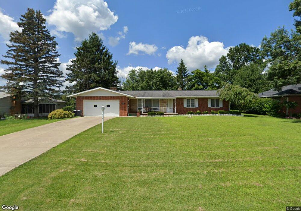
1038 Devonwood Rd Mansfield, OH 44907
Estimated Value: $238,000 - $243,000
3
Beds
2
Baths
1,604
Sq Ft
$150/Sq Ft
Est. Value
About This Home
This home is located at 1038 Devonwood Rd, Mansfield, OH 44907 and is currently estimated at $240,373, approximately $149 per square foot. 1038 Devonwood Rd is a home located in Richland County with nearby schools including Mansfield Christian School, Discovery School, and Mansfield Seventh-day Adventist School.
Ownership History
Date
Name
Owned For
Owner Type
Purchase Details
Closed on
Apr 4, 2019
Sold by
Estate Of Kathleen Maureen O Leary
Bought by
Leary Sean O and Leary Colleen O
Current Estimated Value
Purchase Details
Closed on
Oct 1, 2001
Sold by
Kovacs Lajos J
Bought by
O'Leary Christine M
Home Financials for this Owner
Home Financials are based on the most recent Mortgage that was taken out on this home.
Original Mortgage
$121,500
Interest Rate
6.97%
Mortgage Type
New Conventional
Create a Home Valuation Report for This Property
The Home Valuation Report is an in-depth analysis detailing your home's value as well as a comparison with similar homes in the area
Home Values in the Area
Average Home Value in this Area
Purchase History
| Date | Buyer | Sale Price | Title Company |
|---|---|---|---|
| Leary Sean O | -- | Chicago Title | |
| O'Leary Christine M | $135,000 | -- |
Source: Public Records
Mortgage History
| Date | Status | Borrower | Loan Amount |
|---|---|---|---|
| Previous Owner | O'Leary Christine M | $121,500 |
Source: Public Records
Tax History
| Year | Tax Paid | Tax Assessment Tax Assessment Total Assessment is a certain percentage of the fair market value that is determined by local assessors to be the total taxable value of land and additions on the property. | Land | Improvement |
|---|---|---|---|---|
| 2024 | $2,761 | $57,650 | $8,910 | $48,740 |
| 2023 | $2,760 | $57,650 | $8,910 | $48,740 |
| 2022 | $2,543 | $44,520 | $7,770 | $36,750 |
| 2021 | $2,561 | $44,520 | $7,770 | $36,750 |
| 2020 | $2,619 | $44,520 | $7,770 | $36,750 |
| 2019 | $2,460 | $37,720 | $6,580 | $31,140 |
| 2018 | $2,427 | $37,720 | $6,580 | $31,140 |
| 2017 | $2,401 | $37,720 | $6,580 | $31,140 |
| 2016 | $2,440 | $37,790 | $6,250 | $31,540 |
| 2015 | $1,751 | $37,790 | $6,250 | $31,540 |
| 2014 | $1,728 | $37,790 | $6,250 | $31,540 |
| 2012 | $703 | $39,770 | $6,580 | $33,190 |
Source: Public Records
Map
Nearby Homes
- 400 James Ave
- 1179 Burkwood Rd
- 0 Lexington Ave Unit 224009661
- 0 George Ave
- 489 Clifton Blvd
- 810 Lexington Ave
- 104 Elmridge Rd
- 575 Crescent Rd
- 33 Rambleside Dr
- 695 S Andover Rd
- 470 Lexington Ave
- 466 Lexington Ave
- 101 Chilton Ave
- 986 Woodland Rd
- 456 Lexington Ave
- 341 Townview Cir N
- 65 Logan Rd
- 755 Locust Ln
- 655 Woodhill Rd
- 310 Townview Cir N
- 1030 Devonwood Rd
- 1048 Devonwood Rd
- 1052 Devonwood Rd
- 1020 Devonwood Rd
- 1037 Devonwood Rd
- 1047 Devonwood Rd
- 1031 Devonwood Rd
- 1060 Devonwood Rd
- 1051 Devonwood Rd
- 1021 Devonwood Rd
- 1033 Larchwood Rd
- 1061 Devonwood Rd
- 1066 Devonwood Rd
- 1013 Devonwood Rd
- 1038 Yorkwood Rd
- 1048 Yorkwood Rd
- 1030 Yorkwood Rd
- 1052 Yorkwood Rd
- 1020 Yorkwood Rd
- 1067 Devonwood Rd
Your Personal Tour Guide
Ask me questions while you tour the home.