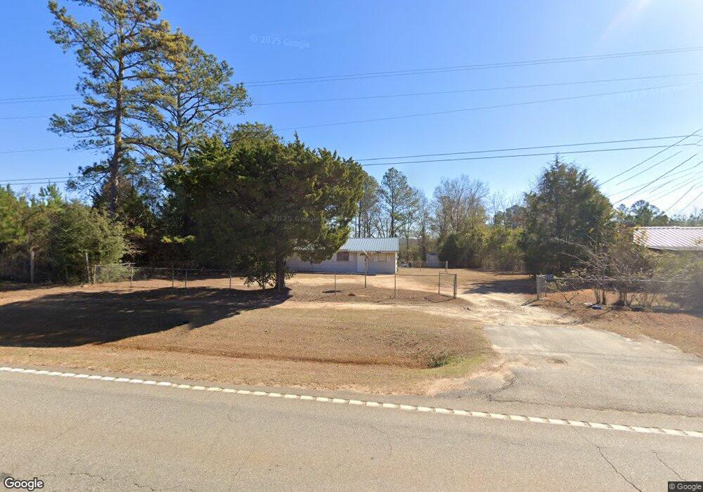
1038 Ga Highway 39 S Georgetown, GA 39854
Estimated Value: $41,593 - $110,000
2
Beds
1
Bath
800
Sq Ft
$108/Sq Ft
Est. Value
About This Home
This home is located at 1038 Ga Highway 39 S, Georgetown, GA 39854 and is currently estimated at $86,148, approximately $107 per square foot. 1038 Ga Highway 39 S is a home with nearby schools including Quitman County Elementary School and Quitman County High School.
Ownership History
Date
Name
Owned For
Owner Type
Purchase Details
Closed on
Jul 21, 2000
Sold by
Gillis Marvin W
Bought by
Barnett Edward
Current Estimated Value
Purchase Details
Closed on
May 27, 1999
Sold by
Walker Nell O
Bought by
Gillis Marvin W
Purchase Details
Closed on
May 24, 1999
Sold by
Walker Walker J and Walker T
Bought by
Walker Nell O
Purchase Details
Closed on
May 25, 1994
Sold by
Walker Walker J and Walker T
Bought by
Walker Walker J and Walker T
Purchase Details
Closed on
Jul 28, 1992
Sold by
Walker Walker J and Walker T
Bought by
Walker Walker J and Walker T
Create a Home Valuation Report for This Property
The Home Valuation Report is an in-depth analysis detailing your home's value as well as a comparison with similar homes in the area
Home Values in the Area
Average Home Value in this Area
Purchase History
| Date | Buyer | Sale Price | Title Company |
|---|---|---|---|
| Barnett Edward | $26,000 | -- | |
| Gillis Marvin W | $18,000 | -- | |
| Walker Nell O | -- | -- | |
| Walker Walker J | -- | -- | |
| Walker Walker J | $20,000 | -- |
Source: Public Records
Tax History Compared to Growth
Tax History
| Year | Tax Paid | Tax Assessment Tax Assessment Total Assessment is a certain percentage of the fair market value that is determined by local assessors to be the total taxable value of land and additions on the property. | Land | Improvement |
|---|---|---|---|---|
| 2025 | $490 | $10,201 | $1,860 | $8,341 |
| 2024 | $490 | $10,201 | $1,860 | $8,341 |
| 2023 | $636 | $14,905 | $1,860 | $13,045 |
| 2022 | $636 | $14,905 | $1,860 | $13,045 |
| 2021 | $300 | $9,025 | $1,116 | $7,909 |
| 2020 | $300 | $9,025 | $1,116 | $7,909 |
| 2019 | $300 | $9,025 | $1,116 | $7,909 |
| 2018 | $289 | $9,025 | $1,116 | $7,909 |
| 2017 | $229 | $9,362 | $1,116 | $8,246 |
| 2016 | $239 | $9,362 | $1,116 | $8,246 |
| 2015 | -- | $9,362 | $1,116 | $8,246 |
| 2014 | -- | $9,362 | $1,116 | $8,246 |
| 2013 | -- | $9,362 | $1,116 | $8,245 |
Source: Public Records
Map
Nearby Homes
- 15 Bay Ln
- 2036 Georgia 39
- 1794 Georgia 50
- 48 Ralph Sr Rd
- 10 Whip o Will Ln
- 0 Lots 2 3 4 Point Dr Unit 20065
- 0 Tanglewood Trail Unit 27290
- 102-103 Magnolia Dr
- 0 Old 39 Rd Unit 15.69
- 15.69 Old 39 Rd
- 111 Arrowhead Dr
- 98 Cool Branch Rd
- 000 Cool Branch Rd
- 0 Cool Branch Rd
- 1 Cool Branch Rd
- 0 Lower Lumpkin Rd
- 0 Lower Lumpkin Rd Unit 10511110
- 24 Point Dr
- 43 Plantation Blvd
- LOT 215 Winding Way Blvd
- 1036 Ga Highway 39 S
- 1028 Ga Highway 39 S
- 1043 Ga Hwy 39 S
- 563 Old 39 Rd
- 613 Old 39 Rd
- 613 Old 39 Rd
- 1063 Ga Highway 39 S
- 561 Old 39 Rd
- 000 Joy Ln
- 0 Old Hwy 39
- 0 N A Unit 10131326
- N/A N A
- 51 Lakeside Dr
- 1090 Ga Highway 39 S
- 978 Ga Highway 39 S
- 1101 Ga Highway 39 S
- 10 Lot 10
- 1112 Ga Highway 39 S
- 507 Old 39 Rd
- 507 Old 39 Rd