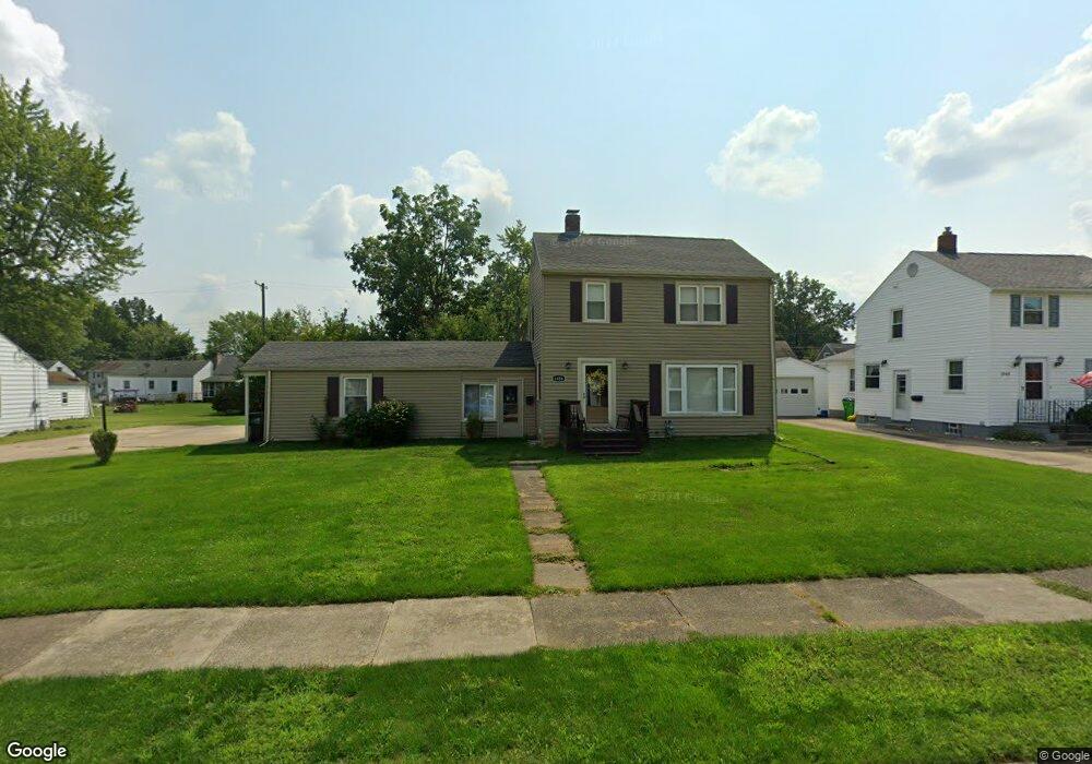
1038 Lilly Rd Alliance, OH 44601
Estimated Value: $155,000 - $200,000
3
Beds
1
Bath
1,248
Sq Ft
$136/Sq Ft
Est. Value
About This Home
This home is located at 1038 Lilly Rd, Alliance, OH 44601 and is currently estimated at $170,322, approximately $136 per square foot. 1038 Lilly Rd is a home located in Stark County with nearby schools including Alliance Early Learning School, Alliance Intermediate School at Northside, and Alliance Middle School.
Ownership History
Date
Name
Owned For
Owner Type
Purchase Details
Closed on
Apr 10, 1998
Sold by
Koehn Leslie D
Bought by
Zaleski Martin A and Zaleski Tracie L
Current Estimated Value
Home Financials for this Owner
Home Financials are based on the most recent Mortgage that was taken out on this home.
Original Mortgage
$72,396
Outstanding Balance
$13,851
Interest Rate
7.19%
Mortgage Type
New Conventional
Estimated Equity
$156,471
Purchase Details
Closed on
Feb 20, 1996
Sold by
Stillwell John R
Bought by
Koehn Leslie D and Koehn Karen
Purchase Details
Closed on
Nov 30, 1994
Sold by
Stillwell Mary H
Bought by
Stillwell John R and Stillwell Ronda
Purchase Details
Closed on
Oct 2, 1989
Create a Home Valuation Report for This Property
The Home Valuation Report is an in-depth analysis detailing your home's value as well as a comparison with similar homes in the area
Home Values in the Area
Average Home Value in this Area
Purchase History
| Date | Buyer | Sale Price | Title Company |
|---|---|---|---|
| Zaleski Martin A | $80,900 | -- | |
| Koehn Leslie D | $79,550 | -- | |
| Stillwell John R | $45,000 | -- | |
| -- | $45,000 | -- |
Source: Public Records
Mortgage History
| Date | Status | Borrower | Loan Amount |
|---|---|---|---|
| Open | Zaleski Martin A | $72,396 |
Source: Public Records
Tax History
| Year | Tax Paid | Tax Assessment Tax Assessment Total Assessment is a certain percentage of the fair market value that is determined by local assessors to be the total taxable value of land and additions on the property. | Land | Improvement |
|---|---|---|---|---|
| 2025 | -- | $46,940 | $16,280 | $30,660 |
| 2024 | -- | $46,940 | $16,280 | $30,660 |
| 2023 | $1,474 | $36,680 | $12,880 | $23,800 |
| 2022 | $1,484 | $36,680 | $12,880 | $23,800 |
| 2021 | $1,485 | $36,680 | $12,880 | $23,800 |
| 2020 | $1,335 | $30,800 | $11,200 | $19,600 |
| 2019 | $1,316 | $30,590 | $11,200 | $19,390 |
Source: Public Records
Map
Nearby Homes
- 1016 Roseland Rd
- 1539 Parkway Blvd
- 1718 Fernwood Blvd
- 1534 Fernwood Blvd
- 864 W College Rd
- 720 Vincent Blvd
- 1156 Parkside Dr
- 1310 Overlook Dr
- 0 Federal Ave
- 2120 Blenheim Ave
- 1114 Briarcliff Ave
- 1044 Glamorgan St
- 1601 Raywood Rd
- 2580 Edgewood Ave
- 1235 Spring Ridge Cir Unit 17A
- 2630 Blenheim Ave
- 664 Fairview Place
- 2625 Belleflower Dr
- 2635 Blenheim Ave
- 203 Glamorgan St
- 1048 Lilly Rd
- 1022 Lilly Rd
- 1054 Lilly Rd
- 1014 Lilly Rd
- 1037 W College Rd
- 1021 W College Rd
- 1047 W College Rd
- 1004 Lilly Rd
- 1062 Lilly Rd
- 1053 W College Rd
- 1029 Lilly Rd
- 1045 Lilly Rd
- 1015 W College Rd
- 1061 W College Rd
- 1007 W College Rd
- 1070 Lilly Rd
- 1015 Lilly Rd
- 998 Lilly Rd
- 1061 Lilly Rd
- 1061 Lilly Rd
Your Personal Tour Guide
Ask me questions while you tour the home.