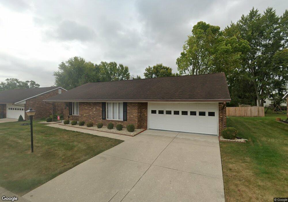
1039 Armsgate Rd Unit 7 Springfield, OH 45503
Estimated Value: $197,000 - $205,072
2
Beds
2
Baths
1,300
Sq Ft
$155/Sq Ft
Est. Value
About This Home
This home is located at 1039 Armsgate Rd Unit 7, Springfield, OH 45503 and is currently estimated at $201,268, approximately $154 per square foot. 1039 Armsgate Rd Unit 7 is a home located in Clark County with nearby schools including Rolling Hills Elementary School, Northridge Middle School, and Kenton Ridge Middle & High School.
Ownership History
Date
Name
Owned For
Owner Type
Purchase Details
Closed on
Mar 19, 2021
Sold by
Carson Darrell S and Carson Daniel J
Bought by
Stroop Twiy Diane
Current Estimated Value
Purchase Details
Closed on
Mar 27, 2009
Sold by
Carson Darrell S
Bought by
Carson Daniel J and Carson Dale E
Purchase Details
Closed on
Feb 4, 2009
Sold by
Carson Henry L and Carson Virginia L
Bought by
Carson Darrell S
Purchase Details
Closed on
Jan 10, 2005
Sold by
Matthai Dora B
Bought by
Carson Henry L and Carson Virginia L
Home Financials for this Owner
Home Financials are based on the most recent Mortgage that was taken out on this home.
Original Mortgage
$108,272
Interest Rate
5.83%
Mortgage Type
Purchase Money Mortgage
Create a Home Valuation Report for This Property
The Home Valuation Report is an in-depth analysis detailing your home's value as well as a comparison with similar homes in the area
Home Values in the Area
Average Home Value in this Area
Purchase History
| Date | Buyer | Sale Price | Title Company |
|---|---|---|---|
| Stroop Twiy Diane | $127,000 | Team Ttl & Closing Svcs Llc | |
| Stroop Twiy Diane | $127,000 | Team Title & Closing Services | |
| Carson Daniel J | -- | Attorney | |
| Carson Darrell S | -- | Attorney | |
| Carson Henry L | $107,000 | -- |
Source: Public Records
Mortgage History
| Date | Status | Borrower | Loan Amount |
|---|---|---|---|
| Previous Owner | Carson Henry L | $108,272 |
Source: Public Records
Tax History Compared to Growth
Tax History
| Year | Tax Paid | Tax Assessment Tax Assessment Total Assessment is a certain percentage of the fair market value that is determined by local assessors to be the total taxable value of land and additions on the property. | Land | Improvement |
|---|---|---|---|---|
| 2024 | $1,238 | $39,380 | $6,300 | $33,080 |
| 2023 | $1,238 | $39,380 | $6,300 | $33,080 |
| 2022 | $1,851 | $39,380 | $6,300 | $33,080 |
| 2021 | $1,851 | $38,470 | $5,250 | $33,220 |
| 2020 | $1,853 | $38,470 | $5,250 | $33,220 |
| 2019 | $1,890 | $38,470 | $5,250 | $33,220 |
| 2018 | $1,564 | $30,880 | $5,570 | $25,310 |
| 2017 | $1,330 | $30,212 | $5,565 | $24,647 |
| 2016 | $1,320 | $30,212 | $5,565 | $24,647 |
| 2015 | $1,232 | $29,897 | $5,250 | $24,647 |
| 2014 | $1,232 | $29,897 | $5,250 | $24,647 |
| 2013 | $1,229 | $29,897 | $5,250 | $24,647 |
Source: Public Records
Map
Nearby Homes
- 3029 Bradford Dr Unit 46
- 3032 Armsgate Rd Unit 25
- 1732 Falmouth Ave
- 1148 Foxboro Rd
- 1225 Vester Ave
- 3129 Haverhill St
- 3229 Bristol Dr
- 647 Villa Rd Unit A
- 3307 Tackett St
- 1506 Hyannis Dr
- 1405 Hyannis Dr
- 2933 Bahia Dr
- 542 Villa Rd
- 2907 Mystic Ln
- 2022 Westboro Ave
- 3214 Revels St
- 3231 Vineyard St
- 2933 Stonehaven Dr
- 732 Grandview Dr Unit 732
- 3631 Kingsgate Ln
- 1037 Armsgate Rd
- 1041 Armsgate Rd Unit 6
- 1041 Armsgate Rd
- 1041 Armsgate Rd
- 1038 Armsgate Rd Unit 33
- 1036 Armsgate Rd
- 1040 Armsgate Rd Unit 34
- 1035 Armsgate Rd Unit 9
- 1043 Armsgate Rd
- 1124 Villa Rd
- 1034 Armsgate Rd
- 1136 Villa Rd
- 1112 Villa Rd
- 1042 Armsgate Rd Unit 35
- 1037 Bradford Dr Unit 43
- 1045 Armsgate Rd
- 1045 Armsgate Rd Unit 4
- 1033 Armsgate Rd
- 1039 Bradford Dr Unit 42
- 1032 Armsgate Rd