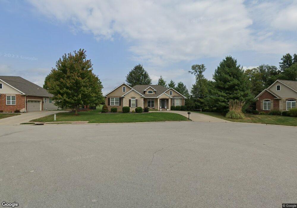
1039 Barteau Dr Swansea, IL 62226
Estimated Value: $474,000 - $552,240
4
Beds
3
Baths
2,550
Sq Ft
$204/Sq Ft
Est. Value
About This Home
This home is located at 1039 Barteau Dr, Swansea, IL 62226 and is currently estimated at $519,810, approximately $203 per square foot. 1039 Barteau Dr is a home located in St. Clair County with nearby schools including Wolf Branch Elementary School, Wolf Branch Middle School, and Elite Scholars STEAM Academy.
Ownership History
Date
Name
Owned For
Owner Type
Purchase Details
Closed on
Sep 30, 2008
Sold by
Homes By Design Inc
Bought by
Bisso Joseph R and Bisso Laney P
Current Estimated Value
Home Financials for this Owner
Home Financials are based on the most recent Mortgage that was taken out on this home.
Original Mortgage
$345,985
Outstanding Balance
$231,064
Interest Rate
6.52%
Mortgage Type
Purchase Money Mortgage
Estimated Equity
$288,746
Purchase Details
Closed on
Feb 28, 2008
Sold by
Friedla Development Group Llc
Bought by
Homes By Deesign Inc
Home Financials for this Owner
Home Financials are based on the most recent Mortgage that was taken out on this home.
Original Mortgage
$282,970
Interest Rate
6%
Mortgage Type
Construction
Create a Home Valuation Report for This Property
The Home Valuation Report is an in-depth analysis detailing your home's value as well as a comparison with similar homes in the area
Home Values in the Area
Average Home Value in this Area
Purchase History
| Date | Buyer | Sale Price | Title Company |
|---|---|---|---|
| Bisso Joseph R | $364,500 | Metro East Title Corporation | |
| Homes By Deesign Inc | $78,000 | Metro East Title Corporation |
Source: Public Records
Mortgage History
| Date | Status | Borrower | Loan Amount |
|---|---|---|---|
| Open | Bisso Joseph R | $345,985 | |
| Previous Owner | Homes By Deesign Inc | $282,970 |
Source: Public Records
Tax History Compared to Growth
Tax History
| Year | Tax Paid | Tax Assessment Tax Assessment Total Assessment is a certain percentage of the fair market value that is determined by local assessors to be the total taxable value of land and additions on the property. | Land | Improvement |
|---|---|---|---|---|
| 2024 | $11,692 | $151,460 | $28,999 | $122,461 |
| 2023 | $11,958 | $153,355 | $28,599 | $124,756 |
| 2022 | $11,164 | $139,667 | $26,046 | $113,621 |
| 2021 | $10,896 | $133,935 | $24,977 | $108,958 |
| 2020 | $10,588 | $124,731 | $23,261 | $101,470 |
| 2019 | $10,603 | $128,177 | $24,189 | $103,988 |
| 2018 | $10,326 | $124,904 | $23,571 | $101,333 |
| 2017 | $10,054 | $121,579 | $22,944 | $98,635 |
| 2016 | $9,980 | $117,388 | $22,153 | $95,235 |
| 2014 | $8,630 | $114,765 | $22,181 | $92,584 |
| 2013 | $7,121 | $114,765 | $22,181 | $92,584 |
Source: Public Records
Map
Nearby Homes
- 1518 William Ln
- 4092 Redcastle Place
- 34 Twilight Dr
- 3232 Joel Dr
- 4167 Addiston Dr
- 1513 Pasteur Ln
- 4171 Addiston Dr
- 3837 N Illinois St
- 14 Timber Waters Ct
- 4184 Red Field Dr
- 0 Smelting Works Rd
- 505 Thistle Ln
- 525 Big Bend Blvd
- 4480 Biverton Dr
- 3920 Michael John Dr
- 117 Timber Dr
- 9 Lake Christine Dr
- 9 Brian Dr
- 0 Frank Scott Pkwy E
- 104 Britanna Dr
- 1035 Barteau Dr
- 1043 Barteau Dr
- 1031 Barteau Dr
- 1014 Warwick Place
- 1018 Warwick Place
- 1042 Barteau Dr
- 1034 Barteau Dr
- 1010 Warwick Place
- 1027 Barteau Dr
- 1319 Merganser Blvd
- 1022 Barteau Dr
- 3404 Castle Pines Ct
- 3414 Castle Pines Ct
- 1026 Barteau Dr
- 1022 Warwick Place
- 1023 Barteau Dr
- 4093 Towbridge Place
- 1015 Warwick Place
- 3417 Castle Pines Ct
- 1401 Merganser Blvd