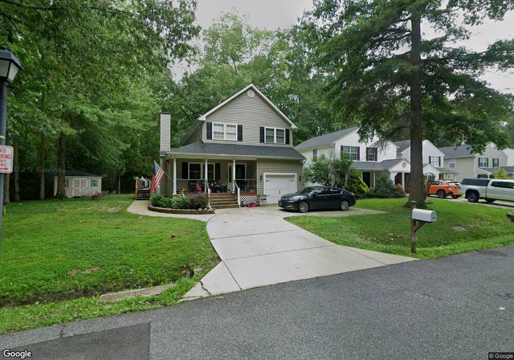
1039 Biltmore Ave West River, MD 20778
Estimated Value: $438,000 - $519,000
--
Bed
2
Baths
1,843
Sq Ft
$260/Sq Ft
Est. Value
About This Home
This home is located at 1039 Biltmore Ave, West River, MD 20778 and is currently estimated at $480,078, approximately $260 per square foot. 1039 Biltmore Ave is a home located in Anne Arundel County with nearby schools including Deale Elementary School, Southern Middle School, and Southern High School.
Ownership History
Date
Name
Owned For
Owner Type
Purchase Details
Closed on
May 31, 2022
Sold by
Marshall Gene A
Bought by
Wilson Colin T and Marshall Ashley M
Current Estimated Value
Home Financials for this Owner
Home Financials are based on the most recent Mortgage that was taken out on this home.
Original Mortgage
$408,500
Outstanding Balance
$387,761
Interest Rate
5%
Mortgage Type
New Conventional
Estimated Equity
$92,317
Purchase Details
Closed on
May 21, 1999
Sold by
Back Bay Inc
Bought by
Marshall Gene A and Marshall Amy M
Create a Home Valuation Report for This Property
The Home Valuation Report is an in-depth analysis detailing your home's value as well as a comparison with similar homes in the area
Home Values in the Area
Average Home Value in this Area
Purchase History
| Date | Buyer | Sale Price | Title Company |
|---|---|---|---|
| Wilson Colin T | $430,000 | Sage Title | |
| Marshall Gene A | $164,000 | -- |
Source: Public Records
Mortgage History
| Date | Status | Borrower | Loan Amount |
|---|---|---|---|
| Open | Wilson Colin T | $408,500 | |
| Closed | Marshall Gene A | -- |
Source: Public Records
Tax History Compared to Growth
Tax History
| Year | Tax Paid | Tax Assessment Tax Assessment Total Assessment is a certain percentage of the fair market value that is determined by local assessors to be the total taxable value of land and additions on the property. | Land | Improvement |
|---|---|---|---|---|
| 2025 | $4,335 | $363,000 | -- | -- |
| 2024 | $4,335 | $350,000 | $0 | $0 |
| 2023 | $4,154 | $337,000 | $149,100 | $187,900 |
| 2022 | $3,932 | $335,100 | $0 | $0 |
| 2021 | $5,946 | $333,200 | $0 | $0 |
| 2020 | $2,888 | $331,300 | $154,100 | $177,200 |
| 2019 | $5,552 | $320,200 | $0 | $0 |
| 2018 | $3,134 | $309,100 | $0 | $0 |
| 2017 | $2,629 | $298,000 | $0 | $0 |
| 2016 | -- | $284,167 | $0 | $0 |
| 2015 | -- | $270,333 | $0 | $0 |
| 2014 | -- | $256,500 | $0 | $0 |
Source: Public Records
Map
Nearby Homes
- 1037 Biltmore Ave
- 5162 Cedarlea Dr
- 5860 Shady Side Rd
- 4938 Rullman Rd
- 4992 Lerch Dr
- 5235 Chalk Point Rd
- 676 Plantation Blvd
- 1133 Steamboat Rd
- 4907 Quince St
- 4908 Aspen St
- 4912 Beech St
- 4900 Thomas Dr
- 1302 Spruce St
- 5277 Cedar St
- 0 Riverside Dr Unit B43 MDAA2117960
- 0 Riverside Dr Unit C4 MDAA2119968
- 6152 Shady Side Rd
- 6118 Shady Side Rd
- 5771 Shady Side Rd
- 6070 Shady Side Rd
- 1035 Biltmore Ave
- 1036 Harding Blvd
- 1034 Harding Blvd
- 1033 Biltmore Ave
- 1032 Harding Blvd
- 1038 Harding Blvd
- 1105 Cherry Point Rd
- 1030 Harding Blvd
- 1031 Biltmore Ave
- 1038 Allen Ave
- 1029 Biltmore Ave
- 1026 Harding Blvd
- 5108 Jacks Ln
- 1020 Cherry Point Rd
- 1031 Harding Blvd
- 1029 Harding Blvd
- 1033 Harding Blvd
- 1024 Harding Blvd
- 1036 Allen Ave
- 1035 Harding Blvd