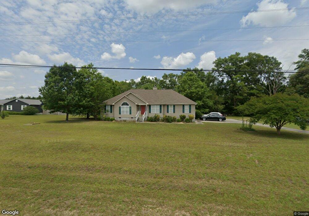
1039 Blackshear Ferry Rd W Dublin, GA 31021
Estimated Value: $204,701 - $249,000
3
Beds
2
Baths
1,649
Sq Ft
$140/Sq Ft
Est. Value
About This Home
This home is located at 1039 Blackshear Ferry Rd W, Dublin, GA 31021 and is currently estimated at $231,675, approximately $140 per square foot. 1039 Blackshear Ferry Rd W is a home located in Laurens County with nearby schools including Northwest Laurens Elementary School, Southwest Laurens Elementary School, and East Laurens Primary School.
Ownership History
Date
Name
Owned For
Owner Type
Purchase Details
Closed on
Aug 22, 2003
Sold by
Chambers Andrew G
Bought by
Hutchinson Annie R
Current Estimated Value
Purchase Details
Closed on
Jul 14, 1999
Sold by
Chambers Andrew G
Bought by
Chambers Andrew G
Purchase Details
Closed on
Jul 8, 1999
Sold by
Harrison Freeman
Bought by
Chambers Andrew G
Purchase Details
Closed on
Mar 31, 1999
Sold by
Chambers Andrew & Co
Bought by
Harrison Freeman
Purchase Details
Closed on
Sep 23, 1996
Sold by
Pope Sheila and Pope Jones
Bought by
Parrish Development
Create a Home Valuation Report for This Property
The Home Valuation Report is an in-depth analysis detailing your home's value as well as a comparison with similar homes in the area
Home Values in the Area
Average Home Value in this Area
Purchase History
| Date | Buyer | Sale Price | Title Company |
|---|---|---|---|
| Hutchinson Annie R | $107,000 | -- | |
| Chambers Andrew G | -- | -- | |
| Chambers Andrew G | -- | -- | |
| Harrison Freeman | $7,500 | -- | |
| Chambers Andrew & Co | $7,500 | -- | |
| Parrish Development | -- | -- |
Source: Public Records
Tax History Compared to Growth
Tax History
| Year | Tax Paid | Tax Assessment Tax Assessment Total Assessment is a certain percentage of the fair market value that is determined by local assessors to be the total taxable value of land and additions on the property. | Land | Improvement |
|---|---|---|---|---|
| 2024 | $1,392 | $68,111 | $8,000 | $60,111 |
| 2023 | $1,278 | $62,161 | $8,000 | $54,161 |
| 2022 | $1,328 | $62,161 | $8,000 | $54,161 |
| 2021 | $957 | $43,616 | $3,960 | $39,656 |
| 2020 | $958 | $43,616 | $3,960 | $39,656 |
| 2019 | $959 | $43,616 | $3,960 | $39,656 |
| 2018 | $960 | $43,616 | $3,960 | $39,656 |
| 2017 | $959 | $43,616 | $3,960 | $39,656 |
| 2016 | $960 | $43,616 | $3,960 | $39,656 |
| 2015 | $961 | $43,616 | $3,960 | $39,656 |
| 2014 | $871 | $38,627 | $3,230 | $35,397 |
Source: Public Records
Map
Nearby Homes
- 1940 Barrington Dr
- 00 Lexington Dr
- 235 Strawberry Cir
- 603 Old Toomsboro Rd
- 0 Flanders Ct N Unit 30069
- 0 Flanders Ct N Unit 10554837
- 0 Flanders Ct N Unit 29123
- 618 Gordon Edwards Rd
- 719 Jones Ln
- 0 Woodland Heights Rd Unit 29127
- 0 Woodland Heights Rd Unit 29121
- 0 Woodland Heights Rd Unit 29120
- 0 Woodland Heights Rd Unit 21231
- 168 Woodland Heights Rd
- 0 Gordon Edwards Rd Unit 27918
- 0 Cameron Ct
- 11 Creekwood Dr
- 0 Woodland Trail Unit 22343
- 0 Woodland Trail Unit 22344
- 311 Holly Dr
- 1045 Blackshear Ferry Rd W
- 788 Old Toomsboro Rd
- 1053 Blackshear Ferry Rd W
- 1032 Blackshear Ferry Rd W
- 198 Blackshears Cir
- 814 Old Toomsboro Rd
- 194 Blackshears Cir
- 1022 Blackshear Ferry Rd W
- 818 Old Toomsboro Rd
- 199 Blackshears Cir
- 199 Blackshear Ferry Cir
- 799 Old Toomsboro Rd
- 1061 Blackshear Ferry Rd W
- 189 Blackshear Ferry Cir
- 189 Blackshears Cir
- 760 Old Toomsboro Rd
- 188 Blackshear Ferry Cir
- 188 Blackshears Cir
- 1065 Blackshear Ferry Rd W
- 822 Old Toomsboro Rd