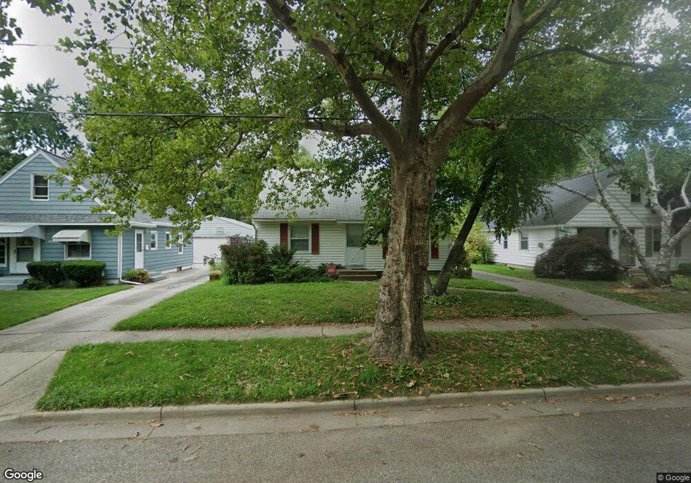
1039 Drexel Dr NE Grand Rapids, MI 49505
Creston NeighborhoodEstimated Value: $228,522 - $284,000
--
Bed
--
Bath
1,020
Sq Ft
$252/Sq Ft
Est. Value
About This Home
This home is located at 1039 Drexel Dr NE, Grand Rapids, MI 49505 and is currently estimated at $256,881, approximately $251 per square foot. 1039 Drexel Dr NE is a home located in Kent County with nearby schools including Kent Hills School, Riverside Middle School, and Union High School.
Ownership History
Date
Name
Owned For
Owner Type
Purchase Details
Closed on
Aug 28, 2015
Sold by
Hess Steven J and Hess Linda S
Bought by
Hess Alicia
Current Estimated Value
Home Financials for this Owner
Home Financials are based on the most recent Mortgage that was taken out on this home.
Original Mortgage
$52,000
Outstanding Balance
$40,926
Interest Rate
3.97%
Mortgage Type
New Conventional
Estimated Equity
$215,955
Purchase Details
Closed on
Oct 11, 1985
Create a Home Valuation Report for This Property
The Home Valuation Report is an in-depth analysis detailing your home's value as well as a comparison with similar homes in the area
Home Values in the Area
Average Home Value in this Area
Purchase History
| Date | Buyer | Sale Price | Title Company |
|---|---|---|---|
| Hess Alicia | $65,000 | Sun Title Agency Of Mi Llc | |
| -- | $36,500 | -- |
Source: Public Records
Mortgage History
| Date | Status | Borrower | Loan Amount |
|---|---|---|---|
| Open | Hess Alicia | $52,000 |
Source: Public Records
Tax History Compared to Growth
Tax History
| Year | Tax Paid | Tax Assessment Tax Assessment Total Assessment is a certain percentage of the fair market value that is determined by local assessors to be the total taxable value of land and additions on the property. | Land | Improvement |
|---|---|---|---|---|
| 2025 | $1,572 | $107,800 | $0 | $0 |
| 2024 | $1,572 | $96,700 | $0 | $0 |
| 2023 | $1,665 | $81,700 | $0 | $0 |
| 2022 | $1,581 | $70,300 | $0 | $0 |
| 2021 | $1,546 | $64,100 | $0 | $0 |
| 2020 | $1,478 | $58,900 | $0 | $0 |
| 2019 | $1,495 | $48,500 | $0 | $0 |
| 2018 | $1,495 | $45,100 | $0 | $0 |
| 2017 | $1,455 | $41,700 | $0 | $0 |
| 2016 | $1,473 | $37,600 | $0 | $0 |
| 2015 | $1,752 | $37,600 | $0 | $0 |
| 2013 | -- | $33,200 | $0 | $0 |
Source: Public Records
Map
Nearby Homes
- 1683 Herrick Ave NE
- 1119 Kentwood Dr NE
- 2036 Fuller Ave NE
- 1237 Dale Ct NE
- 1848 Emerald Ave NE
- 1755 Benjamin Ave NE
- 1448 Herrick Ave NE
- 1825 Meadowfield Dr NE
- 1757 Westlane Dr NE
- 1701 Carlton Ave NE
- 1649 Carlton Ave NE
- 1804 Carlton Ave NE
- 1339 Fuller Ave NE
- 1335 Knapp St NE
- 2100 Dawson Ave NE
- 1256 Diamond Ave NE
- 1238 Diamond Ave NE
- 2031 Eastern Ave NE
- 741 Knapp St NE
- 1223 Ridgeway St NE
- 1035 Drexel Dr NE
- 1045 Drexel Dr NE
- 1029 Drexel Dr NE
- 1049 Drexel Dr NE
- 0 Drexel Dr NE
- 953955 Drexel Dr NE
- 1034 Kentwood St NE
- 1025 Drexel Dr NE
- 1038 Kentwood St NE
- 1055 Drexel Dr NE
- 1028 Kentwood St NE
- 1044 Kentwood St NE
- 1024 Kentwood St NE
- 1019 Drexel Dr NE
- 1040 Drexel Dr NE
- 1034 Drexel Dr NE
- 1050 Drexel Dr NE
- 1048 Kentwood St NE
- 1048 Kentwood Dr NE
- 1018 Kentwood St NE