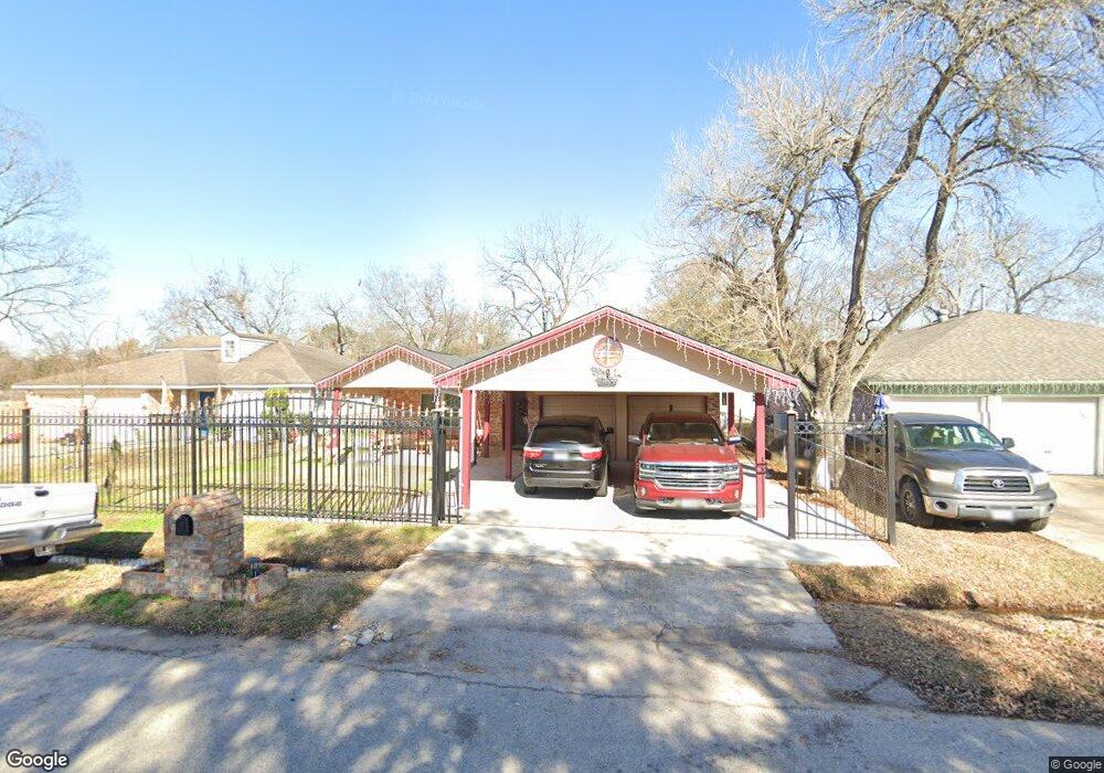
1039 Hartwick Rd Houston, TX 77037
Northside-Northline NeighborhoodEstimated Value: $198,000 - $212,000
3
Beds
2
Baths
1,528
Sq Ft
$134/Sq Ft
Est. Value
About This Home
This home is located at 1039 Hartwick Rd, Houston, TX 77037 and is currently estimated at $204,575, approximately $133 per square foot. 1039 Hartwick Rd is a home located in Harris County with nearby schools including Barrick Elementary School, Patrick Henry Middle School, and Sam Houston Math, Science & Technology Center.
Ownership History
Date
Name
Owned For
Owner Type
Purchase Details
Closed on
Aug 11, 2000
Sold by
Shami Farouk and Shami Ezzia Ali
Bought by
Loera Joel and Loera Maria G
Current Estimated Value
Home Financials for this Owner
Home Financials are based on the most recent Mortgage that was taken out on this home.
Original Mortgage
$52,725
Outstanding Balance
$19,104
Interest Rate
8.21%
Mortgage Type
Stand Alone First
Estimated Equity
$185,471
Create a Home Valuation Report for This Property
The Home Valuation Report is an in-depth analysis detailing your home's value as well as a comparison with similar homes in the area
Home Values in the Area
Average Home Value in this Area
Purchase History
| Date | Buyer | Sale Price | Title Company |
|---|---|---|---|
| Loera Joel | -- | Texas American Title Company |
Source: Public Records
Mortgage History
| Date | Status | Borrower | Loan Amount |
|---|---|---|---|
| Open | Loera Joel | $52,725 |
Source: Public Records
Tax History Compared to Growth
Tax History
| Year | Tax Paid | Tax Assessment Tax Assessment Total Assessment is a certain percentage of the fair market value that is determined by local assessors to be the total taxable value of land and additions on the property. | Land | Improvement |
|---|---|---|---|---|
| 2025 | $2,400 | $210,594 | $38,266 | $172,328 |
| 2024 | $2,400 | $197,546 | $38,266 | $159,280 |
| 2023 | $2,400 | $228,215 | $38,266 | $189,949 |
| 2022 | $3,546 | $193,932 | $24,956 | $168,976 |
| 2021 | $3,413 | $159,688 | $24,956 | $134,732 |
| 2020 | $3,223 | $148,149 | $24,956 | $123,193 |
| 2019 | $3,062 | $126,292 | $19,965 | $106,327 |
| 2018 | $1,936 | $110,154 | $19,965 | $90,189 |
| 2017 | $2,529 | $110,154 | $19,965 | $90,189 |
| 2016 | $2,299 | $104,431 | $19,965 | $84,466 |
| 2015 | $1,529 | $82,654 | $19,965 | $62,689 |
| 2014 | $1,529 | $82,654 | $19,965 | $62,689 |
Source: Public Records
Map
Nearby Homes
- 1122 Havner Ln
- 12806 Bauman Rd
- 931 Mitchell Rd
- 1450 Mesquite St
- 1449 Mesquite St
- 13610 Carmilenda St
- 12969 W Hardy Rd
- 511 Gulf Bank Rd Unit 5
- 11110 E Hardy Rd
- 12002 Privada Saratoga Ave
- 1508 Hopper Rd Unit 1
- 904 Hill Rd
- 1703 & 0 Sunny Dr
- 28351 W Hardy Rd
- 8605 Airline Dr
- 7713 Airline Dr
- 10022 E Hardy Rd
- 1925 Sunny Dr
- 822 Aldine Mail Route Rd
- 1802 Kowis St
- 1043 Hartwick Rd
- 1035 Hartwick Rd
- 1042 Castledale Dr
- 1034 Castledale Dr
- 1103 Hartwick Rd
- 1102 Castledale Dr
- 1038 Hartwick Rd
- 1107 Hartwick Rd
- 1042 Hartwick Rd
- 1034 Hartwick Rd
- 1102 Hartwick Rd Unit 770
- 1106 Castledale Dr
- 1111 Mitchell Rd
- 1111 Hartwick Rd
- 1106 Hartwick Rd
- 1043 Castledale Dr
- 1035 Castledale Dr
- 1103 Castledale Dr
- 1039 Havner Ln
- 1043 Havner Ln