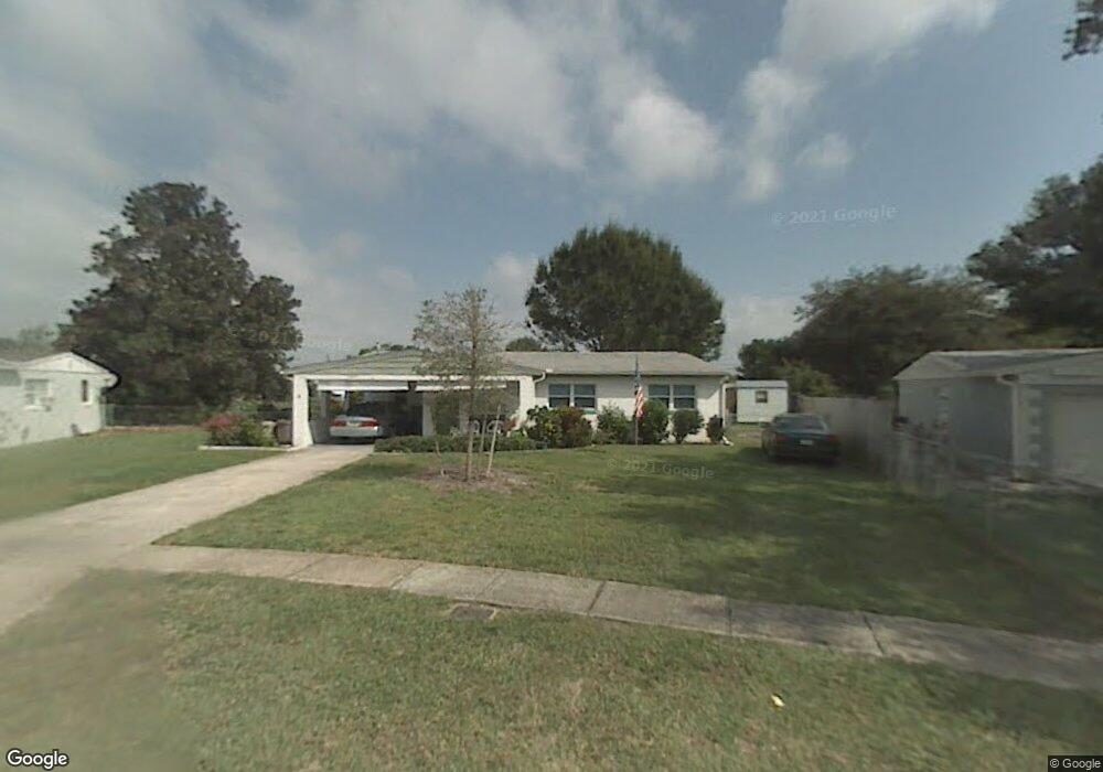
1039 Hoover St Melbourne, FL 32935
Estimated Value: $210,431 - $238,000
3
Beds
2
Baths
1,056
Sq Ft
$214/Sq Ft
Est. Value
About This Home
This home is located at 1039 Hoover St, Melbourne, FL 32935 and is currently estimated at $226,108, approximately $214 per square foot. 1039 Hoover St is a home located in Brevard County with nearby schools including Croton Elementary School, Lyndon B. Johnson Middle School, and Eau Gallie High School.
Ownership History
Date
Name
Owned For
Owner Type
Purchase Details
Closed on
Feb 6, 2020
Sold by
Shrum Lester B and Mckinley Mary R
Bought by
Mckinley Mary R
Current Estimated Value
Purchase Details
Closed on
Mar 12, 2019
Sold by
Shrum Lester B
Bought by
Shrum Lester B and Mckinley Mary R
Purchase Details
Closed on
Jan 21, 2014
Sold by
Shrum Lester B
Bought by
Shrum Lester B and Mckinley Mary R
Purchase Details
Closed on
May 14, 2009
Sold by
Shrum Lester B
Bought by
Shrum Lester B and The Lester B Shrum Revocable L
Create a Home Valuation Report for This Property
The Home Valuation Report is an in-depth analysis detailing your home's value as well as a comparison with similar homes in the area
Home Values in the Area
Average Home Value in this Area
Purchase History
| Date | Buyer | Sale Price | Title Company |
|---|---|---|---|
| Mckinley Mary R | -- | None Available | |
| Shrum Lester B | -- | None Available | |
| Shrum Lester B | -- | None Available | |
| Shrum Lester B | -- | Attorney |
Source: Public Records
Tax History Compared to Growth
Tax History
| Year | Tax Paid | Tax Assessment Tax Assessment Total Assessment is a certain percentage of the fair market value that is determined by local assessors to be the total taxable value of land and additions on the property. | Land | Improvement |
|---|---|---|---|---|
| 2025 | $1,766 | $140,680 | -- | -- |
| 2024 | $1,714 | $136,720 | -- | -- |
| 2023 | $1,714 | $132,740 | $0 | $0 |
| 2022 | $1,593 | $128,880 | $0 | $0 |
| 2021 | $1,500 | $125,130 | $60,000 | $65,130 |
| 2020 | $457 | $45,160 | $0 | $0 |
| 2019 | $452 | $44,150 | $0 | $0 |
| 2018 | $444 | $43,330 | $0 | $0 |
| 2017 | $436 | $42,440 | $0 | $0 |
| 2016 | $437 | $41,570 | $24,000 | $17,570 |
| 2015 | $339 | $41,290 | $19,870 | $21,420 |
| 2014 | $330 | $40,970 | $18,160 | $22,810 |
Source: Public Records
Map
Nearby Homes
- 1883 Sarno Access
- 1674 Tynan Ave
- 925 Bell St
- 941 Croton Rd
- 1963 Tyler Ave
- 1798 Hudson Cir S
- 862 Tupelo Dr
- 1768 Hudson Cir S
- 2004 Tyler Ave
- 2125 Laden Rd
- 2189 Smathers Cir S
- 2158 Laden Rd
- 2121 Colony Dr
- 1375 Isabella Dr Unit 108
- 2027 Wallace Ave
- 2002 Barkley Ave
- 787 Tupelo Dr
- 2180 Lakeview Dr
- 2019 Barkley Ave
- 1480 Isabella Dr Unit 103
- 1029 Hoover St
- 1868 Adams Ave
- 1040 Cleveland St
- 1028 Cleveland St
- 1052 Cleveland St
- 1052 E Cleveland
- 1881 Adams Ave
- 1858 Jefferson Ave
- 1878 Adams Ave
- 1064 Cleveland St
- 1840 Jefferson Ave
- 1018 Hoover St
- 991 Taft Ct
- 1853 Washington Ave
- 1893 Adams Ave
- 1865 Washington Ave
- 1890 Adams Ave
- 1080 Cleveland St
- 1877 Washington Ave
- 1051 Cleveland St