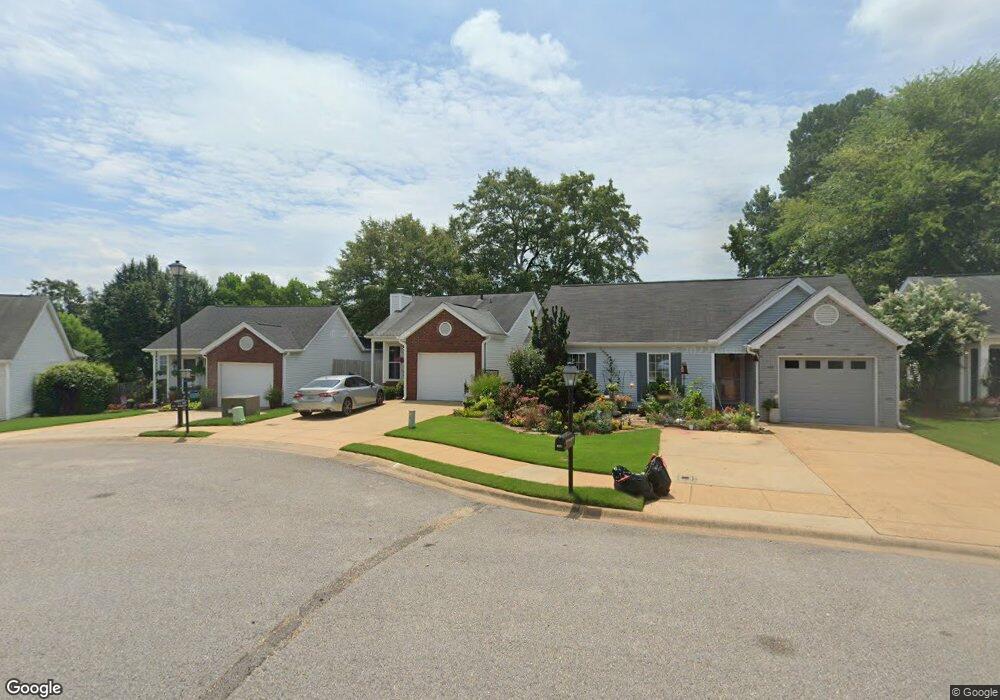
1039 Mockingbird Ln Northport, AL 35476
Estimated Value: $198,437 - $217,000
2
Beds
1
Bath
876
Sq Ft
$238/Sq Ft
Est. Value
About This Home
This home is located at 1039 Mockingbird Ln, Northport, AL 35476 and is currently estimated at $208,359, approximately $237 per square foot. 1039 Mockingbird Ln is a home located in Tuscaloosa County with nearby schools including Englewood Elementary School, Hillcrest Middle School, and Hillcrest High School.
Ownership History
Date
Name
Owned For
Owner Type
Purchase Details
Closed on
Jun 3, 2008
Sold by
Tacapa Capital Llc
Bought by
Davis Kimberly K
Current Estimated Value
Home Financials for this Owner
Home Financials are based on the most recent Mortgage that was taken out on this home.
Original Mortgage
$126,613
Outstanding Balance
$80,454
Interest Rate
5.86%
Estimated Equity
$127,905
Purchase Details
Closed on
May 27, 2008
Sold by
Crowe Properties Llc
Bought by
Tacapa Capital Llc
Home Financials for this Owner
Home Financials are based on the most recent Mortgage that was taken out on this home.
Original Mortgage
$126,613
Outstanding Balance
$80,454
Interest Rate
5.86%
Estimated Equity
$127,905
Create a Home Valuation Report for This Property
The Home Valuation Report is an in-depth analysis detailing your home's value as well as a comparison with similar homes in the area
Home Values in the Area
Average Home Value in this Area
Purchase History
| Date | Buyer | Sale Price | Title Company |
|---|---|---|---|
| Davis Kimberly K | $128,613 | -- | |
| Tacapa Capital Llc | $101,900 | -- |
Source: Public Records
Mortgage History
| Date | Status | Borrower | Loan Amount |
|---|---|---|---|
| Open | Tacapa Capital Llc | $126,613 |
Source: Public Records
Tax History Compared to Growth
Tax History
| Year | Tax Paid | Tax Assessment Tax Assessment Total Assessment is a certain percentage of the fair market value that is determined by local assessors to be the total taxable value of land and additions on the property. | Land | Improvement |
|---|---|---|---|---|
| 2024 | $349 | $20,540 | $3,780 | $16,760 |
| 2023 | $349 | $20,540 | $3,780 | $16,760 |
| 2022 | $350 | $20,560 | $3,780 | $16,780 |
| 2021 | $361 | $21,160 | $3,780 | $17,380 |
| 2020 | $326 | $9,670 | $1,890 | $7,780 |
| 2019 | $326 | $9,670 | $1,890 | $7,780 |
| 2018 | $326 | $9,670 | $1,890 | $7,780 |
| 2017 | $375 | $0 | $0 | $0 |
| 2016 | $377 | $0 | $0 | $0 |
| 2015 | $377 | $0 | $0 | $0 |
| 2014 | $377 | $11,010 | $1,890 | $9,120 |
Source: Public Records
Map
Nearby Homes
- 1023 Mockingbird Ln
- 2205 18th Ave
- 2161 Fox Ridge Rd
- 2103 18th Ave
- 1711 17th St
- 2421 21st Ave
- 115 Brookside Dr
- 3801 Blackberry Ln
- 1514 17th Ave
- 2301 22nd Ave
- 3809 Blackberry Ln
- 2203 22nd Ave
- 2105 22nd Ave
- 1332 Independence Dr
- 1738 Hollow Ln
- 2805 Mayfield Way
- 0 Lurleen B Wallace Blvd
- 00 Lurleen B Wallace Blvd
- 2126 Bellwood Dr
- 1711 St Andrews Dr
- 1043 Mockingbird Ln
- 1035 Mockingbird Ln
- 1047 Mockingbird Ln
- 1026 Yellowhammer Ln
- 1022 Yellowhammer Ln
- 1101 Mockingbird Ln
- 1027 Mockingbird Ln
- 1018 Yellowhammer Ln
- 1014 Yellowhammer Ln
- 1030 Yellowhammer Ln
- 1105 Mockingbird Ln
- 1010 Yellowhammer Ln
- 1032 Mockingbird Ln
- 2521 Swallow Ln
- 1006 Yellowhammer Ln
- 1019 Mockingbird Ln
- 2517 Swallow Ln
- 1109 Mockingbird Ln
- 2623 Swallow Ln
- 2513 Swallow Ln