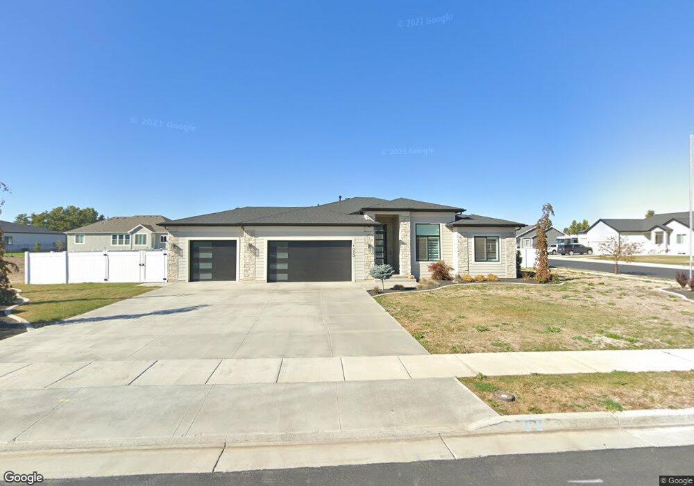
1039 N 1275 W Unit 21 Farr West, UT 84404
Estimated Value: $652,000 - $836,000
6
Beds
3
Baths
3,760
Sq Ft
$202/Sq Ft
Est. Value
About This Home
This home is located at 1039 N 1275 W Unit 21, Farr West, UT 84404 and is currently estimated at $759,579, approximately $202 per square foot. 1039 N 1275 W Unit 21 is a home located in Weber County with nearby schools including Farr West Elementary School, Wahlquist Junior High School, and Fremont High School.
Ownership History
Date
Name
Owned For
Owner Type
Purchase Details
Closed on
Aug 26, 2020
Sold by
Visionary Homes 2018 Llc
Bought by
Strong Adam and Strong Alexis
Current Estimated Value
Home Financials for this Owner
Home Financials are based on the most recent Mortgage that was taken out on this home.
Original Mortgage
$530,100
Outstanding Balance
$470,429
Interest Rate
2.9%
Mortgage Type
New Conventional
Estimated Equity
$289,150
Purchase Details
Closed on
Apr 16, 2018
Sold by
Visionary Homes Llc
Bought by
Visionary Homes 2018 Llc
Create a Home Valuation Report for This Property
The Home Valuation Report is an in-depth analysis detailing your home's value as well as a comparison with similar homes in the area
Home Values in the Area
Average Home Value in this Area
Purchase History
| Date | Buyer | Sale Price | Title Company |
|---|---|---|---|
| Strong Adam | -- | Apex Ttl & Closing Svcs Llc | |
| Visionary Homes 2018 Llc | -- | Cache Title Logan |
Source: Public Records
Mortgage History
| Date | Status | Borrower | Loan Amount |
|---|---|---|---|
| Open | Strong Adam | $530,100 |
Source: Public Records
Tax History Compared to Growth
Tax History
| Year | Tax Paid | Tax Assessment Tax Assessment Total Assessment is a certain percentage of the fair market value that is determined by local assessors to be the total taxable value of land and additions on the property. | Land | Improvement |
|---|---|---|---|---|
| 2025 | $4,214 | $735,307 | $201,213 | $534,094 |
| 2024 | $4,066 | $397,099 | $110,513 | $286,586 |
| 2023 | $4,116 | $397,650 | $110,322 | $287,328 |
| 2022 | $3,926 | $387,750 | $93,900 | $293,850 |
| 2021 | $3,312 | $552,000 | $110,596 | $441,404 |
| 2020 | $5,441 | $457,000 | $95,456 | $361,544 |
| 2019 | $2,855 | $412,000 | $90,442 | $321,558 |
| 2018 | $995 | $75,572 | $75,572 | $0 |
| 2017 | $0 | $0 | $0 | $0 |
Source: Public Records
Map
Nearby Homes
- 3219 1200 St W Unit 201
- 1290 E 1640 S
- 1555 1200 St W
- 9175 W 900 S Unit 345
- 1030 W 1600 N
- 3323 1200 West St
- 1111 N 2000 W Unit 52
- 1111 N 2000 W Unit 123
- 1111 N 2000 W Unit 335
- 1111 N 2000 W Unit 170
- 1111 N 2000 W Unit 222
- 1111 N 2000 W Unit 404
- 1111 N 2000 W Unit 84
- 1111 N 2000 W Unit 201
- 1111 N 2000 W Unit 197
- 1111 N 2000 W Unit 155
- 1111 N 2000 W Unit 21
- 928 N 2075 W
- 377 N 1900 St W
- 1917 W 250 N