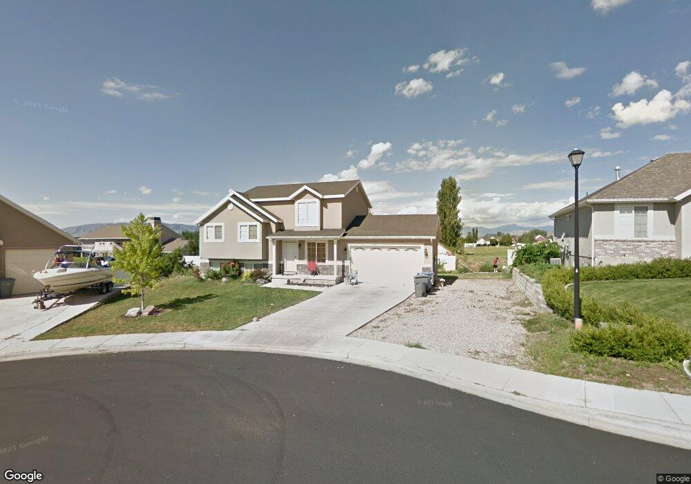
1039 N 420 W American Fork, UT 84003
Estimated Value: $567,000 - $667,000
6
Beds
3
Baths
1,928
Sq Ft
$313/Sq Ft
Est. Value
About This Home
This home is located at 1039 N 420 W, American Fork, UT 84003 and is currently estimated at $603,159, approximately $312 per square foot. 1039 N 420 W is a home located in Utah County with nearby schools including Shelley Elementary School, American Fork Junior High School, and American Fork High School.
Ownership History
Date
Name
Owned For
Owner Type
Purchase Details
Closed on
Apr 15, 2011
Sold by
Fannie Mae
Bought by
Taveras Omar
Current Estimated Value
Home Financials for this Owner
Home Financials are based on the most recent Mortgage that was taken out on this home.
Original Mortgage
$204,676
Outstanding Balance
$141,669
Interest Rate
4.87%
Mortgage Type
FHA
Estimated Equity
$461,490
Purchase Details
Closed on
Oct 5, 2010
Sold by
Jeffrey Joel and Jeffrey Elizabeth
Bought by
Federal National Mortgage Association
Purchase Details
Closed on
Apr 1, 2008
Sold by
Jeffrey Joel and Jeffrey Elizabeth
Bought by
Jeffrey Joel Philip and Jeffrey Elizabeth Jane Ellis
Home Financials for this Owner
Home Financials are based on the most recent Mortgage that was taken out on this home.
Original Mortgage
$268,000
Interest Rate
6.04%
Mortgage Type
New Conventional
Purchase Details
Closed on
Jul 31, 2007
Sold by
Jeffrey Joel Philip and Jeffrey Elizabeth Jane Ellis
Bought by
Jeffrey Joel and Jeffrey Elizabeth
Purchase Details
Closed on
Apr 11, 2006
Sold by
Joel & Elizabeth Jeffrey Family Trust
Bought by
Jeffrey Joel and Jeffrey Elizabeth
Purchase Details
Closed on
Jul 7, 2003
Sold by
Jeffrey Joel and Jeffrey Elizabeth
Bought by
Jeffrey Joel Philip and Jeffrey Elizabeth E
Home Financials for this Owner
Home Financials are based on the most recent Mortgage that was taken out on this home.
Original Mortgage
$156,000
Interest Rate
5.22%
Mortgage Type
Purchase Money Mortgage
Purchase Details
Closed on
Jan 15, 2003
Sold by
Jeffrey Joel and Jeffrey Elizabeth
Bought by
Jeffrey Joel Philip and Jeffrey Elizabeth E
Home Financials for this Owner
Home Financials are based on the most recent Mortgage that was taken out on this home.
Original Mortgage
$175,750
Interest Rate
5.86%
Purchase Details
Closed on
Dec 20, 2002
Sold by
Salisbury Development Lc
Bought by
Jeffrey Joel and Jeffrey Elizabeth
Home Financials for this Owner
Home Financials are based on the most recent Mortgage that was taken out on this home.
Original Mortgage
$175,750
Interest Rate
5.86%
Create a Home Valuation Report for This Property
The Home Valuation Report is an in-depth analysis detailing your home's value as well as a comparison with similar homes in the area
Home Values in the Area
Average Home Value in this Area
Purchase History
| Date | Buyer | Sale Price | Title Company |
|---|---|---|---|
| Taveras Omar | -- | Empire Land Title Inc | |
| Federal National Mortgage Association | $294,170 | Etitle Insurance Agency | |
| Jeffrey Joel Philip | -- | First American Legend Hil | |
| Jeffrey Joel | -- | First American Legend Hil | |
| Jeffrey Joel | -- | Access Title Company | |
| Jeffrey Joel Philip | -- | First American Title Co | |
| Jeffrey Joel | -- | First American Title Co | |
| Jeffrey Joel Philip | -- | -- | |
| Jeffrey Joel | -- | Provo Land Title Company |
Source: Public Records
Mortgage History
| Date | Status | Borrower | Loan Amount |
|---|---|---|---|
| Open | Taveras Omar | $204,676 | |
| Previous Owner | Jeffrey Joel Philip | $268,000 | |
| Previous Owner | Jeffrey Joel | $156,000 | |
| Previous Owner | Jeffrey Joel | $175,750 | |
| Closed | Jeffrey Joel | $29,250 |
Source: Public Records
Tax History Compared to Growth
Tax History
| Year | Tax Paid | Tax Assessment Tax Assessment Total Assessment is a certain percentage of the fair market value that is determined by local assessors to be the total taxable value of land and additions on the property. | Land | Improvement |
|---|---|---|---|---|
| 2025 | $2,390 | $286,000 | $228,700 | $291,300 |
| 2024 | $2,390 | $265,540 | $0 | $0 |
| 2023 | $2,281 | $268,675 | $0 | $0 |
| 2022 | $2,298 | $267,135 | $0 | $0 |
| 2021 | $1,964 | $356,600 | $164,100 | $192,500 |
| 2020 | $1,835 | $323,100 | $146,500 | $176,600 |
| 2019 | $1,700 | $309,700 | $135,500 | $174,200 |
| 2018 | $1,650 | $287,300 | $128,200 | $159,100 |
| 2017 | $1,574 | $147,950 | $0 | $0 |
| 2016 | $1,524 | $133,045 | $0 | $0 |
| 2015 | $1,467 | $121,605 | $0 | $0 |
| 2014 | $1,320 | $107,910 | $0 | $0 |
Source: Public Records
Map
Nearby Homes
- 471 W 1040 N
- 987 N 410 W
- 425 W 1120 N
- 344 W 1080 N
- 3889 W 950 Cir N Unit 366
- 914 N 400 W Unit A
- 984 N 300 W
- 602 W 860 N
- 356 W 1300 N
- 287 W 1360 N
- 796 N 200 W
- 782 N 200 W
- 179 W 1290 N
- 3935 W 1000 N Unit 438
- 3983 W 1000 N Unit 442
- 4007 W 1000 N
- 3947 W 1000 N Unit 439
- 3959 W 1000 N
- 641 N 420 W
- 1438 N 400 W
- 373 W 960 N Unit 216C
- 448 W 960 N Unit 206E
- 442 W 960 N Unit 206C
- 438 W 960 N Unit 206B
- 434 W 960 N Unit 206A
- 444 W 960 N Unit 206D
- 366 W 960 N Unit 213B
- 374 W 960 N Unit 213-E
- 374 W 960 N
- 368 W 960 N Unit 213C
- 419 W 1040 N
- 1047 N 420 W
- 988 N 500 W
- 496 W 990 N
- 471 W 1040 N Unit 35
- 407 W 1040 N
- 406 W 1040 N
- 398 W 990 N
- 1055 N 420 W
- 976 N 500 W