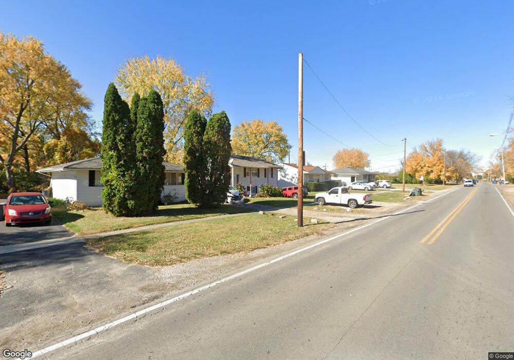
1039 N Cassady Ave Columbus, OH 43219
Estimated Value: $153,000 - $193,000
4
Beds
2
Baths
1,216
Sq Ft
$140/Sq Ft
Est. Value
About This Home
This home is located at 1039 N Cassady Ave, Columbus, OH 43219 and is currently estimated at $170,446, approximately $140 per square foot. 1039 N Cassady Ave is a home located in Franklin County with nearby schools including East Columbus Elementary School, Champion Middle School, and East High School.
Ownership History
Date
Name
Owned For
Owner Type
Purchase Details
Closed on
Nov 20, 2017
Sold by
Knox Paul M and Knox Kelly P
Bought by
Sanchez Eutracio Alvaro
Current Estimated Value
Purchase Details
Closed on
Feb 19, 2008
Sold by
Homesales Inc
Bought by
Knox Paul M
Purchase Details
Closed on
Oct 15, 2007
Sold by
Hollins Michael H and Jpmorgan Chase Bank Na
Bought by
Homesales Inc
Purchase Details
Closed on
Aug 2, 1999
Sold by
Parfitt Gary A and Bankers Trust Company Of Calif
Bought by
Woodford Carl H and Woodford Anthony L
Purchase Details
Closed on
Jan 23, 1978
Bought by
Parfitt Gary A
Create a Home Valuation Report for This Property
The Home Valuation Report is an in-depth analysis detailing your home's value as well as a comparison with similar homes in the area
Home Values in the Area
Average Home Value in this Area
Purchase History
| Date | Buyer | Sale Price | Title Company |
|---|---|---|---|
| Sanchez Eutracio Alvaro | $28,000 | Peak Title | |
| Knox Paul M | $24,000 | Accutitle Agency Inc | |
| Homesales Inc | $30,000 | None Available | |
| Woodford Carl H | $32,600 | -- | |
| Parfitt Gary A | $27,600 | -- |
Source: Public Records
Tax History Compared to Growth
Tax History
| Year | Tax Paid | Tax Assessment Tax Assessment Total Assessment is a certain percentage of the fair market value that is determined by local assessors to be the total taxable value of land and additions on the property. | Land | Improvement |
|---|---|---|---|---|
| 2024 | $3,498 | $52,190 | $14,000 | $38,190 |
| 2023 | $2,312 | $52,185 | $14,000 | $38,185 |
| 2022 | $656 | $12,640 | $1,930 | $10,710 |
| 2021 | $657 | $12,640 | $1,930 | $10,710 |
| 2020 | $658 | $12,640 | $1,930 | $10,710 |
| 2019 | $678 | $11,170 | $1,750 | $9,420 |
| 2018 | $661 | $11,240 | $1,750 | $9,490 |
| 2017 | $1,040 | $16,730 | $1,750 | $14,980 |
| 2016 | $666 | $9,810 | $2,910 | $6,900 |
| 2015 | $607 | $9,810 | $2,910 | $6,900 |
| 2014 | $608 | $9,810 | $2,910 | $6,900 |
| 2013 | $2,218 | $9,800 | $2,905 | $6,895 |
Source: Public Records
Map
Nearby Homes
- 2812 E 11th Ave
- 2718 Roxbury Rd
- 2857 E 10th Ave
- 2814 E 9th Ave
- 2969 E 11th Ave
- 799 Alton Ave
- 796 Northview Ave
- 782 Northview Ave
- 2872 E 6th Ave
- 2742 E 5th Ave
- 2822-2824 E 5th Ave
- 2421 Airport Dr
- 0 E 7th Ave Unit Lot 79 225013171
- 0 E 7th Ave Unit Lot 77 225013170
- 0 E 7th Ave Unit Lot 78 225013168
- 00 E 7th Ave
- 691-693 N Dawson Ave
- 3059 E 8th Ave
- 3018 E 6th Ave Unit 20
- 1065 Sunbury Rd
- 1031 N Cassady Ave
- 1045 N Cassady Ave
- 1025 N Cassady Ave
- 1044 Dalehurst Rd
- 1052 Dalehurst Rd
- 1038 Dalehurst Rd
- 1055 N Cassady Ave
- 2787 Kenilworth Rd
- 1021 N Cassady Ave
- 2781 Kenilworth Rd
- 1034 N Cassady Ave
- 1038 N Cassady Ave
- 1024 Dalehurst Rd
- 2775 Kenilworth Rd
- 1022 N Cassady Ave
- 1052 N Cassady Ave
- 2772 Roxbury Rd
- 2780 Roxbury Rd
- 1016 N Cassady Ave