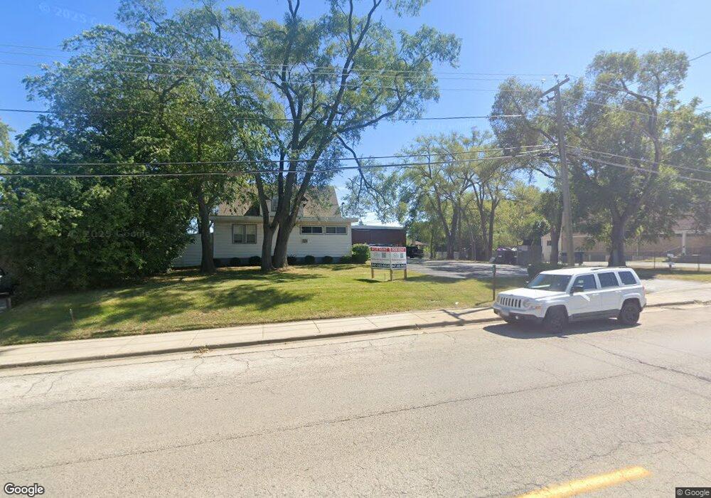
1039 N Mcaree Rd Waukegan, IL 60085
Glenwood Heights NeighborhoodEstimated Value: $628,000
1
Bed
2
Baths
1,000
Sq Ft
$628/Sq Ft
Est. Value
About This Home
This home is located at 1039 N Mcaree Rd, Waukegan, IL 60085 and is currently priced at $628,000, approximately $628 per square foot. 1039 N Mcaree Rd is a home located in Lake County with nearby schools including Glenwood Elementary School, Miguel Juarez Middle School, and Waukegan High School.
Ownership History
Date
Name
Owned For
Owner Type
Purchase Details
Closed on
Apr 4, 2012
Sold by
Lbt Residential Llc
Bought by
Berg Holdings Inc
Current Estimated Value
Home Financials for this Owner
Home Financials are based on the most recent Mortgage that was taken out on this home.
Original Mortgage
$250,000
Outstanding Balance
$172,596
Interest Rate
3.9%
Mortgage Type
Commercial
Purchase Details
Closed on
Feb 11, 2004
Sold by
Scott Glenn and Scott Donna
Bought by
Lake Point Terrace Llc
Home Financials for this Owner
Home Financials are based on the most recent Mortgage that was taken out on this home.
Original Mortgage
$517,924
Interest Rate
6.25%
Mortgage Type
Commercial
Create a Home Valuation Report for This Property
The Home Valuation Report is an in-depth analysis detailing your home's value as well as a comparison with similar homes in the area
Home Values in the Area
Average Home Value in this Area
Purchase History
| Date | Buyer | Sale Price | Title Company |
|---|---|---|---|
| Berg Holdings Inc | $350,000 | Ct | |
| Lake Point Terrace Llc | $520,000 | Chicago Title Insurance Co |
Source: Public Records
Mortgage History
| Date | Status | Borrower | Loan Amount |
|---|---|---|---|
| Open | Berg Holdings Inc | $250,000 | |
| Previous Owner | Lake Point Terrace Llc | $517,924 |
Source: Public Records
Property History
| Date | Event | Price | List to Sale | Price per Sq Ft |
|---|---|---|---|---|
| 08/09/2023 08/09/23 | For Rent | -- | -- | -- |
Tax History Compared to Growth
Tax History
| Year | Tax Paid | Tax Assessment Tax Assessment Total Assessment is a certain percentage of the fair market value that is determined by local assessors to be the total taxable value of land and additions on the property. | Land | Improvement |
|---|---|---|---|---|
| 2024 | $11,812 | $202,003 | $38,389 | $163,614 |
| 2023 | $11,812 | $194,980 | $38,540 | $156,440 |
| 2022 | $13,148 | $134,493 | $37,028 | $97,465 |
| 2021 | $17,946 | $158,318 | $36,705 | $121,613 |
| 2020 | $19,657 | $158,318 | $34,195 | $124,123 |
| 2019 | $19,657 | $157,893 | $31,334 | $126,559 |
| 2018 | $20,132 | $155,712 | $30,899 | $124,813 |
| 2017 | $19,743 | $137,762 | $27,337 | $110,425 |
| 2016 | $18,499 | $119,710 | $23,755 | $95,955 |
| 2015 | $18,099 | $107,142 | $21,261 | $85,881 |
| 2014 | $16,846 | $108,498 | $21,530 | $86,968 |
| 2012 | $17,203 | $107,875 | $23,326 | $84,549 |
Source: Public Records
Map
Nearby Homes
- 806 Leith Ave
- 1051 Glenwood Ave
- 2712 W Grove Ave
- 2105 W Grove Ave
- 1213 Grand Ave
- 1425 N Mcaree Rd
- 2115 Lydia St
- 1005 N Lewis Ave
- 1019 N Lewis Ave
- 12352 W Atlantic Ave
- 12787 W Grove Ave
- 1023 N Elmwood Ave
- 1038 Indiana Ave
- 0 Brookside Ave
- 2810 W Atlantic Ave
- 2917 Hyde Park Ave
- 2008 Harding Ave
- 1001 Judge Ave
- 12698 W Grandview Ave
- 1117 Judge Ave
- 1037 N Mcaree Rd
- 1028 Flossmoor Ave
- 1024 Flossmoor Ave
- 1030 Flossmoor Ave
- 1043 N Mcaree Rd
- 1020 Flossmoor Ave
- 1013 N Mcaree Rd
- 1034 Flossmoor Ave
- 1016 Flossmoor Ave
- 2511 Nemery Ct
- 2507 Nemery Ct
- 2515 Nemery Ct
- 2439 Nemery Ct
- 1011 N Mcaree Rd
- 1012 Flossmoor Ave
- 1045 N Mcaree Rd
- 2435 Nemery Ct
- 1009 N Mcaree Rd
- 1010 Flossmoor Ave
- 1018 N Mcaree Rd