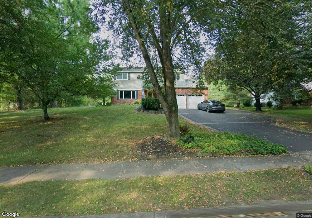
1039 Schultz Rd Unit 23 Norristown, PA 19403
East Norriton Township NeighborhoodEstimated Value: $502,000 - $664,000
4
Beds
3
Baths
2,344
Sq Ft
$241/Sq Ft
Est. Value
About This Home
This home is located at 1039 Schultz Rd Unit 23, Norristown, PA 19403 and is currently estimated at $565,224, approximately $241 per square foot. 1039 Schultz Rd Unit 23 is a home located in Montgomery County with nearby schools including Paul V Fly Elementary School, East Norriton Middle School, and Charles Blockson Middle School.
Ownership History
Date
Name
Owned For
Owner Type
Purchase Details
Closed on
Oct 24, 2011
Sold by
Yarnall Bruce R and Mannino Flora
Bought by
Yarnall Bruce R and Yarnall Flora
Current Estimated Value
Home Financials for this Owner
Home Financials are based on the most recent Mortgage that was taken out on this home.
Original Mortgage
$224,000
Outstanding Balance
$152,629
Interest Rate
4.08%
Estimated Equity
$412,595
Purchase Details
Closed on
Jan 26, 1995
Sold by
Bath Ronald F and Bath Taryn W
Bought by
Varnall Bruce R and Mannino Flora
Create a Home Valuation Report for This Property
The Home Valuation Report is an in-depth analysis detailing your home's value as well as a comparison with similar homes in the area
Home Values in the Area
Average Home Value in this Area
Purchase History
| Date | Buyer | Sale Price | Title Company |
|---|---|---|---|
| Yarnall Bruce R | -- | None Available | |
| Varnall Bruce R | $171,900 | -- |
Source: Public Records
Mortgage History
| Date | Status | Borrower | Loan Amount |
|---|---|---|---|
| Open | Yarnall Bruce R | $224,000 |
Source: Public Records
Tax History Compared to Growth
Tax History
| Year | Tax Paid | Tax Assessment Tax Assessment Total Assessment is a certain percentage of the fair market value that is determined by local assessors to be the total taxable value of land and additions on the property. | Land | Improvement |
|---|---|---|---|---|
| 2025 | $7,879 | $167,260 | $48,450 | $118,810 |
| 2024 | $7,879 | $167,260 | $48,450 | $118,810 |
| 2023 | $7,787 | $167,260 | $48,450 | $118,810 |
| 2022 | $7,735 | $167,260 | $48,450 | $118,810 |
| 2021 | $7,686 | $167,260 | $48,450 | $118,810 |
| 2020 | $7,448 | $167,260 | $48,450 | $118,810 |
| 2019 | $7,275 | $167,260 | $48,450 | $118,810 |
| 2018 | $7,275 | $167,260 | $48,450 | $118,810 |
| 2017 | $6,852 | $167,260 | $48,450 | $118,810 |
| 2016 | $6,787 | $167,260 | $48,450 | $118,810 |
| 2015 | $6,431 | $167,260 | $48,450 | $118,810 |
| 2014 | $6,431 | $167,260 | $48,450 | $118,810 |
Source: Public Records
Map
Nearby Homes
- 2967 Township Line Rd
- 1507 Potshop Rd
- 1534 N Trooper Rd
- 3023 Eisenhower Rd
- 1241 & 1243 Valley Forge Rd
- 906 N Trooper Rd
- 1103 Arden Dr Unit METHACTON SCHOOL
- 3103 Hayes Rd
- 0 Windy Hill Rd Unit METHACTON SD
- LOT 1 Wanda
- 2939 W Germantown Pike
- 934 Heritage Dr
- 643 Barbara Dr
- 805 Sandra Ln
- 515 Faith Dr
- 511 Faith Dr
- 3116 Methacton Ave
- LOT 28 Heebner Rd
- 1716 Landis Rd
- 805 Stonybrook Dr