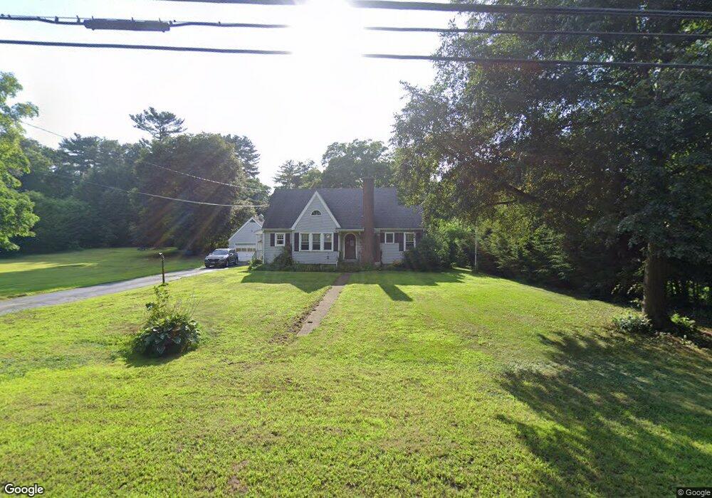
1039 Upper Maple St Dayville, CT 06241
Estimated Value: $313,000 - $357,000
4
Beds
2
Baths
1,058
Sq Ft
$317/Sq Ft
Est. Value
About This Home
This home is located at 1039 Upper Maple St, Dayville, CT 06241 and is currently estimated at $335,233, approximately $316 per square foot. 1039 Upper Maple St is a home located in Windham County with nearby schools including Killingly Central School, Killingly Memorial School, and Killingly Intermediate School.
Ownership History
Date
Name
Owned For
Owner Type
Purchase Details
Closed on
Nov 17, 1998
Sold by
Est Kramer Frances R and Kramer Judith
Bought by
Neal Darilyn F
Current Estimated Value
Home Financials for this Owner
Home Financials are based on the most recent Mortgage that was taken out on this home.
Original Mortgage
$43,250
Interest Rate
6.65%
Create a Home Valuation Report for This Property
The Home Valuation Report is an in-depth analysis detailing your home's value as well as a comparison with similar homes in the area
Home Values in the Area
Average Home Value in this Area
Purchase History
| Date | Buyer | Sale Price | Title Company |
|---|---|---|---|
| Neal Darilyn F | $100,000 | -- | |
| Neal Darilyn F | $100,000 | -- |
Source: Public Records
Mortgage History
| Date | Status | Borrower | Loan Amount |
|---|---|---|---|
| Closed | Neal Darilyn F | $13,000 | |
| Closed | Neal Darilyn F | $43,250 |
Source: Public Records
Tax History Compared to Growth
Tax History
| Year | Tax Paid | Tax Assessment Tax Assessment Total Assessment is a certain percentage of the fair market value that is determined by local assessors to be the total taxable value of land and additions on the property. | Land | Improvement |
|---|---|---|---|---|
| 2025 | $4,140 | $176,540 | $41,070 | $135,470 |
| 2024 | $3,896 | $176,540 | $41,070 | $135,470 |
| 2023 | $4,287 | $149,630 | $33,990 | $115,640 |
| 2022 | $4,095 | $152,180 | $36,540 | $115,640 |
| 2021 | $4,095 | $152,180 | $36,540 | $115,640 |
| 2020 | $4,008 | $152,180 | $36,540 | $115,640 |
| 2019 | $4,088 | $152,180 | $36,540 | $115,640 |
| 2017 | $3,548 | $121,450 | $30,240 | $91,210 |
| 2016 | $3,535 | $121,450 | $30,240 | $91,210 |
| 2015 | $3,560 | $121,450 | $30,240 | $91,210 |
| 2014 | $3,463 | $121,450 | $30,240 | $91,210 |
Source: Public Records
Map
Nearby Homes
- 4 Bluebird Ln
- 3 Ferland Dr
- 11 Kenneth Dr
- 98 Williamsville Rd
- 7 Shelby Cir
- 85 Soap St
- 1067 N Main St
- 1032 N Main St Unit 9
- 10 Conrad's Park
- 14 Valley View Dr
- 18 Valley View Dr
- 16 Valley View Dr
- 30 Huntley Rd
- 860 N Main St
- 140 Woodward St
- 38-82 Ballouville Rd
- 61 Deerwood Dr
- 842 Hartford Pike
- 420 Putnam Pike
- 36 Breakneck Hill Rd
- 1043 Upper Maple St
- 1033 Upper Maple St
- 1049 Upper Maple St
- 1044 Upper Maple St
- 1029 Upper Maple St
- 1040 Upper Maple St
- 1048 Upper Maple St
- 1030 Upper Maple St
- 269 Hartford Pike
- 265 Hartford Pike
- 1019 Upper Maple St
- 1024 Upper Maple St
- 259 Hartford Pike
- 20 Colonial Dr
- 1034 Upper Maple St
- 323 Hartford Pike
- 14 Colonial Dr
- 5 Colonial Dr
- 253 Hartford Pike
- 245 Hartford Pike