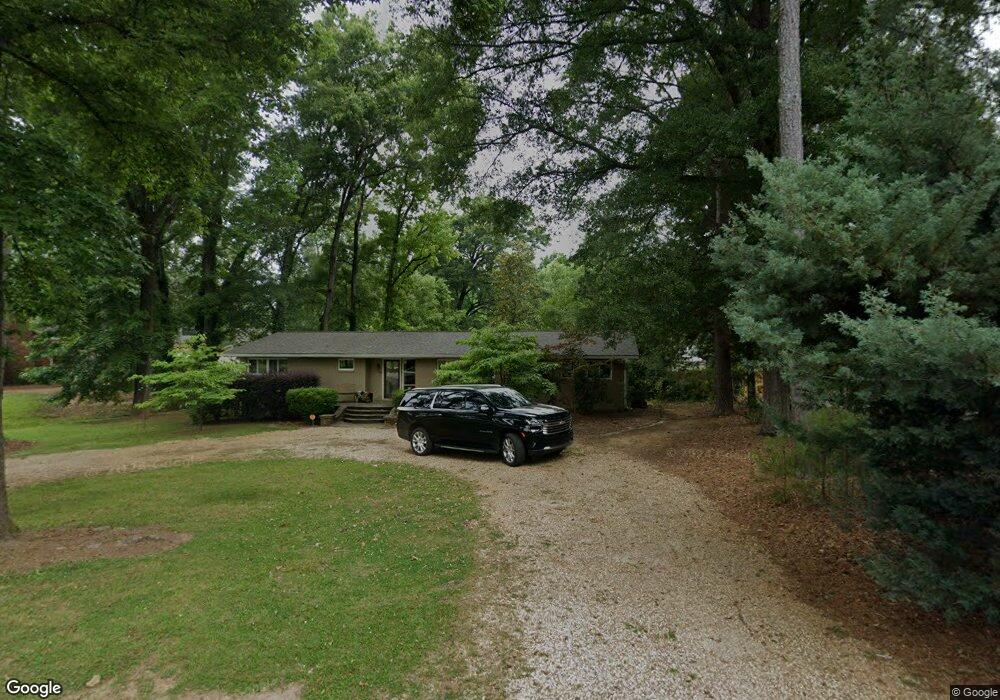
1039 William St Madison, GA 30650
Estimated Value: $342,053 - $482,000
--
Bed
--
Bath
1,968
Sq Ft
$218/Sq Ft
Est. Value
About This Home
This home is located at 1039 William St, Madison, GA 30650 and is currently estimated at $428,263, approximately $217 per square foot. 1039 William St is a home located in Morgan County with nearby schools including Morgan County Primary School, Morgan County Elementary School, and Morgan County Middle School.
Ownership History
Date
Name
Owned For
Owner Type
Purchase Details
Closed on
Jul 3, 2006
Sold by
Attaway A R
Bought by
Sarkin Jamie Moore
Current Estimated Value
Home Financials for this Owner
Home Financials are based on the most recent Mortgage that was taken out on this home.
Original Mortgage
$185,000
Interest Rate
6.6%
Mortgage Type
New Conventional
Purchase Details
Closed on
Apr 16, 1971
Sold by
Prior William A
Bought by
Attaway A R Mrs
Create a Home Valuation Report for This Property
The Home Valuation Report is an in-depth analysis detailing your home's value as well as a comparison with similar homes in the area
Home Values in the Area
Average Home Value in this Area
Purchase History
| Date | Buyer | Sale Price | Title Company |
|---|---|---|---|
| Sarkin Jamie Moore | $165,000 | -- | |
| Attaway A R Mrs | -- | -- |
Source: Public Records
Mortgage History
| Date | Status | Borrower | Loan Amount |
|---|---|---|---|
| Closed | Sarkin Jamie Moore | $185,000 |
Source: Public Records
Tax History Compared to Growth
Tax History
| Year | Tax Paid | Tax Assessment Tax Assessment Total Assessment is a certain percentage of the fair market value that is determined by local assessors to be the total taxable value of land and additions on the property. | Land | Improvement |
|---|---|---|---|---|
| 2024 | $2,683 | $97,112 | $22,000 | $75,112 |
| 2023 | $2,507 | $88,294 | $22,000 | $66,294 |
| 2022 | $2,416 | $82,114 | $20,000 | $62,114 |
| 2021 | $2,365 | $80,114 | $18,000 | $62,114 |
| 2020 | $2,388 | $80,114 | $18,000 | $62,114 |
| 2019 | $2,426 | $80,114 | $18,000 | $62,114 |
| 2018 | $2,459 | $80,114 | $18,000 | $62,114 |
| 2017 | $2,545 | $79,986 | $18,000 | $61,986 |
| 2016 | $2,201 | $69,158 | $18,000 | $51,158 |
| 2015 | $2,224 | $68,960 | $18,000 | $50,960 |
| 2014 | $2,172 | $69,080 | $20,000 | $49,080 |
| 2013 | -- | $63,800 | $20,000 | $43,800 |
Source: Public Records
Map
Nearby Homes
- .78 +/- acres Poplar St
- 1291 Spinnaker Rd
- 1000 Jacob Prickett Ln
- 1033 Crawford St
- 991 Crawford St
- 1001 Alaina Ave
- 1041 Alaina Ave
- 1001 Alaina Ave Unit 71
- 1041 Alaina Ave Unit 69
- 691 Skyline Dr
- 811 Foster St
- 665 E Walton St
- 757 Markhams Dr
- 1.19 +/- ACRES Poplar St
- 426 Poplar St
- 855 Meadow Ridge Dr
- 601 Foster Park Ln
- 690 Foster Park Ln
- 411 Old Post Rd
- 617 Dixie Ave