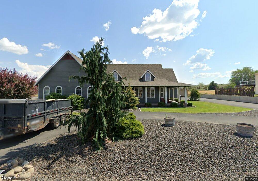
10391 Road 5.6 NE Moses Lake, WA 98837
Estimated Value: $780,000 - $851,000
4
Beds
3
Baths
3,303
Sq Ft
$249/Sq Ft
Est. Value
About This Home
This home is located at 10391 Road 5.6 NE, Moses Lake, WA 98837 and is currently estimated at $823,992, approximately $249 per square foot. 10391 Road 5.6 NE is a home located in Grant County with nearby schools including Longview Elementary School, Frontier Middle School, and Moses Lake High School.
Ownership History
Date
Name
Owned For
Owner Type
Purchase Details
Closed on
Aug 18, 2025
Sold by
Williams Michael V and Williams Tammy
Bought by
Dahms Randy and Dahms Kelly
Current Estimated Value
Home Financials for this Owner
Home Financials are based on the most recent Mortgage that was taken out on this home.
Original Mortgage
$200,000
Outstanding Balance
$199,825
Interest Rate
6.67%
Mortgage Type
New Conventional
Estimated Equity
$624,167
Purchase Details
Closed on
Mar 14, 2017
Sold by
Williams Staci M
Bought by
Williams Michael V
Home Financials for this Owner
Home Financials are based on the most recent Mortgage that was taken out on this home.
Original Mortgage
$254,100
Interest Rate
4.16%
Mortgage Type
New Conventional
Create a Home Valuation Report for This Property
The Home Valuation Report is an in-depth analysis detailing your home's value as well as a comparison with similar homes in the area
Home Values in the Area
Average Home Value in this Area
Purchase History
| Date | Buyer | Sale Price | Title Company |
|---|---|---|---|
| Dahms Randy | $849,000 | Frontier Title & Escrow | |
| Williams Michael V | -- | Stewart Title |
Source: Public Records
Mortgage History
| Date | Status | Borrower | Loan Amount |
|---|---|---|---|
| Open | Dahms Randy | $200,000 | |
| Previous Owner | Williams Michael V | $254,100 |
Source: Public Records
Tax History Compared to Growth
Tax History
| Year | Tax Paid | Tax Assessment Tax Assessment Total Assessment is a certain percentage of the fair market value that is determined by local assessors to be the total taxable value of land and additions on the property. | Land | Improvement |
|---|---|---|---|---|
| 2024 | $5,045 | $462,460 | $64,120 | $398,340 |
| 2023 | $4,856 | $395,195 | $64,120 | $331,075 |
| 2022 | $4,578 | $395,195 | $64,120 | $331,075 |
| 2021 | $4,544 | $395,195 | $64,120 | $331,075 |
| 2020 | $4,754 | $382,265 | $64,120 | $318,145 |
| 2019 | $4,340 | $334,940 | $60,000 | $274,940 |
| 2018 | $4,659 | $305,785 | $60,000 | $245,785 |
| 2017 | $4,219 | $292,130 | $60,000 | $232,130 |
| 2016 | $4,176 | $283,190 | $60,000 | $223,190 |
| 2013 | -- | $283,190 | $60,000 | $223,190 |
Source: Public Records
Map
Nearby Homes
- 9 Road J 6 NE
- 5724 Road J 4 NE
- 5788 Road K NE
- 5426 Crystal Springs Place NE
- 921 W Ted Yao Way
- 9749 NE Harris Rd NE
- 211 W Newfield Place
- 4235 W Sandy Ct
- 4208 W Sandy Ct
- 5502 Crystal Springs Place NE
- 10117 Maple Dr NE
- 4913 Alma Rd NE
- 4652 Covey Ln
- 9840 Apple Rd NE
- 6712 NE K
- 4331 Road K NE
- 0 NNA Road I NE
- 4750 Bluff Dr NE
- 4187 Miller St NE
- 4560 Bluff Dr NE
- 0 25/19/27 E Rd NE
- 10365 Road 5.6 NE
- 10392 Road 5.6 NE
- 10439 Road 5 6 NE
- 10439 Road 5.6 NE
- 10392 Road 5 NE
- 10364 Road 5.6 NE
- 10333 5 6 Rd NE
- 5621 Road J 4 NE
- 5621 J 4 Rd NE
- 5621 Road J.4 NE
- 10334 Road 5.6 NE
- 10334 Road 5 NE
- 10305 Road 5.6 NE
- 10305 N 5 6 Rd
- 10519 Road 5 NE
- 10306 Road 5 NE
- 10306 Road 5.6 NE
- 10306 Road 5 6 NE
- 10306 5 6 Rd NE