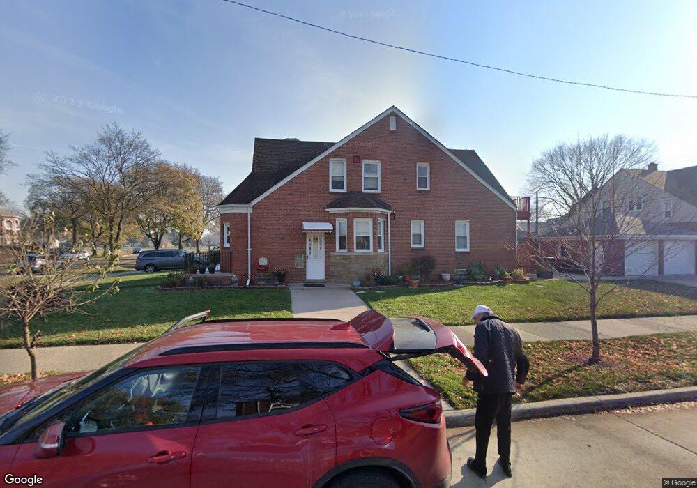
10395 S Morrow Cir Dearborn, MI 48126
Aviation NeighborhoodEstimated Value: $278,000 - $415,000
3
Beds
3
Baths
1,977
Sq Ft
$178/Sq Ft
Est. Value
About This Home
This home is located at 10395 S Morrow Cir, Dearborn, MI 48126 and is currently estimated at $351,328, approximately $177 per square foot. 10395 S Morrow Cir is a home located in Wayne County with nearby schools including McDonald Elementary School, McCollough-Unis School, and Fordson High School.
Ownership History
Date
Name
Owned For
Owner Type
Purchase Details
Closed on
Apr 5, 2023
Sold by
Beydoun Jawan Taleb
Bought by
Beydoun Jawan Taleb and Beydoun Abraham Hassan
Current Estimated Value
Home Financials for this Owner
Home Financials are based on the most recent Mortgage that was taken out on this home.
Original Mortgage
$116,850
Outstanding Balance
$95,050
Interest Rate
6.42%
Mortgage Type
Credit Line Revolving
Estimated Equity
$256,278
Purchase Details
Closed on
May 5, 2004
Sold by
Taleb Hassan and Taleb Ahmed
Bought by
Taleb Jawan
Purchase Details
Closed on
Nov 13, 1995
Sold by
Taleb Hassan and Taleb Ahmad
Bought by
Taleb Hassan and Taleb Ahmad
Create a Home Valuation Report for This Property
The Home Valuation Report is an in-depth analysis detailing your home's value as well as a comparison with similar homes in the area
Home Values in the Area
Average Home Value in this Area
Purchase History
| Date | Buyer | Sale Price | Title Company |
|---|---|---|---|
| Beydoun Jawan Taleb | -- | None Listed On Document | |
| Beydoun Jawan Taleb | -- | None Listed On Document | |
| Taleb Jawan | $140,000 | -- | |
| Taleb Hassan | $123,000 | -- |
Source: Public Records
Mortgage History
| Date | Status | Borrower | Loan Amount |
|---|---|---|---|
| Open | Beydoun Jawan Taleb | $116,850 | |
| Closed | Beydoun Jawan Taleb | $116,850 |
Source: Public Records
Tax History
| Year | Tax Paid | Tax Assessment Tax Assessment Total Assessment is a certain percentage of the fair market value that is determined by local assessors to be the total taxable value of land and additions on the property. | Land | Improvement |
|---|---|---|---|---|
| 2025 | $3,125 | $184,600 | $0 | $0 |
| 2024 | $3,100 | $150,100 | $0 | $0 |
| 2023 | $2,847 | $118,500 | $0 | $0 |
| 2022 | $3,239 | $106,300 | $0 | $0 |
| 2021 | $3,548 | $99,900 | $0 | $0 |
| 2019 | $3,506 | $81,700 | $0 | $0 |
| 2018 | $3,003 | $75,800 | $0 | $0 |
| 2017 | $791 | $66,900 | $0 | $0 |
| 2011 | -- | $53,650 | $0 | $0 |
Source: Public Records
Map
Nearby Homes
- 7815 Normile St
- 7900 Middlepointe St
- 8511 Lonyo St
- 10339 Tireman Ave
- 7658 Appoline St
- 7929 Normile St
- 8100 Middlepoint St
- 8805 Whitlock Ave
- 7857 Esper Blvd
- 8048 Kentucky St
- 8116 Wyoming Ave
- 55 Morross Cir Unit 7
- 7758 Reuter St
- 12953 Tireman Ave
- 30 Morross Cir Unit 44
- 8088 Wisconsin St
- 8205 Appoline St
- 8258 Meyers Rd
- 8315 Freda St
- 8265 Kentucky St
- 10383 S Morrow Cir
- 7334 Middlepointe St
- 10375 S Morrow Cir
- 10427 S Morrow Cir
- 7330 Middlepointe St
- 10365 S Morrow Cir
- 7320 Middlepointe St
- 10437 S Morrow Cir
- 7337 Middlepointe St
- 7335 Kingsley St
- 10356 S Morrow Cir
- 7355 Kingsley St
- 7329 Middlepointe St
- 7329 Kingsley St
- 7312 Middlepointe St
- 10390 S Morrow Cir
- 10445 S Morrow Cir
- 10376 S Morrow Cir
- 7321 Middlepointe St
- 7323 Kingsley St
Your Personal Tour Guide
Ask me questions while you tour the home.