Estimated Value: $495,668 - $666,000
2
Beds
2
Baths
1,616
Sq Ft
$371/Sq Ft
Est. Value
About This Home
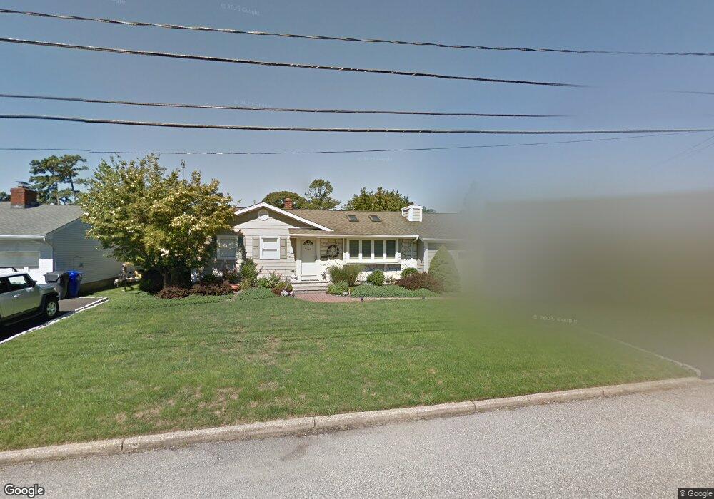
This home is located at 104 Albert St, Brick, NJ 08724 and is currently estimated at $599,917, approximately $371 per square foot. 104 Albert St is a home located in Ocean County with nearby schools including Midstreams Elementary School, Veterans Memorial Middle School, and Brick Township Memorial High School.
Ownership History
Date
Name
Owned For
Owner Type
Purchase Details
Closed on
Aug 5, 2002
Sold by
Corbett Jeffrey
Bought by
Mcguire Rosalie
Current Estimated Value
Home Financials for this Owner
Home Financials are based on the most recent Mortgage that was taken out on this home.
Original Mortgage
$150,000
Interest Rate
6.36%
Purchase Details
Closed on
Jul 17, 1998
Sold by
Kelly Kathryn C
Bought by
Corbett Jeffrey
Home Financials for this Owner
Home Financials are based on the most recent Mortgage that was taken out on this home.
Original Mortgage
$110,634
Interest Rate
6.94%
Mortgage Type
FHA
Purchase Details
Closed on
Nov 19, 1993
Sold by
Winder Edward
Bought by
Corbett Jeffrey
Home Financials for this Owner
Home Financials are based on the most recent Mortgage that was taken out on this home.
Original Mortgage
$107,000
Interest Rate
6.78%
Create a Home Valuation Report for This Property
The Home Valuation Report is an in-depth analysis detailing your home's value as well as a comparison with similar homes in the area
Home Values in the Area
Average Home Value in this Area
Purchase History
| Date | Buyer | Sale Price | Title Company |
|---|---|---|---|
| Mcguire Rosalie | $232,900 | -- | |
| Corbett Jeffrey | -- | -- | |
| Corbett Jeffrey | $118,500 | -- |
Source: Public Records
Mortgage History
| Date | Status | Borrower | Loan Amount |
|---|---|---|---|
| Previous Owner | Mcguire Rosalie | $150,000 | |
| Previous Owner | Corbett Jeffrey | $110,634 | |
| Previous Owner | Corbett Jeffrey | $107,000 |
Source: Public Records
Tax History
| Year | Tax Paid | Tax Assessment Tax Assessment Total Assessment is a certain percentage of the fair market value that is determined by local assessors to be the total taxable value of land and additions on the property. | Land | Improvement |
|---|---|---|---|---|
| 2025 | $6,689 | $256,300 | $150,000 | $106,300 |
| 2024 | $6,349 | $256,300 | $150,000 | $106,300 |
Source: Public Records
Map
Nearby Homes
- 511 Robinhood Rd
- 173 Cliff Rd
- 515 Carroll Fox Rd
- 1621 Northstream Pkwy
- 118 Solar Dr
- 153 Natick Trail
- 470 Princeton Ave
- 556 Parker Ave
- 1553 Littlehill Rd
- 157 Natick Trail
- 546 Princeton Ave
- 665 Bancroft Rd
- 599 Parker Ave
- 90 Canis Dr
- 500 Princeton Ave
- 140 Meridian Dr
- 49 N Cherokee Ln
- 36 Lenape Trail
- 603 Point Ave
- 599 Point Ave
Your Personal Tour Guide
Ask me questions while you tour the home.