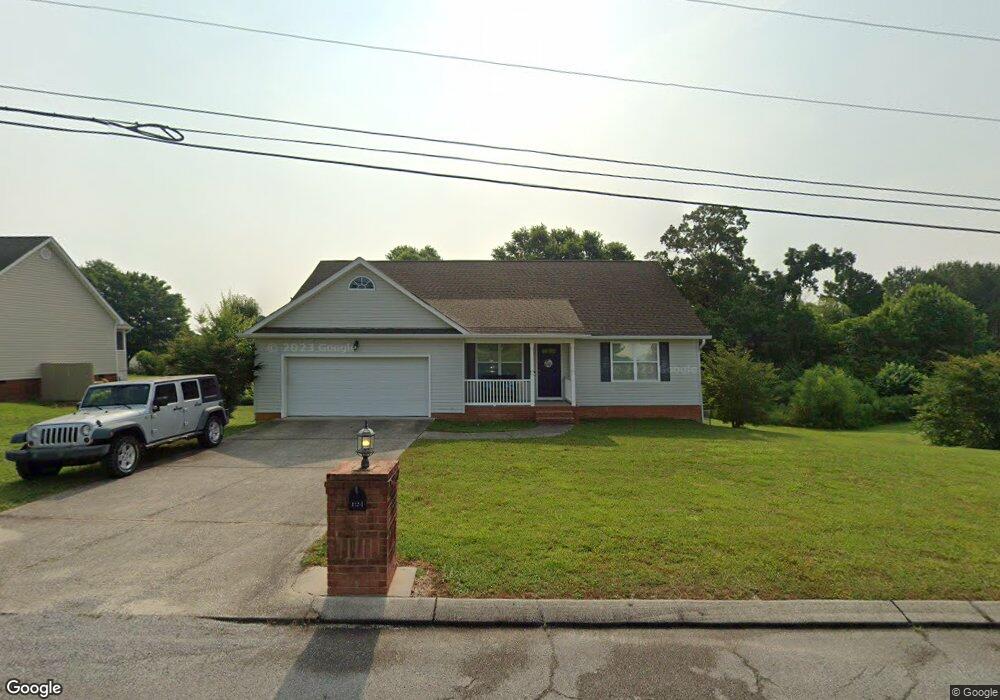
104 Bent Tree Dr Ringgold, GA 30736
Estimated Value: $275,609 - $307,000
Studio
2
Baths
1,353
Sq Ft
$215/Sq Ft
Est. Value
About This Home
This home is located at 104 Bent Tree Dr, Ringgold, GA 30736 and is currently estimated at $291,402, approximately $215 per square foot. 104 Bent Tree Dr is a home located in Catoosa County with nearby schools including Ringgold Primary School, Ringgold Elementary School, and Heritage Middle School.
Ownership History
Date
Name
Owned For
Owner Type
Purchase Details
Closed on
Dec 4, 2018
Sold by
Boran Robert W
Bought by
Bankston John and Bankston Darlene
Current Estimated Value
Home Financials for this Owner
Home Financials are based on the most recent Mortgage that was taken out on this home.
Original Mortgage
$95,000
Outstanding Balance
$54,438
Interest Rate
4.9%
Mortgage Type
New Conventional
Estimated Equity
$236,964
Purchase Details
Closed on
Jan 16, 2003
Bought by
Boran Robert W And
Create a Home Valuation Report for This Property
The Home Valuation Report is an in-depth analysis detailing your home's value as well as a comparison with similar homes in the area
Home Values in the Area
Average Home Value in this Area
Purchase History
| Date | Buyer | Sale Price | Title Company |
|---|---|---|---|
| Bankston John | $95,000 | -- | |
| Boran Robert W And | $100,000 | -- |
Source: Public Records
Mortgage History
| Date | Status | Borrower | Loan Amount |
|---|---|---|---|
| Open | Bankston John | $95,000 |
Source: Public Records
Tax History
| Year | Tax Paid | Tax Assessment Tax Assessment Total Assessment is a certain percentage of the fair market value that is determined by local assessors to be the total taxable value of land and additions on the property. | Land | Improvement |
|---|---|---|---|---|
| 2025 | $2,178 | $114,692 | $16,000 | $98,692 |
| 2024 | $2,363 | $110,786 | $16,000 | $94,786 |
| 2023 | $1,973 | $88,131 | $16,000 | $72,131 |
| 2022 | $1,563 | $69,828 | $16,000 | $53,828 |
| 2021 | $1,461 | $69,828 | $16,000 | $53,828 |
| 2020 | $1,416 | $61,211 | $14,000 | $47,211 |
| 2019 | $1,385 | $59,211 | $12,000 | $47,211 |
| 2018 | $1,413 | $57,211 | $10,000 | $47,211 |
| 2017 | $1,384 | $56,016 | $10,000 | $46,016 |
| 2016 | $1,262 | $48,544 | $10,000 | $38,544 |
| 2015 | -- | $48,544 | $10,000 | $38,544 |
| 2014 | -- | $48,544 | $10,000 | $38,544 |
| 2013 | -- | $48,543 | $10,000 | $38,543 |
Source: Public Records
Map
Nearby Homes
- 56 Ginger Dr
- 166 Misty Ridge Ln
- 478 Dedmon Rd
- 185 Cornerstone Dr
- 65 Night Shade Ln
- 486 E Sharon Cir
- 81 Shrader Ln
- 299 Southern Dr
- 506 Crestview Cir
- 63 Sunset Dr
- 8 E Sharon Cir
- 428 Dodd Rd
- 155 Willowbrook Dr
- 391 Oak Tree Rd
- 8690 Alabama Hwy
- 0 Battlefield Pkwy Unit 1521890
- 141 Harbour Ln
- 54 Crest Cir
- 138 Red Tail Dr
- 126 Red Tail Dr
- 132 Bent Tree Dr
- 103 Bent Tree Dr
- 78 Bent Tree Dr
- 155 Misty Ridge Ln
- 156 Bent Tree Dr Unit LT 15
- 135 Misty Ridge Ln
- 65 Bent Tree Dr
- 175 Misty Ridge Ln
- 19 Ginger Dr
- 19 Ginger Dr Unit 2
- 195 Misty Ridge Ln
- 0 Ginger Dr Unit 1001009
- 58 Bent Tree Dr
- 121 Misty Ridge Ln
- 39 Ginger Dr
- 0 Ginger Dr
- 0 Misty Ridge Ln Unit RTC2724260
- 0 Misty Ridge Ln Unit RTC2332200
- 175 Bent Tree Dr
- 182 Bent Tree Dr
Your Personal Tour Guide
Ask me questions while you tour the home.