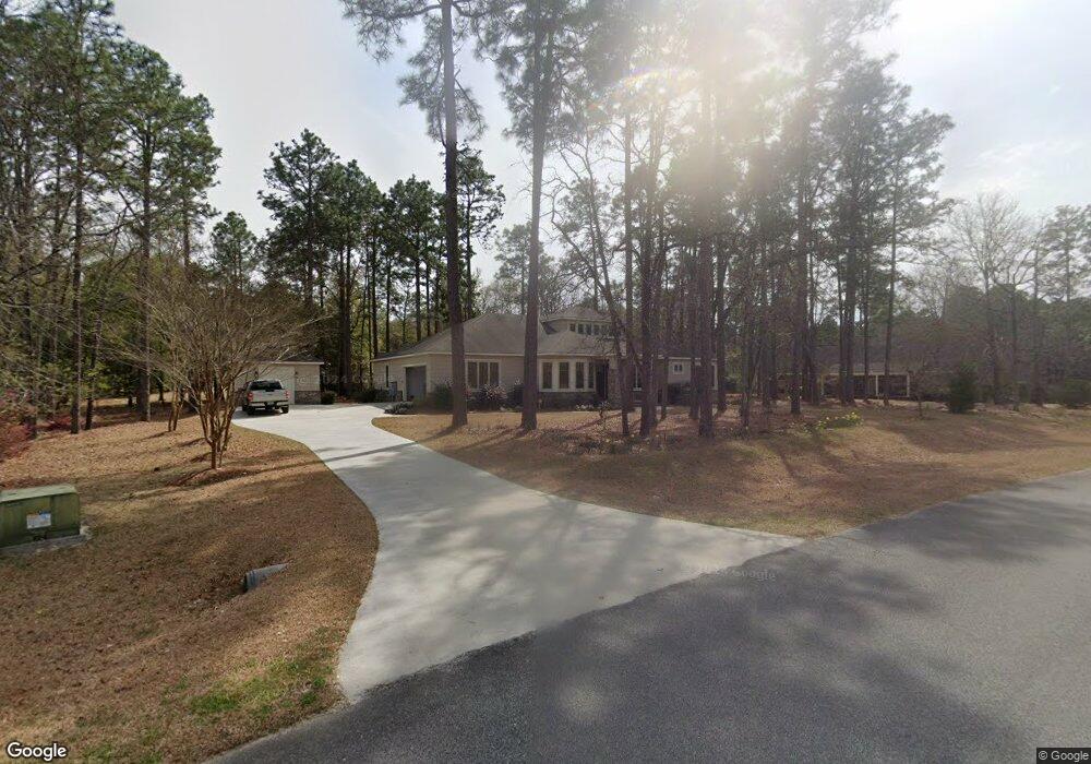
104 Brentwood Cir Statesboro, GA 30458
Estimated Value: $567,000 - $575,000
4
Beds
4
Baths
3,361
Sq Ft
$170/Sq Ft
Est. Value
About This Home
This home is located at 104 Brentwood Cir, Statesboro, GA 30458 and is currently estimated at $571,952, approximately $170 per square foot. 104 Brentwood Cir is a home located in Bulloch County with nearby schools including Julia P. Bryant Elementary School, Statesboro High School, and William James Middle School.
Ownership History
Date
Name
Owned For
Owner Type
Purchase Details
Closed on
Nov 16, 2021
Sold by
Brooks Elizabeth Collins
Bought by
Brooks John R
Current Estimated Value
Purchase Details
Closed on
Aug 17, 2020
Sold by
Evans Gregory
Bought by
Brooks John R and Brooks Elizabeth Collins
Home Financials for this Owner
Home Financials are based on the most recent Mortgage that was taken out on this home.
Original Mortgage
$165,000
Interest Rate
2.9%
Mortgage Type
New Conventional
Purchase Details
Closed on
Dec 16, 2011
Bought by
Evans Gregory
Purchase Details
Closed on
Oct 1, 2009
Sold by
Stavriotis Paul
Bought by
Metter Bank
Purchase Details
Closed on
Nov 21, 2007
Sold by
Not Provided
Bought by
Metter Bank
Purchase Details
Closed on
Apr 16, 2007
Sold by
Not Provided
Bought by
Metter Bank
Purchase Details
Closed on
Jul 27, 2006
Sold by
Not Provided
Bought by
Metter Bank
Create a Home Valuation Report for This Property
The Home Valuation Report is an in-depth analysis detailing your home's value as well as a comparison with similar homes in the area
Home Values in the Area
Average Home Value in this Area
Purchase History
| Date | Buyer | Sale Price | Title Company |
|---|---|---|---|
| Brooks John R | -- | -- | |
| Brooks John R | $339,000 | -- | |
| Evans Gregory | $32,500 | -- | |
| Metter Bank | -- | -- | |
| Metter Bank | -- | -- | |
| Metter Bank | $58,500 | -- | |
| Metter Bank | $54,000 | -- | |
| Metter Bank | -- | -- |
Source: Public Records
Mortgage History
| Date | Status | Borrower | Loan Amount |
|---|---|---|---|
| Previous Owner | Brooks John R | $165,000 |
Source: Public Records
Tax History Compared to Growth
Tax History
| Year | Tax Paid | Tax Assessment Tax Assessment Total Assessment is a certain percentage of the fair market value that is determined by local assessors to be the total taxable value of land and additions on the property. | Land | Improvement |
|---|---|---|---|---|
| 2024 | $4,779 | $219,040 | $19,800 | $199,240 |
| 2023 | $4,855 | $204,720 | $18,000 | $186,720 |
| 2022 | $3,901 | $181,102 | $18,000 | $163,102 |
| 2021 | $2,969 | $152,934 | $18,000 | $134,934 |
| 2020 | $3,259 | $140,717 | $18,000 | $122,717 |
| 2019 | $3,307 | $144,442 | $21,600 | $122,842 |
| 2018 | $3,402 | $143,315 | $21,600 | $121,715 |
| 2017 | $3,325 | $138,403 | $21,600 | $116,803 |
| 2016 | $3,310 | $134,505 | $21,600 | $112,905 |
| 2015 | $3,199 | $129,412 | $21,600 | $107,812 |
| 2014 | $2,998 | $129,412 | $21,600 | $107,812 |
Source: Public Records
Map
Nearby Homes
- 202 Plantation Trail
- 0 Brentwood Cir Unit 10648008
- 101 Remington Way
- 218 Wellington Cir
- 225 Wellington Cir
- 0 Country Club Rd Unit SA343019
- 0 Country Club Rd Unit 10637928
- 220 Bald Cypress Ct
- 137 Pin Oak Ln
- 105 Oak Ridge Dr
- 0 Surrey Ln Unit 10441906
- 16 Forest Pine Dr
- 0 Golf Club Cir Unit 10651857
- 214 Surrey Ln
- 418 Brannen Dr Unit 2
- 135 Avalon Lot 18 Trace
- 324 Farmington Rd
- 7 Woodrum Place
- 15 Woodrum Place
- 19 Woodrum Place
- 21 Brentwood Cir Unit 21
- 305 Yorkshire Ct
- 207 Plantation Trail
- 0 Iron Gate Phase 4 Unit LOT 27 3194806
- 108 Brentwood Cir
- 203 Plantation Trail
- 308 Yorkshire Ct
- 119 Brentwood Cir
- 206 Plantation Trail
- 213 Plantation Trail
- 210 Plantation Trail
- 208 Plantation Trail
- 0 Plantation Trail Unit 22 8268672
- 0 Plantation Trail Unit 23 8268678
- 0 Plantation Trail Unit 3166624
- 24 Plantation Trail
- 0 Plantation Trail Unit 3265345
- 0 Plantation Trail Unit 19 7016800
- 0 Plantation Trail Unit 34 7127923
- 0 Plantation Trail Unit LOT 19 7284570