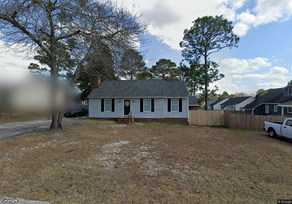
104 Carlsbad Ct West Columbia, SC 29170
Estimated Value: $173,000 - $200,842
3
Beds
2
Baths
1,064
Sq Ft
$178/Sq Ft
Est. Value
About This Home
This home is located at 104 Carlsbad Ct, West Columbia, SC 29170 and is currently estimated at $189,711, approximately $178 per square foot. 104 Carlsbad Ct is a home located in Lexington County with nearby schools including White Knoll Elementary School, White Knoll Middle School, and White Knoll High School.
Ownership History
Date
Name
Owned For
Owner Type
Purchase Details
Closed on
Aug 31, 2017
Sold by
Pifer Joshua A
Bought by
Wright Carynn Amber
Current Estimated Value
Purchase Details
Closed on
Feb 24, 2012
Sold by
Branham Travis M and Watson Kimberly L
Bought by
Pifer Joshua A
Home Financials for this Owner
Home Financials are based on the most recent Mortgage that was taken out on this home.
Original Mortgage
$87,718
Interest Rate
3.75%
Mortgage Type
FHA
Purchase Details
Closed on
Sep 8, 2004
Sold by
Branham Travis M and Watson Kimberly L
Bought by
Branham Travis M and Branham Kimberly L
Create a Home Valuation Report for This Property
The Home Valuation Report is an in-depth analysis detailing your home's value as well as a comparison with similar homes in the area
Home Values in the Area
Average Home Value in this Area
Purchase History
| Date | Buyer | Sale Price | Title Company |
|---|---|---|---|
| Wright Carynn Amber | $100,500 | None Available | |
| Pifer Joshua A | $90,000 | -- | |
| Branham Travis M | -- | -- |
Source: Public Records
Mortgage History
| Date | Status | Borrower | Loan Amount |
|---|---|---|---|
| Previous Owner | Pifer Joshua A | $87,718 |
Source: Public Records
Tax History Compared to Growth
Tax History
| Year | Tax Paid | Tax Assessment Tax Assessment Total Assessment is a certain percentage of the fair market value that is determined by local assessors to be the total taxable value of land and additions on the property. | Land | Improvement |
|---|---|---|---|---|
| 2024 | $623 | $4,169 | $1,000 | $3,169 |
| 2023 | $623 | $4,169 | $1,000 | $3,169 |
| 2022 | $621 | $4,169 | $1,000 | $3,169 |
| 2020 | $637 | $4,169 | $1,000 | $3,169 |
| 2019 | $625 | $4,020 | $800 | $3,220 |
| 2018 | $613 | $4,020 | $800 | $3,220 |
| 2017 | $545 | $3,680 | $800 | $2,880 |
| 2016 | $540 | $3,680 | $800 | $2,880 |
| 2014 | $505 | $3,599 | $880 | $2,719 |
| 2013 | -- | $3,600 | $880 | $2,720 |
Source: Public Records
Map
Nearby Homes
- 142 Katie Ct
- 766 Samantha St
- 758 Samantha St
- 807 Daniel Lake Ct
- 815 Daniel Lake Ct
- Cooper Plan at Emanuel Creek
- Keowee Plan at Emanuel Creek
- Wylie Plan at Emanuel Creek
- Murray Plan at Emanuel Creek
- Adger Plan at Emanuel Creek
- Thurmond Plan at Emanuel Creek
- 724 Samantha St
- 827 Daniel Lake Ct
- 812 Daniel Lake Ct
- 189 Pebble Creek Dr
- 720 Samantha St
- 725 Samantha St
- 816 Daniel Lake Ct
- 241 Dove Trace Dr
- 712 Samantha St
- 106 Carlsbad Ct
- 201 Coronado Rd
- 205 Coronado Rd
- 118 Carlsbad Ct
- 120 Carlsbad Ct
- 207 Coronado Rd
- 123 Coronado Rd
- 105 Carlsbad Ct
- 114 Carlsbad Ct
- 107 Carlsbad Ct
- 200 Coronado Rd
- 211 Coronado Rd
- 122 Carlsbad Ct
- 204 Coronado Rd
- 119 Coronado Rd
- 128 Coronado Rd
- 111 Carlsbad Ct
- 109 Carlsbad Ct
- 124 Coronado Rd
- 113 Carlsbad Ct