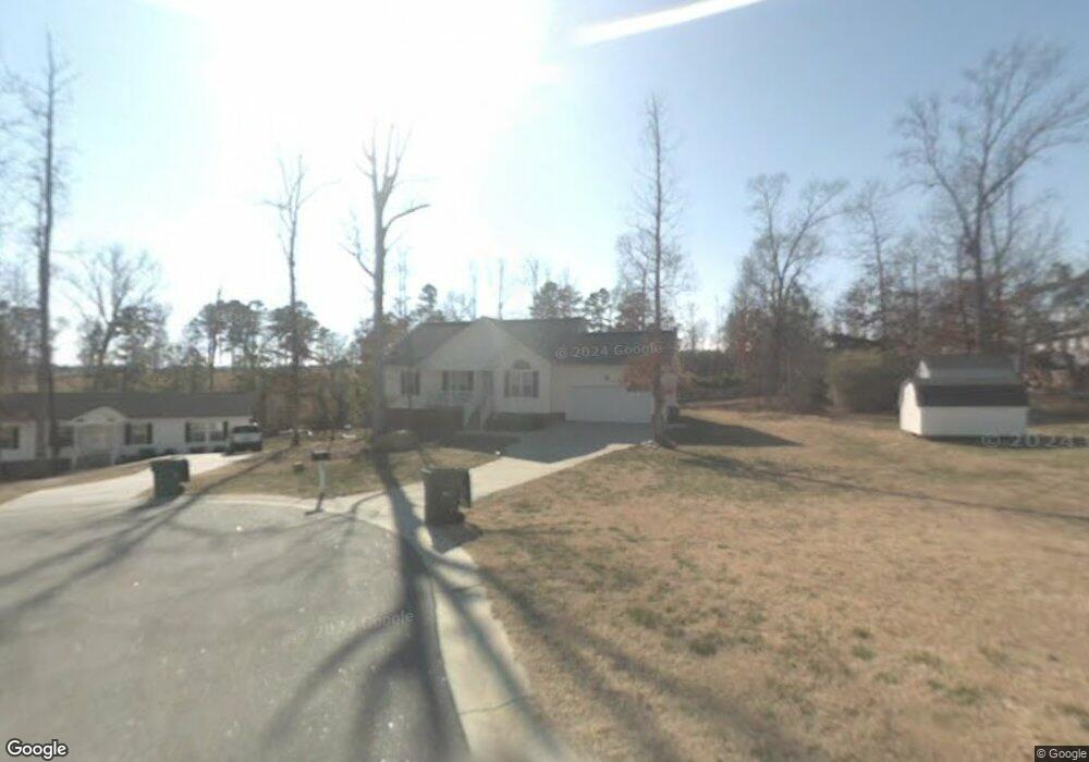
104 Darfield Ct Clayton, NC 27520
Estimated Value: $302,000 - $315,281
3
Beds
2
Baths
1,455
Sq Ft
$212/Sq Ft
Est. Value
About This Home
This home is located at 104 Darfield Ct, Clayton, NC 27520 and is currently estimated at $308,570, approximately $212 per square foot. 104 Darfield Ct is a home located in Johnston County with nearby schools including West Clayton Elementary School, Clayton Middle School, and Clayton High.
Ownership History
Date
Name
Owned For
Owner Type
Purchase Details
Closed on
Nov 15, 2016
Sold by
American Homes 4 Rent Properties Nine Ll
Bought by
Amii Nc Properties Lp
Current Estimated Value
Purchase Details
Closed on
Mar 10, 2015
Sold by
Mitchell Jennifer Skiles and Mitchell Christopher David
Bought by
American Homes 4 Rent Propcrtics Nine Ll
Purchase Details
Closed on
Feb 10, 2005
Sold by
R&S Real Estate Investments Llc
Bought by
Mitchell Christopher David and Mitechell Jennifer Skiles
Home Financials for this Owner
Home Financials are based on the most recent Mortgage that was taken out on this home.
Original Mortgage
$147,584
Interest Rate
5.61%
Mortgage Type
FHA
Purchase Details
Closed on
Aug 23, 2004
Sold by
R & S Real Estate Investments
Bought by
Gordon Charles B
Purchase Details
Closed on
Aug 21, 2002
Sold by
Charles B Gordon Trust #1
Bought by
Gordon Charles B
Create a Home Valuation Report for This Property
The Home Valuation Report is an in-depth analysis detailing your home's value as well as a comparison with similar homes in the area
Home Values in the Area
Average Home Value in this Area
Purchase History
| Date | Buyer | Sale Price | Title Company |
|---|---|---|---|
| Amii Nc Properties Lp | -- | None Available | |
| American Homes 4 Rent Propcrtics Nine Ll | $120,800 | None Available | |
| Mitchell Christopher David | $150,000 | None Available | |
| Gordon Charles B | -- | -- | |
| Gordon Charles B | -- | -- | |
| Gordon Charles Brantley | -- | -- |
Source: Public Records
Mortgage History
| Date | Status | Borrower | Loan Amount |
|---|---|---|---|
| Previous Owner | Mitchell Christopher David | $147,584 |
Source: Public Records
Tax History
| Year | Tax Paid | Tax Assessment Tax Assessment Total Assessment is a certain percentage of the fair market value that is determined by local assessors to be the total taxable value of land and additions on the property. | Land | Improvement |
|---|---|---|---|---|
| 2025 | $2,995 | $296,510 | $82,500 | $214,010 |
| 2024 | $2,488 | $188,500 | $48,000 | $140,500 |
| 2023 | $2,432 | $188,500 | $48,000 | $140,500 |
| 2022 | $2,507 | $188,500 | $48,000 | $140,500 |
| 2021 | $2,469 | $188,500 | $48,000 | $140,500 |
| 2020 | $2,526 | $188,500 | $48,000 | $140,500 |
| 2019 | $2,526 | $188,500 | $48,000 | $140,500 |
| 2018 | $2,038 | $149,870 | $32,000 | $117,870 |
| 2017 | $1,993 | $149,870 | $32,000 | $117,870 |
| 2016 | $1,993 | $149,870 | $32,000 | $117,870 |
| 2015 | $1,956 | $149,870 | $32,000 | $117,870 |
| 2014 | $1,956 | $149,870 | $32,000 | $117,870 |
Source: Public Records
Map
Nearby Homes
- 603 Lakemont Dr
- 76 Douglas Fir Place
- 257 Dairy Rd
- 2833 Bennington Dr
- 25 W Fire Opal Ct
- 201 Dairy Rd
- 1029 Cove Cir
- 882 John St
- 878 John St
- 874 John St
- 658 Yorkshire Dr
- 60 Rowan Dr
- 133 Lynn Dr
- 33 Cheltenham Dr
- 468 Hunter Way
- 205 Field Sparrow Way
- 199 Field Sparrow Way
- 382 Black Oak Ct
- 175 Field Sparrow Way
- 1080 Avondale Dr
- 108 Darfield Ct
- 303 Marrian Dr
- 305 Marrian Dr
- 2902 Brittany Dr
- 2904 Brittany Dr
- 2900 Brittany Dr
- 112 Darfield Ct
- 113 Darfield Ct
- 2906 Brittany Dr
- 109 Darfield Ct
- 105 Darfield Ct
- 304 Marrian Dr
- 439 Rolling Creek Cir
- 2814 Brittany Dr
- 2903 Brittany Dr
- 2908 Brittany Dr
- 2901 Brittany Dr
- 2905 Brittany Dr
- 255 Rolling Creek Cir
- 239 Rolling Creek Cir
Your Personal Tour Guide
Ask me questions while you tour the home.