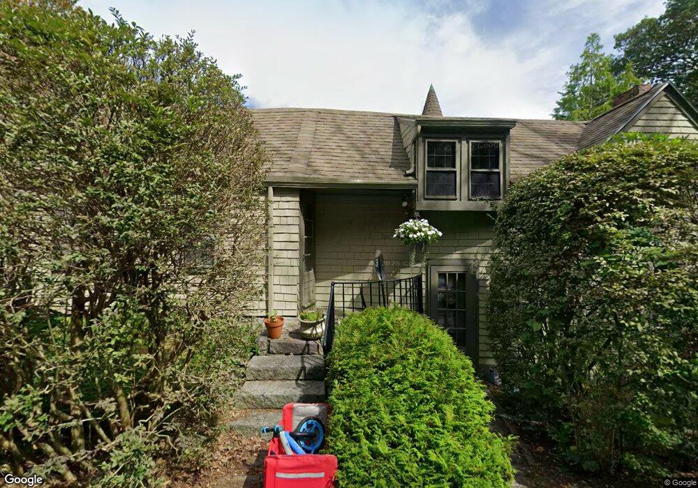
104 Dennison St Gloucester, MA 01930
Estimated Value: $918,593 - $1,344,000
3
Beds
4
Baths
2,392
Sq Ft
$450/Sq Ft
Est. Value
About This Home
This home is located at 104 Dennison St, Gloucester, MA 01930 and is currently estimated at $1,077,148, approximately $450 per square foot. 104 Dennison St is a home located in Essex County with nearby schools including Plum Cove School, Ralph B O'maley Middle School, and Gloucester High School.
Ownership History
Date
Name
Owned For
Owner Type
Purchase Details
Closed on
Jun 13, 1991
Sold by
Zadig Kathleen E
Bought by
Lanzano Ellen A
Current Estimated Value
Create a Home Valuation Report for This Property
The Home Valuation Report is an in-depth analysis detailing your home's value as well as a comparison with similar homes in the area
Purchase History
We collect this data history from publicly available records. To have your information removed, we recommend requesting removal directly through your county’s website.
| Date | Buyer | Sale Price | Title Company |
|---|---|---|---|
| Lanzano Ellen A | $225,000 | -- |
Source: Public Records
Mortgage History
We collect this data history from publicly available records. To have your information removed, we recommend requesting removal directly through your county’s website.
| Date | Status | Borrower | Loan Amount |
|---|---|---|---|
| Open | Lanzano Ellen A | $164,000 | |
| Closed | Lanzano Ellen A | $168,000 |
Source: Public Records
Tax History
| Year | Tax Paid | Tax Assessment Tax Assessment Total Assessment is a certain percentage of the fair market value that is determined by local assessors to be the total taxable value of land and additions on the property. | Land | Improvement |
|---|---|---|---|---|
| 2025 | $7,888 | $811,500 | $293,000 | $518,500 |
| 2024 | $7,760 | $797,500 | $279,000 | $518,500 |
| 2023 | $7,449 | $703,400 | $249,100 | $454,300 |
| 2022 | $7,167 | $611,000 | $211,700 | $399,300 |
| 2021 | $6,929 | $557,000 | $192,500 | $364,500 |
| 2020 | $6,911 | $560,500 | $192,500 | $368,000 |
| 2019 | $6,710 | $528,800 | $192,500 | $336,300 |
| 2018 | $6,546 | $506,300 | $192,500 | $313,800 |
| 2017 | $6,351 | $481,500 | $183,300 | $298,200 |
| 2016 | $6,205 | $455,900 | $183,800 | $272,100 |
| 2015 | $5,950 | $435,900 | $183,800 | $252,100 |
Source: Public Records
Map
Nearby Homes
- 672 Washington St
- 65 Leonard St
- 38 Revere St
- 27 Gee Ave
- 136 Leonard St
- 498 Washington St
- 4 Ciaramitaro Ct
- 3 Colburn St Unit 1
- 457 Washington St Unit 2
- 31 Echo Ave
- 226 Atlantic St
- 220 Atlantic St
- 35 Reservoir Rd
- 6 Corliss Ave
- 178 Atlantic St
- 167 Atlantic St
- 176 Main St Unit B
- 176 Main St Unit A
- 6-8 Joppa Way
- 27 Hodgkins Rd
Your Personal Tour Guide
Ask me questions while you tour the home.