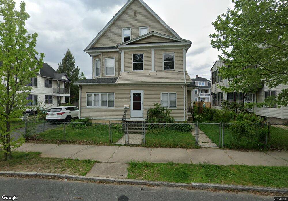
104 Dunmoreland St Unit 106 Springfield, MA 01109
Upper Hill NeighborhoodEstimated Value: $378,238 - $499,000
8
Beds
3
Baths
3,545
Sq Ft
$121/Sq Ft
Est. Value
About This Home
This home is located at 104 Dunmoreland St Unit 106, Springfield, MA 01109 and is currently estimated at $427,560, approximately $120 per square foot. 104 Dunmoreland St Unit 106 is a home located in Hampden County with nearby schools including Mary M. Walsh Elementary School, M Marcus Kiley Middle, and Springfield High School of Science and Technology.
Ownership History
Date
Name
Owned For
Owner Type
Purchase Details
Closed on
Dec 7, 2022
Sold by
Lefebvre Robert J
Bought by
Ali Jiijo
Current Estimated Value
Home Financials for this Owner
Home Financials are based on the most recent Mortgage that was taken out on this home.
Original Mortgage
$252,340
Outstanding Balance
$244,947
Interest Rate
7.08%
Mortgage Type
FHA
Estimated Equity
$182,613
Create a Home Valuation Report for This Property
The Home Valuation Report is an in-depth analysis detailing your home's value as well as a comparison with similar homes in the area
Home Values in the Area
Average Home Value in this Area
Purchase History
| Date | Buyer | Sale Price | Title Company |
|---|---|---|---|
| Ali Jiijo | $310,000 | None Available |
Source: Public Records
Mortgage History
| Date | Status | Borrower | Loan Amount |
|---|---|---|---|
| Open | Ali Jiijo | $252,340 |
Source: Public Records
Tax History Compared to Growth
Tax History
| Year | Tax Paid | Tax Assessment Tax Assessment Total Assessment is a certain percentage of the fair market value that is determined by local assessors to be the total taxable value of land and additions on the property. | Land | Improvement |
|---|---|---|---|---|
| 2025 | $5,005 | $319,200 | $31,100 | $288,100 |
| 2024 | $5,181 | $322,600 | $31,100 | $291,500 |
| 2023 | $4,259 | $249,800 | $28,300 | $221,500 |
| 2022 | $4,011 | $213,100 | $26,400 | $186,700 |
| 2021 | $3,258 | $172,400 | $18,700 | $153,700 |
| 2020 | $3,334 | $170,700 | $18,700 | $152,000 |
| 2019 | $3,066 | $155,800 | $16,000 | $139,800 |
| 2018 | $2,997 | $152,300 | $16,000 | $136,300 |
| 2017 | $2,894 | $147,200 | $15,000 | $132,200 |
| 2016 | $2,507 | $127,500 | $15,000 | $112,500 |
| 2015 | $2,461 | $125,100 | $15,000 | $110,100 |
Source: Public Records
Map
Nearby Homes
- 88 Dunmoreland St
- 21 Westford Cir
- 179 Albemarle St
- 124-126 Westford Cir
- 140 Northampton Ave
- 19 Westford Ave
- 162 Northampton Ave
- 135-137 Suffolk St
- 290 Quincy St
- 62-64 Bristol St
- 129 Eastern Ave
- 158 Norfolk St
- 0 NS (24) Alden St
- 111 Marlborough St
- 43 Colonial Ave
- 52-56 Andrew St
- 65 Montrose St
- 67 Carlisle St
- 705-707 Union St
- 58 Willard Ave
- 104-106 Dunmoreland St
- 98 Dunmoreland St Unit 100
- 110 Dunmoreland St Unit 112
- 110 Dunmoreland St Unit 1
- 101 Massachusetts Ave Unit 103
- 105-107 Massachusetts Ave
- 105 Massachusetts Ave Unit 107
- 97 Massachusetts Ave
- 92 Dunmoreland St Unit 94
- 92-94 Dunmoreland St
- 116 Dunmoreland St Unit 118
- 111 Dunmoreland St
- 111-113 Massachusetts Ave
- 103 Dunmoreland St
- 91 Massachusetts Ave
- 99 Massachusetts Ave
- 117 Dunmoreland St
- 109 Dunmoreland St
- 99 Dunmoreland St
- 113 Massachusetts Ave