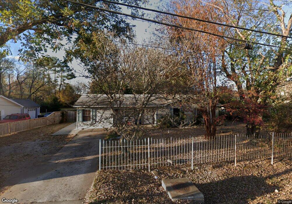
104 Front St Madison, AL 35758
Estimated Value: $111,000 - $263,000
Studio
--
Bath
1,444
Sq Ft
$125/Sq Ft
Est. Value
About This Home
This home is located at 104 Front St, Madison, AL 35758 and is currently estimated at $180,955, approximately $125 per square foot. 104 Front St is a home with nearby schools including Madison Elementary School, Liberty Middle School, and James Clemens High School.
Ownership History
Date
Name
Owned For
Owner Type
Purchase Details
Closed on
Oct 21, 2024
Sold by
Dr Horton Inc-Huntsville
Bought by
Britt Carolyn Patrice
Current Estimated Value
Purchase Details
Closed on
Dec 27, 2016
Sold by
Mullin Phyllis
Bought by
The Prep Mart Llc
Home Financials for this Owner
Home Financials are based on the most recent Mortgage that was taken out on this home.
Original Mortgage
$36,000
Interest Rate
4.08%
Mortgage Type
Future Advance Clause Open End Mortgage
Create a Home Valuation Report for This Property
The Home Valuation Report is an in-depth analysis detailing your home's value as well as a comparison with similar homes in the area
Home Values in the Area
Average Home Value in this Area
Purchase History
| Date | Buyer | Sale Price | Title Company |
|---|---|---|---|
| Britt Carolyn Patrice | $367,240 | None Listed On Document | |
| Britt Carolyn Patrice | $367,240 | None Listed On Document | |
| The Prep Mart Llc | $40,000 | None Available |
Source: Public Records
Mortgage History
| Date | Status | Borrower | Loan Amount |
|---|---|---|---|
| Previous Owner | The Prep Mart Llc | $36,000 |
Source: Public Records
Tax History
| Year | Tax Paid | Tax Assessment Tax Assessment Total Assessment is a certain percentage of the fair market value that is determined by local assessors to be the total taxable value of land and additions on the property. | Land | Improvement |
|---|---|---|---|---|
| 2025 | $1,424 | $20,380 | $2,120 | $18,260 |
| 2024 | $1,424 | $19,080 | $2,120 | $16,960 |
| 2023 | $1,333 | $19,080 | $2,120 | $16,960 |
| 2022 | $1,176 | $16,820 | $2,120 | $14,700 |
| 2021 | $1,101 | $15,740 | $2,120 | $13,620 |
| 2020 | $1,082 | $15,460 | $1,840 | $13,620 |
| 2019 | $896 | $15,460 | $1,840 | $13,620 |
| 2018 | $907 | $15,640 | $0 | $0 |
| 2017 | $412 | $7,820 | $0 | $0 |
| 2016 | $412 | $7,820 | $0 | $0 |
| 2015 | $412 | $7,820 | $0 | $0 |
| 2014 | $382 | $7,480 | $0 | $0 |
Source: Public Records
Map
Nearby Homes
- 4286 Sullivan St
- 16 Cain St
- 4312 Sullivan St
- 126 Cresent Cir
- 102 Evergreen Mill Ln
- 122 Todd Dr
- 422 Landers Rd
- 424 Landers Rd
- 185 Rugby Dr
- 119 Todd Dr
- 129 Protestant Dr
- 145 Protestant Dr
- 131 Protestant Dr
- 120 Westminster Way
- 135 Rugby Dr
- 401 Celtic Dr
- 540 Mill Rd
- 105 Spenryn Dr
- 137 Cormorant Landing
- 161 Protestant Dr
- 106 Front St
- 4176 Sullivan St
- 4178 Sullivan St
- 4136 Sullivan St
- 1 Moon Creek Cir
- 7 Moon Creek Cir
- 12 Allen St
- 10 Allen St
- 11 Moon Creek Cir
- 13 Moon Creek Cir
- 4182 Sullivan St
- 14 Allen St
- 2 Moon Creek Cir
- 6 Moon Creek Cir
- 10 Moon Creek Cir
- 17 Perry St
- 16 Allen St
- 15 Perry St
- 18 Allen St
- 0 Stone St Unit 1097905
Your Personal Tour Guide
Ask me questions while you tour the home.