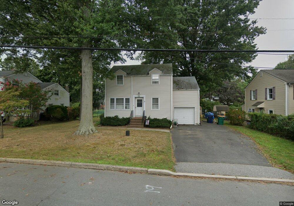
104 Harron Ave Hightstown, NJ 08520
Estimated Value: $394,000 - $490,000
--
Bed
--
Bath
1,310
Sq Ft
$339/Sq Ft
Est. Value
About This Home
This home is located at 104 Harron Ave, Hightstown, NJ 08520 and is currently estimated at $443,581, approximately $338 per square foot. 104 Harron Ave is a home located in Mercer County with nearby schools including Melvin H. Kreps Middle School, Hightstown High School, and SciCore Academy.
Ownership History
Date
Name
Owned For
Owner Type
Purchase Details
Closed on
Jul 1, 2004
Sold by
Pawelczak Peter
Bought by
Brown Donald and Brown Francene
Current Estimated Value
Home Financials for this Owner
Home Financials are based on the most recent Mortgage that was taken out on this home.
Original Mortgage
$244,625
Interest Rate
6.08%
Purchase Details
Closed on
Dec 23, 2002
Sold by
Flatley Patrick
Bought by
Pawelczak Peter and Thomas Lora
Home Financials for this Owner
Home Financials are based on the most recent Mortgage that was taken out on this home.
Original Mortgage
$195,000
Interest Rate
6.19%
Create a Home Valuation Report for This Property
The Home Valuation Report is an in-depth analysis detailing your home's value as well as a comparison with similar homes in the area
Home Values in the Area
Average Home Value in this Area
Purchase History
| Date | Buyer | Sale Price | Title Company |
|---|---|---|---|
| Brown Donald | $257,500 | -- | |
| Pawelczak Peter | $225,000 | -- |
Source: Public Records
Mortgage History
| Date | Status | Borrower | Loan Amount |
|---|---|---|---|
| Previous Owner | Brown Donald | $244,625 | |
| Previous Owner | Pawelczak Peter | $195,000 |
Source: Public Records
Tax History Compared to Growth
Tax History
| Year | Tax Paid | Tax Assessment Tax Assessment Total Assessment is a certain percentage of the fair market value that is determined by local assessors to be the total taxable value of land and additions on the property. | Land | Improvement |
|---|---|---|---|---|
| 2025 | $9,571 | $195,200 | $71,300 | $123,900 |
| 2024 | $9,473 | $195,200 | $71,300 | $123,900 |
| 2023 | $9,473 | $195,200 | $71,300 | $123,900 |
| 2022 | $8,815 | $195,200 | $71,300 | $123,900 |
| 2021 | $8,815 | $195,200 | $71,300 | $123,900 |
| 2020 | $8,614 | $195,200 | $71,300 | $123,900 |
| 2019 | $8,374 | $195,200 | $71,300 | $123,900 |
| 2018 | $8,051 | $195,200 | $71,300 | $123,900 |
| 2017 | $7,976 | $195,200 | $71,300 | $123,900 |
| 2016 | $7,976 | $195,200 | $71,300 | $123,900 |
| 2015 | $7,925 | $195,200 | $71,300 | $123,900 |
| 2014 | $7,976 | $195,200 | $71,300 | $123,900 |
Source: Public Records
Map
Nearby Homes
- 108 Harron Ave
- 100 Harron Ave
- 107 Dutch Neck Rd
- 109 Dutch Neck Rd
- 401 Stockton St
- 126 Gilman Place
- 110 Dutch Neck Rd
- 116 Harron Ave
- 413 Stockton St
- 106 Gilman Place
- 114 Dutch Neck Rd
- 419 Stockton St
- 120 Harron Ave
- 122 Gilman Place
- 116 Dutch Neck Rd
- 105 Gilman Place
- 124 Harron Ave
- 107 Gilman Place
- 120 Gilman Place
- 118 Dutch Neck Rd