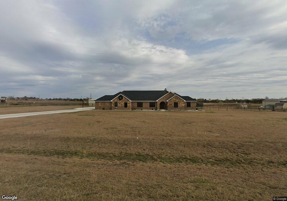
104 Hawk Ridge Rd Decatur, TX 76234
Estimated Value: $647,834 - $692,000
4
Beds
3
Baths
2,972
Sq Ft
$226/Sq Ft
Est. Value
About This Home
This home is located at 104 Hawk Ridge Rd, Decatur, TX 76234 and is currently estimated at $672,959, approximately $226 per square foot. 104 Hawk Ridge Rd is a home located in Wise County with nearby schools including Decatur High School.
Ownership History
Date
Name
Owned For
Owner Type
Purchase Details
Closed on
Dec 8, 2021
Sold by
Mchalffey Dustin
Bought by
Cooper Darin
Current Estimated Value
Purchase Details
Closed on
Apr 13, 2020
Sold by
Kuykendall Brandi
Bought by
Mchalffey Dustin
Home Financials for this Owner
Home Financials are based on the most recent Mortgage that was taken out on this home.
Original Mortgage
$394,250
Interest Rate
3.2%
Mortgage Type
New Conventional
Purchase Details
Closed on
Dec 9, 2015
Sold by
Graham Deatra P
Bought by
Kuykendall Brandi and Kuykendall Sean
Home Financials for this Owner
Home Financials are based on the most recent Mortgage that was taken out on this home.
Original Mortgage
$306,375
Interest Rate
3.79%
Mortgage Type
New Conventional
Purchase Details
Closed on
Jul 3, 2015
Sold by
Kairos Homes Llc
Bought by
Graham Deatra Patrice
Home Financials for this Owner
Home Financials are based on the most recent Mortgage that was taken out on this home.
Original Mortgage
$309,294
Interest Rate
3.25%
Mortgage Type
FHA
Purchase Details
Closed on
Jun 24, 2015
Sold by
Kbf Trust
Bought by
Kaireos Homes Llc
Home Financials for this Owner
Home Financials are based on the most recent Mortgage that was taken out on this home.
Original Mortgage
$309,294
Interest Rate
3.25%
Mortgage Type
FHA
Purchase Details
Closed on
Sep 9, 2013
Sold by
Baker Terry
Bought by
Kbf Trust
Home Financials for this Owner
Home Financials are based on the most recent Mortgage that was taken out on this home.
Original Mortgage
$20,000
Interest Rate
4.41%
Mortgage Type
Purchase Money Mortgage
Purchase Details
Closed on
May 3, 2007
Sold by
Elliott Carl Douglas and Elliott Cynthia Jo
Bought by
Baker Terry
Purchase Details
Closed on
Jul 1, 2005
Sold by
Zimmerer Tom
Bought by
Elliott Carl Douglas and Elliott Cynthia Jo
Home Financials for this Owner
Home Financials are based on the most recent Mortgage that was taken out on this home.
Original Mortgage
$42,300
Interest Rate
5.63%
Mortgage Type
Purchase Money Mortgage
Purchase Details
Closed on
Dec 16, 2002
Sold by
Hawk Ridge Limited Partnership
Bought by
Kuykendall Brandi
Purchase Details
Closed on
Oct 19, 2001
Sold by
Wise Co Properties Lp
Bought by
Kuykendall Brandi
Create a Home Valuation Report for This Property
The Home Valuation Report is an in-depth analysis detailing your home's value as well as a comparison with similar homes in the area
Home Values in the Area
Average Home Value in this Area
Purchase History
| Date | Buyer | Sale Price | Title Company |
|---|---|---|---|
| Cooper Darin | -- | Old Republic Title | |
| Cooper Darin | -- | Old Republic Title | |
| Mchalffey Dustin | -- | Providence Title Company | |
| Kuykendall Brandi | -- | None Available | |
| Graham Deatra Patrice | -- | None Available | |
| Kaireos Homes Llc | -- | None Available | |
| Kbf Trust | -- | Guardian Title Co | |
| Baker Terry | $35,000 | -- | |
| Elliott Carl Douglas | -- | None Available | |
| Kuykendall Brandi | -- | -- | |
| Kuykendall Brandi | -- | -- |
Source: Public Records
Mortgage History
| Date | Status | Borrower | Loan Amount |
|---|---|---|---|
| Previous Owner | Mchalffey Dustin | $394,250 | |
| Previous Owner | Kuykendall Brandi | $306,375 | |
| Previous Owner | Graham Deatra Patrice | $309,294 | |
| Previous Owner | Kaireos Homes Llc | $150,000 | |
| Previous Owner | Kbf Trust | $20,000 | |
| Previous Owner | Elliott Carl Douglas | $42,300 | |
| Closed | Baker Terry | $0 |
Source: Public Records
Tax History Compared to Growth
Tax History
| Year | Tax Paid | Tax Assessment Tax Assessment Total Assessment is a certain percentage of the fair market value that is determined by local assessors to be the total taxable value of land and additions on the property. | Land | Improvement |
|---|---|---|---|---|
| 2025 | $6,111 | $641,596 | $168,351 | $473,245 |
| 2024 | $6,111 | $603,213 | $125,036 | $478,177 |
| 2023 | $7,322 | $606,047 | $0 | $0 |
| 2022 | $8,454 | $550,952 | $108,310 | $442,642 |
| 2021 | $7,344 | $458,120 | $90,400 | $367,720 |
| 2020 | $6,899 | $427,650 | $81,000 | $346,650 |
| 2019 | $7,134 | $415,140 | $74,780 | $340,360 |
| 2018 | $7,052 | $407,290 | $68,560 | $338,730 |
| 2017 | $6,349 | $357,680 | $44,290 | $313,390 |
| 2016 | $5,632 | $357,680 | $44,290 | $313,390 |
| 2015 | -- | $211,890 | $33,670 | $178,220 |
| 2014 | -- | $29,910 | $29,910 | $0 |
Source: Public Records
Map
Nearby Homes
- 1421 County Road 4530
- 160 Quail Run Ct
- 1495 County Road 4530
- 1746 County Road 4522
- 709 County Road 4530
- 705 County Road 4530
- 112 Emma Ct
- 117 Emma Ct
- 5926 High Mesa Dr
- TBD County Road 4511
- 6270 High Mesa Dr
- 5090 Fm 2264
- 5345 Moncrief Rd
- 249 Private Road 4434
- 197 Pond View Dr
- 414 County Road 4421
- TBD Lot 4 Fm 2449
- TBD Lot 6 Fm 2449
- TBD Lot 7 Fm 2449
- TBD Lot 5 Fm 2449
- 104 Hawk Ridge Rd
- 102 Hawk Ridge Rd
- 106 Hawk Ridge Rd
- 0 Hawk Ridge Dr Unit 12008314
- 0 Hawk Ridge Dr Unit 11852398
- 0 Hawk Ridge Dr Unit 13126778
- 0 Hawk Ridge Dr Unit 12107000
- 9999 Hawk Ridge Dr
- 0 Hawk Ridge Dr Unit 13367317
- 9999 Hawk Ridge Dr
- 180 Hawk Ridge Rd
- 101 Hawk Ridge Rd
- 105 Hawk Ridge
- 8 Hawk Ridge
- 109 Hawk Ridge Rd
- 1325 County Road 4530
- 1330 County Road 4530
- 1312 County Road 4530
- Lot 4 Hawk Ridge Dr
- 1181 County Road 4530