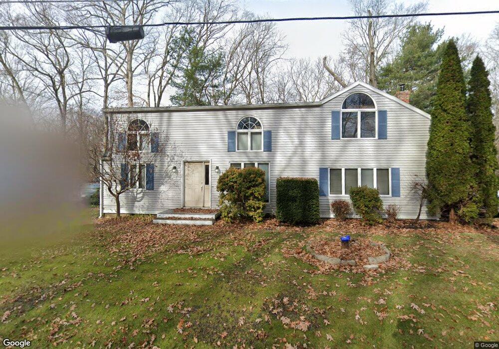
104 Homestead Dr Coventry, CT 06238
Estimated Value: $353,000 - $366,000
3
Beds
2
Baths
2,304
Sq Ft
$157/Sq Ft
Est. Value
About This Home
This home is located at 104 Homestead Dr, Coventry, CT 06238 and is currently estimated at $360,826, approximately $156 per square foot. 104 Homestead Dr is a home located in Tolland County with nearby schools including George Hersey Robertson School, Coventry Grammar School, and Capt. Nathan Hale School.
Ownership History
Date
Name
Owned For
Owner Type
Purchase Details
Closed on
May 14, 2024
Sold by
Hayes Noel M and Hayes Jesse
Bought by
Hayes Jesse and Hayes Noel M
Current Estimated Value
Purchase Details
Closed on
Apr 11, 2024
Sold by
Hayes Jesse and Hayes Noel
Bought by
Hayes Jonah
Purchase Details
Closed on
Dec 20, 2001
Sold by
Nikodemski Bonnie and Nikodemski Robert
Bought by
Hayes Jesse and Hayes Noel
Purchase Details
Closed on
Oct 4, 1993
Sold by
New England B & T Co
Bought by
Nikodemski Robert and Nikodemski Bonnie
Create a Home Valuation Report for This Property
The Home Valuation Report is an in-depth analysis detailing your home's value as well as a comparison with similar homes in the area
Home Values in the Area
Average Home Value in this Area
Purchase History
| Date | Buyer | Sale Price | Title Company |
|---|---|---|---|
| Hayes Jesse | -- | None Available | |
| Hayes Jesse | -- | None Available | |
| Hayes Jonah | -- | None Available | |
| Hayes Jonah | -- | None Available | |
| Hayes Jesse | $138,000 | -- | |
| Nikodemski Robert | $85,000 | -- | |
| Hayes Jesse | $138,000 | -- |
Source: Public Records
Mortgage History
| Date | Status | Borrower | Loan Amount |
|---|---|---|---|
| Previous Owner | Nikodemski Robert | $123,000 | |
| Previous Owner | Nikodemski Robert | $12,000 |
Source: Public Records
Tax History Compared to Growth
Tax History
| Year | Tax Paid | Tax Assessment Tax Assessment Total Assessment is a certain percentage of the fair market value that is determined by local assessors to be the total taxable value of land and additions on the property. | Land | Improvement |
|---|---|---|---|---|
| 2025 | $5,491 | $231,100 | $35,500 | $195,600 |
| 2024 | $4,334 | $130,100 | $30,900 | $99,200 |
| 2023 | $4,129 | $130,100 | $30,900 | $99,200 |
| 2022 | $4,053 | $130,100 | $30,900 | $99,200 |
| 2021 | $4,053 | $130,100 | $30,900 | $99,200 |
| 2020 | $4,055 | $130,100 | $30,900 | $99,200 |
| 2019 | $4,189 | $130,100 | $30,900 | $99,200 |
| 2018 | $4,421 | $137,300 | $30,900 | $106,400 |
| 2017 | $4,394 | $137,300 | $30,900 | $106,400 |
| 2016 | $4,284 | $137,300 | $30,900 | $106,400 |
| 2015 | $4,284 | $137,300 | $30,900 | $106,400 |
| 2014 | $4,245 | $149,100 | $38,200 | $110,900 |
Source: Public Records
Map
Nearby Homes
- 17 Ireland Dr
- 63 Fox Trail
- 1902 South St
- 8 Shore Dr
- 48 Lakeview Dr
- 112 John Hand Dr
- 131 Lakewood Dr
- 78 Bellevue Dr
- 165 Echo Rd
- 53 Stonecroft Ln
- 152 Cheney Ln
- 0 Spring Rd
- 0 Skinner Hill Rd Unit 24077239
- 220 Buena Vista Rd
- 1365 Main St
- 183 Hop River Rd
- 78 Bear Swamp Rd
- 0 Wheeling Rd Unit 24116879
- 40 Old Tolland Turnpike
- 34 Old Tolland Turnpike
- 96 Homestead Dr
- 0 Ireland Dr
- 411 Hinkel Mae Dr
- 9 Ireland Dr
- 402 Hinkel Mae Dr
- 6 Reynolds Dr
- 18 Ireland Dr
- 68 Homestead Dr
- 31 Carson Dr
- 18 Reynolds Dr
- 2137 South St
- 9 Reynolds Dr
- 2125 South St
- 128 Homestead Dr
- 28 Carson Dr
- 17 Woodlawn Dr
- 347 Hinkel Mae Dr
- 32 Ireland Dr
- 436 Hinkel Mae Dr
- 29 Woodlawn Dr