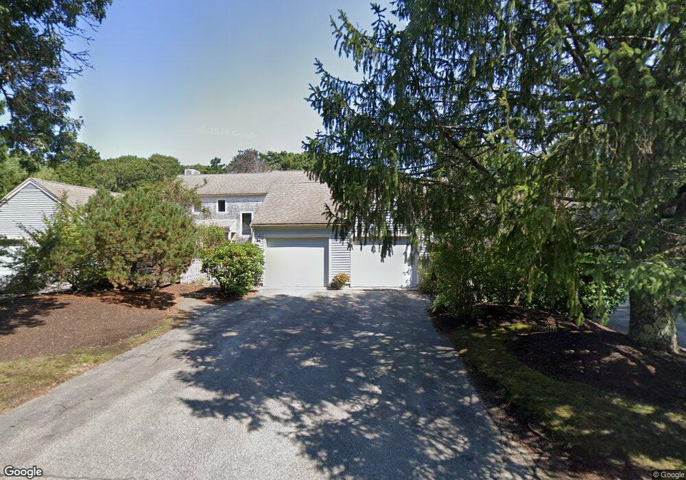
104 Kates Path Yarmouth Port, MA 02675
Yarmouth Port NeighborhoodEstimated Value: $504,595 - $597,000
2
Beds
2
Baths
1,001
Sq Ft
$554/Sq Ft
Est. Value
About This Home
This home is located at 104 Kates Path, Yarmouth Port, MA 02675 and is currently estimated at $554,649, approximately $554 per square foot. 104 Kates Path is a home located in Barnstable County with nearby schools including Dennis-Yarmouth Regional High School.
Ownership History
Date
Name
Owned For
Owner Type
Purchase Details
Closed on
Jun 30, 2006
Sold by
Spezzano Emma C and Spezzano Violet P
Bought by
Gillespie Susan L
Current Estimated Value
Home Financials for this Owner
Home Financials are based on the most recent Mortgage that was taken out on this home.
Original Mortgage
$40,000
Outstanding Balance
$23,655
Interest Rate
6.58%
Mortgage Type
Purchase Money Mortgage
Estimated Equity
$530,994
Purchase Details
Closed on
Jul 14, 1995
Sold by
Rita C Harris T
Bought by
Wood Rachel M
Purchase Details
Closed on
May 13, 1988
Sold by
The Green Co Inc
Bought by
Harris Rita
Create a Home Valuation Report for This Property
The Home Valuation Report is an in-depth analysis detailing your home's value as well as a comparison with similar homes in the area
Home Values in the Area
Average Home Value in this Area
Purchase History
| Date | Buyer | Sale Price | Title Company |
|---|---|---|---|
| Gillespie Susan L | $352,500 | -- | |
| Wood Rachel M | $163,500 | -- | |
| Harris Rita | $156,000 | -- |
Source: Public Records
Mortgage History
| Date | Status | Borrower | Loan Amount |
|---|---|---|---|
| Open | Harris Rita | $40,000 |
Source: Public Records
Tax History Compared to Growth
Tax History
| Year | Tax Paid | Tax Assessment Tax Assessment Total Assessment is a certain percentage of the fair market value that is determined by local assessors to be the total taxable value of land and additions on the property. | Land | Improvement |
|---|---|---|---|---|
| 2025 | $3,054 | $431,300 | $0 | $431,300 |
| 2024 | $3,414 | $462,600 | $0 | $462,600 |
| 2023 | $2,913 | $359,200 | $0 | $359,200 |
| 2022 | $3,150 | $343,100 | $0 | $343,100 |
| 2021 | $3,062 | $320,300 | $0 | $320,300 |
| 2020 | $3,090 | $309,000 | $0 | $309,000 |
| 2019 | $2,896 | $286,700 | $0 | $286,700 |
| 2018 | $2,721 | $264,400 | $0 | $264,400 |
| 2017 | $2,537 | $253,200 | $0 | $253,200 |
| 2016 | $2,415 | $242,000 | $0 | $242,000 |
| 2015 | -- | $252,000 | $0 | $252,000 |
Source: Public Records
Map
Nearby Homes
- 19 John Halls Cartpath Village Unit E
- 19 John Hall Cartway Unit E
- 228 Kates Path
- 50 John Hall Cartway
- 50 John Hall Cartway Unit 50
- 64 Kates Path
- 17 Kates Path Unit A
- 42 John Hall Cartway Unit 42
- 158 Kates Path
- 7 Forest Gate Unit 7
- 43 Canterbury Rd
- 30 W Woods
- 30 W Woods Cir Unit 30
- 28 Oak Glen
- 44 Stratford Ln
- 25 Oak Glen Village Unit 25
- 25 Oak Glen
- 2 Pine Grove
- 800 Route 6a
- 800 Route 6a
- 108 Kates Path
- 106 Kates Path
- 104 Kates Path Unit A
- 102 Kates Path Unit E
- 108 Kates Path Unit H
- 106 Kates Path Unit C
- 106 Kates Path Unit 106
- 7 John Halls Cart Path Unit 7
- 63 Kate's Point Unit 63
- 67 Kathes
- 69 Kate's Path Kings Unit 69
- 11 John Halls Unit 11
- 57 Kate's Path Unit 57
- 106 Kate's Point Unit 106
- 5 John Hall Cartway
- 3 John Hall Cartway
- 1 John Hall Cartway
- 3 John Hall Cartway Unit A
- 5 John Hall Cartway Unit H