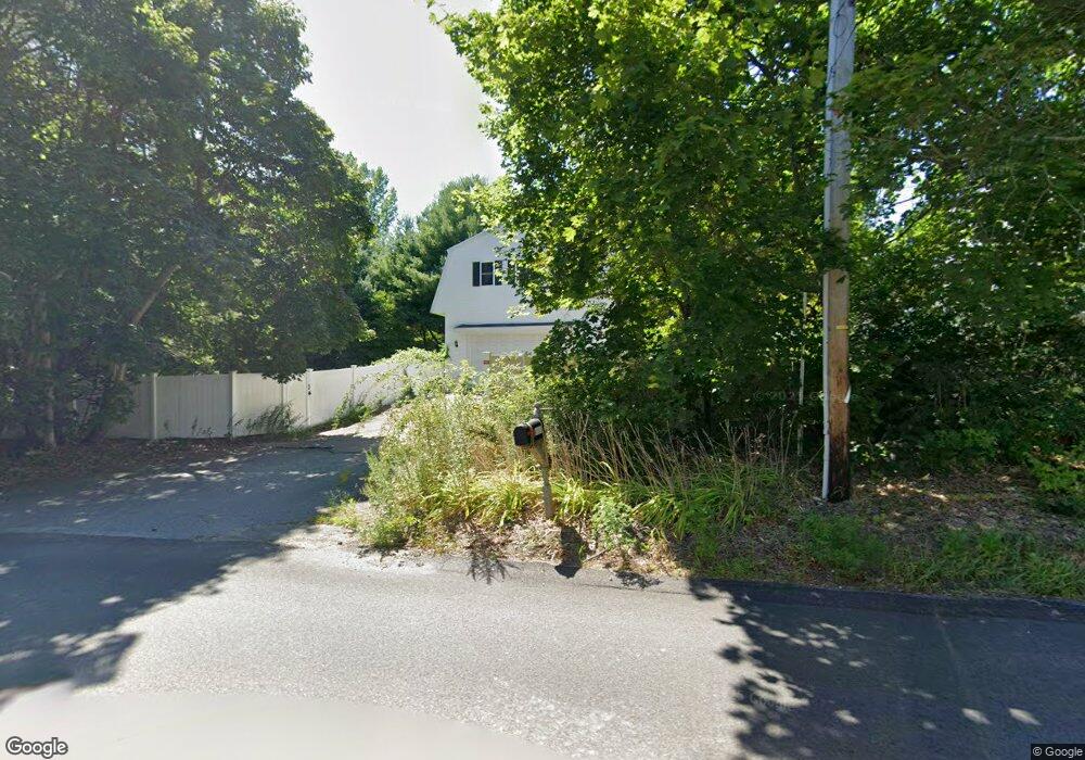
104 Lindsey St North Attleboro, MA 02760
Estimated Value: $521,000 - $598,000
3
Beds
2
Baths
1,650
Sq Ft
$343/Sq Ft
Est. Value
About This Home
This home is located at 104 Lindsey St, North Attleboro, MA 02760 and is currently estimated at $565,427, approximately $342 per square foot. 104 Lindsey St is a home located in Bristol County with nearby schools including North Attleboro High School, Cadence Academy Preschool - North Attleborough, and St John The Evangelist School.
Ownership History
Date
Name
Owned For
Owner Type
Purchase Details
Closed on
Oct 10, 1997
Sold by
Mcnamara Kevin G and Mcnamara Karen J
Bought by
Brennan John F and Manter Leigh C
Current Estimated Value
Home Financials for this Owner
Home Financials are based on the most recent Mortgage that was taken out on this home.
Original Mortgage
$111,200
Interest Rate
7.52%
Mortgage Type
Purchase Money Mortgage
Create a Home Valuation Report for This Property
The Home Valuation Report is an in-depth analysis detailing your home's value as well as a comparison with similar homes in the area
Home Values in the Area
Average Home Value in this Area
Purchase History
| Date | Buyer | Sale Price | Title Company |
|---|---|---|---|
| Brennan John F | $139,000 | -- |
Source: Public Records
Mortgage History
| Date | Status | Borrower | Loan Amount |
|---|---|---|---|
| Open | Brennan John F | $104,000 | |
| Closed | Brennan John F | $111,200 |
Source: Public Records
Tax History Compared to Growth
Tax History
| Year | Tax Paid | Tax Assessment Tax Assessment Total Assessment is a certain percentage of the fair market value that is determined by local assessors to be the total taxable value of land and additions on the property. | Land | Improvement |
|---|---|---|---|---|
| 2025 | $5,113 | $433,700 | $138,900 | $294,800 |
| 2024 | $5,079 | $440,100 | $138,900 | $301,200 |
| 2023 | $4,957 | $387,600 | $138,900 | $248,700 |
| 2022 | $4,824 | $346,300 | $138,900 | $207,400 |
| 2021 | $4,775 | $334,600 | $138,900 | $195,700 |
| 2020 | $49 | $329,700 | $138,900 | $190,800 |
| 2019 | $4,516 | $317,100 | $126,300 | $190,800 |
| 2018 | $52 | $307,300 | $126,300 | $181,000 |
| 2017 | $4,063 | $307,300 | $126,300 | $181,000 |
| 2016 | $3,646 | $275,800 | $140,400 | $135,400 |
| 2015 | $3,528 | $268,500 | $147,500 | $121,000 |
| 2014 | $3,543 | $267,600 | $136,200 | $131,400 |
Source: Public Records
Map
Nearby Homes
- 255 Mckeon Dr
- 11 Buckthorn Ln
- 115 Westfield Dr
- 196 Donald Tennant Cir
- 21 Shady Ln
- 20 Sperry Ln
- 150 Gilbert St
- 57 Vine St
- 11 Landry Ave
- 747 N Main St
- 451R Gilbert St
- 59 Laurelwood Dr
- Lot 2 Jeffrey Dr
- Lot 5 Jeffrey Dr
- 678 N Main St
- 158 Ivy St
- 10 Hazelwood Ct
- 71 Richardson Ave
- 12 Houde St
- 5 Old Wood Rd
- 2 Anthony e Greco Cir
- 2 Grecco Cir
- 25 Anthony e Greco Cir
- 99 Lindsey St
- 107 Lindsey St
- 11 Anthony e Greco Cir
- 3 Anthony e Greco Cir
- 12 Anthony e Greco Cir
- 2 Lochmont Dr
- 21 Anthony e Greco Cir
- 14 Armstrong Dr
- 119 Lindsey St
- 17 Judith Dr
- 9 Armstrong Dr
- 52 Greco Cir
- 132 Lindsey St
- 14 Judith Dr
- 31 Anthony e Greco Cir
- 131 Lindsey St
- 88 Lindsey St