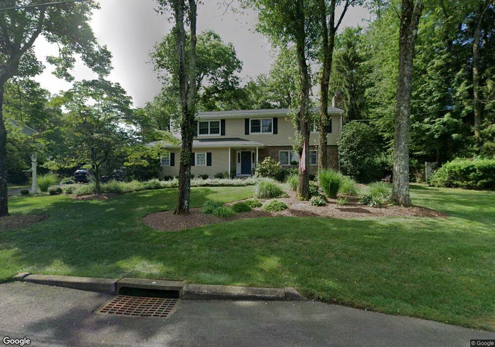
104 Logan Ln Wyckoff, NJ 07481
Estimated Value: $1,118,597 - $1,583,000
--
Bed
--
Bath
2,619
Sq Ft
$522/Sq Ft
Est. Value
About This Home
This home is located at 104 Logan Ln, Wyckoff, NJ 07481 and is currently estimated at $1,366,399, approximately $521 per square foot. 104 Logan Ln is a home located in Bergen County with nearby schools including Abraham Lincoln Elementary School, Dwight D Eisenhower Middle School, and Ramapo High School.
Ownership History
Date
Name
Owned For
Owner Type
Purchase Details
Closed on
Jul 2, 1999
Sold by
Arrington George and Arrington Martha L
Bought by
Daly Michael J and Daly Judith D
Current Estimated Value
Home Financials for this Owner
Home Financials are based on the most recent Mortgage that was taken out on this home.
Original Mortgage
$420,000
Outstanding Balance
$116,066
Interest Rate
7.39%
Estimated Equity
$1,250,333
Purchase Details
Closed on
Sep 7, 1995
Sold by
Culligan Jean
Bought by
Arrington George and Arrington Martha
Create a Home Valuation Report for This Property
The Home Valuation Report is an in-depth analysis detailing your home's value as well as a comparison with similar homes in the area
Home Values in the Area
Average Home Value in this Area
Purchase History
| Date | Buyer | Sale Price | Title Company |
|---|---|---|---|
| Daly Michael J | $525,000 | Commonwealth Land Title Ins | |
| Arrington George | $396,300 | -- |
Source: Public Records
Mortgage History
| Date | Status | Borrower | Loan Amount |
|---|---|---|---|
| Open | Daly Michael J | $420,000 |
Source: Public Records
Tax History Compared to Growth
Tax History
| Year | Tax Paid | Tax Assessment Tax Assessment Total Assessment is a certain percentage of the fair market value that is determined by local assessors to be the total taxable value of land and additions on the property. | Land | Improvement |
|---|---|---|---|---|
| 2025 | $14,412 | $739,100 | $439,400 | $299,700 |
| 2024 | $13,991 | $739,100 | $439,400 | $299,700 |
| 2023 | $13,614 | $739,100 | $439,400 | $299,700 |
| 2022 | $13,614 | $739,100 | $439,400 | $299,700 |
| 2021 | $13,703 | $739,100 | $439,400 | $299,700 |
| 2020 | $13,562 | $739,100 | $439,400 | $299,700 |
| 2019 | $13,378 | $739,100 | $439,400 | $299,700 |
| 2018 | $13,171 | $739,100 | $439,400 | $299,700 |
| 2017 | $13,008 | $739,100 | $439,400 | $299,700 |
| 2016 | $12,801 | $739,100 | $439,400 | $299,700 |
| 2015 | $12,661 | $739,100 | $439,400 | $299,700 |
| 2014 | $14,726 | $927,900 | $510,600 | $417,300 |
Source: Public Records
Map
Nearby Homes
- 39 Edgewood Ave
- 314 Meadowbrook Rd
- 32-3 Tamaron Dr
- 16-3 Tamaron Dr
- 93 Frost Ln
- 21 Whitman Ln
- 7 Sandburg Ct
- 796 Wyckoff Ave
- 253 Madison Ave
- 20 van Schaik Ln
- 436D Bromley Place
- 36 Lockwood Dr
- 444B Bromley Place Unit B
- 444B Bromley Place
- 103 Macintyre Ln
- 284 Village Place
- 137 Elmwood Place
- 103 Crescent Ave
- 24 Scott Ct
- 632 Fairview Place