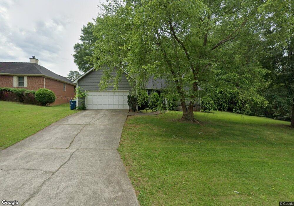
104 Mallard Ln Carrollton, GA 30117
Estimated Value: $266,000 - $296,000
3
Beds
2
Baths
1,466
Sq Ft
$191/Sq Ft
Est. Value
About This Home
This home is located at 104 Mallard Ln, Carrollton, GA 30117 and is currently estimated at $279,833, approximately $190 per square foot. 104 Mallard Ln is a home located in Carroll County with nearby schools including Carrollton Elementary School, Carrollton Upper Elementary School, and Carrollton Middle School.
Ownership History
Date
Name
Owned For
Owner Type
Purchase Details
Closed on
Jul 1, 2022
Sold by
Puryear Kenneth Suc
Bought by
Woods Matthew
Current Estimated Value
Purchase Details
Closed on
Aug 9, 2016
Sold by
Don William
Bought by
Holland Bronwyn Alicia and Holland 2011 Fa
Purchase Details
Closed on
Sep 29, 2005
Sold by
Rogers Danny R
Bought by
Riggins William Don
Home Financials for this Owner
Home Financials are based on the most recent Mortgage that was taken out on this home.
Original Mortgage
$95,200
Interest Rate
5.66%
Mortgage Type
New Conventional
Purchase Details
Closed on
Sep 27, 1996
Bought by
Rogers Danny R and Rogers Candace A
Purchase Details
Closed on
Jul 23, 1991
Bought by
Wright Curtis
Create a Home Valuation Report for This Property
The Home Valuation Report is an in-depth analysis detailing your home's value as well as a comparison with similar homes in the area
Home Values in the Area
Average Home Value in this Area
Purchase History
| Date | Buyer | Sale Price | Title Company |
|---|---|---|---|
| Woods Matthew | -- | -- | |
| Holland Bronwyn Alicia | $129,900 | -- | |
| Riggins William Don | $119,000 | -- | |
| Rogers Danny R | $79,900 | -- | |
| Wright Curtis | $66,000 | -- |
Source: Public Records
Mortgage History
| Date | Status | Borrower | Loan Amount |
|---|---|---|---|
| Previous Owner | Riggins William Don | $95,200 | |
| Previous Owner | Riggins William Don | $23,800 |
Source: Public Records
Tax History Compared to Growth
Tax History
| Year | Tax Paid | Tax Assessment Tax Assessment Total Assessment is a certain percentage of the fair market value that is determined by local assessors to be the total taxable value of land and additions on the property. | Land | Improvement |
|---|---|---|---|---|
| 2024 | $2,790 | $102,090 | $8,000 | $94,090 |
| 2023 | $2,790 | $93,487 | $8,000 | $85,487 |
| 2022 | $2,237 | $76,625 | $8,000 | $68,625 |
| 2021 | $1,947 | $66,684 | $8,000 | $58,684 |
| 2020 | $1,748 | $59,820 | $8,000 | $51,820 |
| 2019 | $1,625 | $55,082 | $8,000 | $47,082 |
| 2018 | $1,449 | $48,431 | $8,000 | $40,431 |
| 2017 | $1,457 | $48,431 | $8,000 | $40,431 |
| 2016 | $1,282 | $48,431 | $8,000 | $40,431 |
| 2015 | $1,098 | $39,548 | $8,000 | $31,548 |
| 2014 | $1,103 | $39,548 | $8,000 | $31,548 |
Source: Public Records
Map
Nearby Homes
- 509 Adamson Ave
- 521 Adamson Ave
- 317 Bledsoe St
- 150 Adamson Dr
- 216 Lane Dr
- 214 Lane Dr
- 212 Lane Dr Unit LOT 60
- 212 Lane Dr
- 210 Lane Dr Unit LOT 61
- 210 Lane Dr
- 202 Laney Dr
- 112 Lane Dr
- 112 Lane Dr Unit LOT 68
- Plan 2121 at Canterbury Villas
- Plan 2307 at Canterbury Villas
- 204 Chaucer Ln
- Plan 1522 at Canterbury Villas
- Plan 1634 at Canterbury Villas
- Plan 2628 at Canterbury Villas
- 406 Harmon Ave
- 102 Mallard Ln
- 0 Mallard Ln Unit 8020621
- 0 Mallard Ln Unit 3083015
- 106 Mallard Ln
- 621 Adamson Ave
- 105 Mallard Ln
- 103 Mallard Ln
- 370 Strickland Rd
- 616 Adamson Ave
- 109 Mallard Ln
- 101 Mallard Ln
- 101 Mallard Ln
- 616 Adamson Ave
- 108 Mallard Ln
- 620 Adamson Ave
- 368 Strickland Rd
- 110 Mallard Ln
- 600 Adamson Ave
- 519 Adamson Ave
- 101 Canterbury Dr