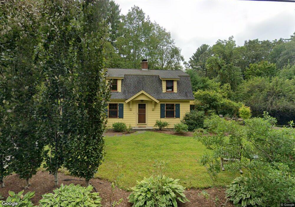
104 Martin Rd Concord, MA 01742
Estimated Value: $1,414,750 - $1,964,000
4
Beds
2
Baths
1,825
Sq Ft
$956/Sq Ft
Est. Value
About This Home
This home is located at 104 Martin Rd, Concord, MA 01742 and is currently estimated at $1,745,438, approximately $956 per square foot. 104 Martin Rd is a home located in Middlesex County with nearby schools including Alcott Elementary School, Concord Middle School, and Concord Carlisle High School.
Ownership History
Date
Name
Owned For
Owner Type
Purchase Details
Closed on
Oct 8, 2014
Sold by
Goodwin Michael and Goodwin Lindsay J
Bought by
Goodwin Michael
Current Estimated Value
Purchase Details
Closed on
Jul 21, 2008
Sold by
Goodwin Doris and Goodwin Michael
Bought by
Goodwin Lindsay J and Goodwin Michael
Home Financials for this Owner
Home Financials are based on the most recent Mortgage that was taken out on this home.
Original Mortgage
$641,600
Interest Rate
6.17%
Mortgage Type
Purchase Money Mortgage
Purchase Details
Closed on
Jun 27, 2006
Sold by
Bumford Jean O and Kelly Jean P
Bought by
Corey Earl M and Corey Elizabeth Dalto
Home Financials for this Owner
Home Financials are based on the most recent Mortgage that was taken out on this home.
Original Mortgage
$520,000
Interest Rate
6.59%
Mortgage Type
Purchase Money Mortgage
Create a Home Valuation Report for This Property
The Home Valuation Report is an in-depth analysis detailing your home's value as well as a comparison with similar homes in the area
Home Values in the Area
Average Home Value in this Area
Purchase History
| Date | Buyer | Sale Price | Title Company |
|---|---|---|---|
| Goodwin Michael | -- | -- | |
| Goodwin Lindsay J | -- | -- | |
| Goodwin Doris | $802,000 | -- | |
| Corey Earl M | $650,000 | -- |
Source: Public Records
Mortgage History
| Date | Status | Borrower | Loan Amount |
|---|---|---|---|
| Previous Owner | Goodwin Doris | $641,600 | |
| Previous Owner | Corey Earl M | $520,000 |
Source: Public Records
Tax History Compared to Growth
Tax History
| Year | Tax Paid | Tax Assessment Tax Assessment Total Assessment is a certain percentage of the fair market value that is determined by local assessors to be the total taxable value of land and additions on the property. | Land | Improvement |
|---|---|---|---|---|
| 2025 | $191 | $1,440,300 | $1,011,100 | $429,200 |
| 2024 | $18,911 | $1,440,300 | $1,011,100 | $429,200 |
| 2023 | $16,017 | $1,235,900 | $827,300 | $408,600 |
| 2022 | $14,795 | $1,002,400 | $661,700 | $340,700 |
| 2021 | $14,457 | $982,100 | $661,700 | $320,400 |
| 2020 | $13,920 | $978,200 | $661,700 | $316,500 |
| 2019 | $14,147 | $997,000 | $689,900 | $307,100 |
| 2018 | $13,068 | $914,500 | $611,600 | $302,900 |
| 2017 | $12,154 | $863,800 | $560,900 | $302,900 |
| 2016 | $11,867 | $852,500 | $560,900 | $291,600 |
| 2015 | $11,236 | $786,300 | $519,400 | $266,900 |
Source: Public Records
Map
Nearby Homes
- 38-40 Court Ln
- 52 Bow St
- 73 Ridge Rd
- 140 Revolutionary Rd
- 96 Independence Rd
- 46 Sudbury Rd
- 181 Stow St
- 143 Everett St
- 14 Thoreau St
- 76 Red Coat Ln
- 775 Monument St
- 168 Nashawtuc Rd
- 22 Belknap Ct
- 212 Hawthorne Ln
- 343 Nashawtuc Rd
- 29 Willard Common
- 49 Willard Common
- 232 Sudbury Rd
- 10 Hatch Farm Ln
- 16 Hatch Farm Ln
- 116 Martin Rd
- 88 Martin Rd
- 99 Martin Rd
- 111 Martin Rd
- 83 Martin Rd
- 130 Martin Rd
- 86 Bartlett Hill Rd
- 98 Bartlett Hill Rd
- 62 Martin Rd
- 71 Martin Rd
- 131 Martin Rd
- 68 Bartlett Hill Rd
- 112 Bartlett Hill Rd
- 59 Martin Rd
- 120 Bartlett Hill Rd
- 56 Bartlett Hill Rd
- 85 Bartlett Hill Rd
- 73 Bartlett Hill Rd
- 97 Bartlett Hill Rd
- 44 Martin Rd