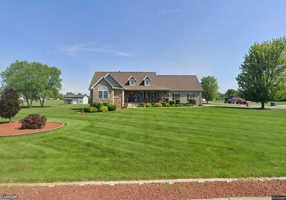
104 Matt Ridge Valparaiso, IN 46383
Porter County NeighborhoodEstimated Value: $500,531 - $575,000
3
Beds
3
Baths
2,052
Sq Ft
$266/Sq Ft
Est. Value
About This Home
This home is located at 104 Matt Ridge, Valparaiso, IN 46383 and is currently estimated at $546,383, approximately $266 per square foot. 104 Matt Ridge is a home located in Porter County with nearby schools including Morgan Township Elementary School, Morgan Township Middle/High School, and Victory Christian Academy.
Ownership History
Date
Name
Owned For
Owner Type
Purchase Details
Closed on
Oct 17, 2005
Sold by
Ely Rodney W and Ely Sandra Kay
Bought by
Ely Rodney W and Ely Sandra Kay
Current Estimated Value
Purchase Details
Closed on
Jan 27, 2005
Sold by
Stalbaum Construction Inc
Bought by
Ely Rodney W and Ely Sandra K
Home Financials for this Owner
Home Financials are based on the most recent Mortgage that was taken out on this home.
Original Mortgage
$175,000
Outstanding Balance
$89,417
Interest Rate
5.83%
Mortgage Type
Fannie Mae Freddie Mac
Estimated Equity
$456,966
Create a Home Valuation Report for This Property
The Home Valuation Report is an in-depth analysis detailing your home's value as well as a comparison with similar homes in the area
Home Values in the Area
Average Home Value in this Area
Purchase History
| Date | Buyer | Sale Price | Title Company |
|---|---|---|---|
| Ely Rodney W | -- | Stewart Title Services | |
| Ely Rodney W | -- | Ticor Title Ins |
Source: Public Records
Mortgage History
| Date | Status | Borrower | Loan Amount |
|---|---|---|---|
| Open | Ely Rodney W | $175,000 |
Source: Public Records
Tax History Compared to Growth
Tax History
| Year | Tax Paid | Tax Assessment Tax Assessment Total Assessment is a certain percentage of the fair market value that is determined by local assessors to be the total taxable value of land and additions on the property. | Land | Improvement |
|---|---|---|---|---|
| 2024 | $2,800 | $459,400 | $64,200 | $395,200 |
| 2023 | $2,660 | $396,900 | $58,400 | $338,500 |
| 2022 | $3,019 | $406,200 | $58,400 | $347,800 |
| 2021 | $2,762 | $346,700 | $58,400 | $288,300 |
| 2020 | $2,549 | $323,400 | $55,600 | $267,800 |
| 2019 | $2,546 | $312,400 | $55,600 | $256,800 |
| 2018 | $2,444 | $306,100 | $55,600 | $250,500 |
| 2017 | $2,445 | $310,500 | $55,600 | $254,900 |
| 2016 | $2,367 | $310,000 | $57,000 | $253,000 |
| 2014 | $2,456 | $306,000 | $55,100 | $250,900 |
| 2013 | -- | $292,000 | $55,800 | $236,200 |
Source: Public Records
Map
Nearby Homes
- 197 Appaloosa Ln
- 323 E 124 S
- 239 Bayberry Ct
- 3353 Field Hawk Dr
- 232 E 250 S
- 3251 Mockingbird Ln
- 279 S State Road 49
- 372 Radcliff Dr
- 3359 Blue Jay Dr
- 421 Amy Rose Ln
- 48 E Division Rd
- 501 Eagle Ct
- 0 Parcel A 325 E
- 0 Parcel B 325 E
- 0 Smoke Rd
- 355 E 300 S
- 168 Jamestown Ave
- 0 Porters Vale Blvd Unit GNR544918
- 0 St Road 2 Unit GNR544911
- 87 Kaper Ln
- 223 Stone Creek Ln
- 217 Stone Creek Ln
- 100 Matt Ridge
- 105 Matt Ridge
- 222 Stone Creek Ln
- 103 Matt Ridge
- 105 Stone Creek Dr
- 228 Stone Creek Ln
- 101 Stone Creek Dr
- 111 Stone Creek Dr
- 96 Matt Ridge
- 99 Matt Ridge
- 99 Stone Creek Dr
- 231 Stone Creek Ln
- 233 Stone Creek Ln
- 398 Matt Ridge
- 395 Matt Ridge
- 383 Matt Ridge
- 381 Matt Ridge
- 77 Matt Ridge