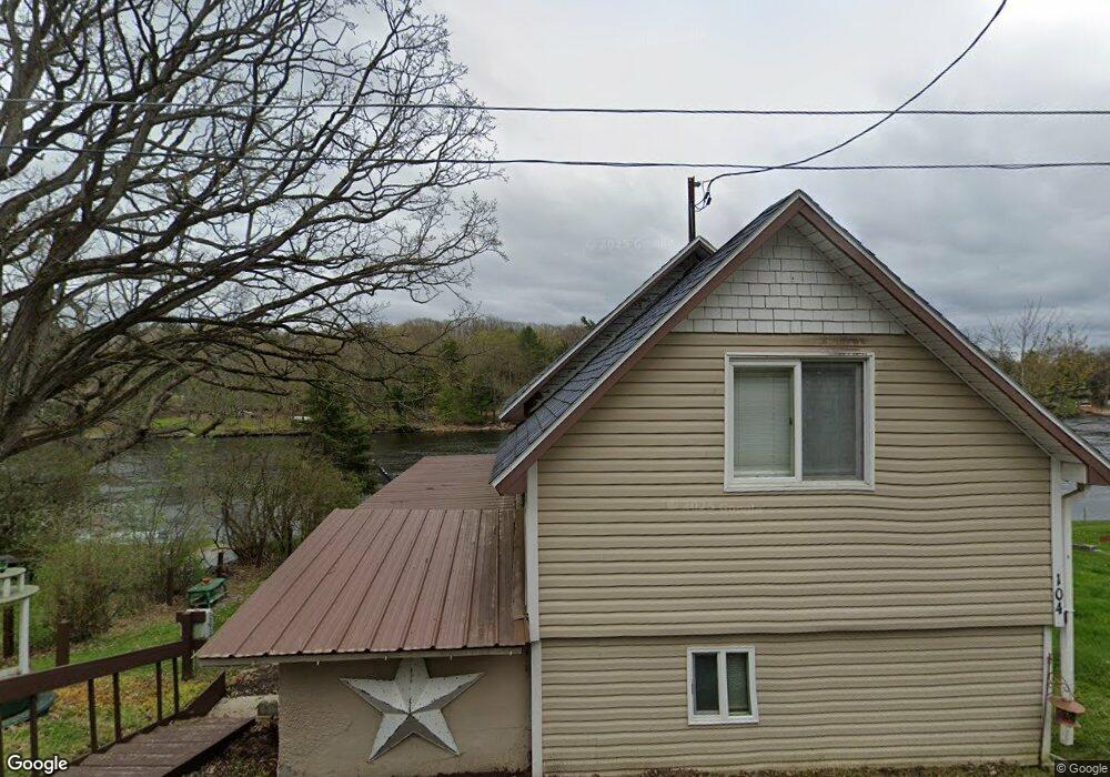
104 Maynard Ave Dexter, NY 13634
Estimated Value: $105,000 - $171,512
2
Beds
1
Bath
904
Sq Ft
$153/Sq Ft
Est. Value
About This Home
This home is located at 104 Maynard Ave, Dexter, NY 13634 and is currently estimated at $138,628, approximately $153 per square foot. 104 Maynard Ave is a home with nearby schools including General Brown Junior/Senior High School.
Ownership History
Date
Name
Owned For
Owner Type
Purchase Details
Closed on
Jan 7, 2022
Sold by
Venton June M and Venton Dann F
Bought by
Pfleger Laura and Shaughnessy Mary A
Current Estimated Value
Purchase Details
Closed on
Apr 11, 2017
Sold by
Reff Adam
Bought by
Venton Dann
Purchase Details
Closed on
Jan 19, 2006
Sold by
Hull Allen
Bought by
Reff Adam
Purchase Details
Closed on
Jan 25, 2002
Sold by
Hewitt Joseph W
Bought by
Hull Alan
Create a Home Valuation Report for This Property
The Home Valuation Report is an in-depth analysis detailing your home's value as well as a comparison with similar homes in the area
Home Values in the Area
Average Home Value in this Area
Purchase History
| Date | Buyer | Sale Price | Title Company |
|---|---|---|---|
| Pfleger Laura | -- | None Available | |
| Venton Dann | $60,000 | Catherine Burns Quencer | |
| Reff Adam | $61,500 | Steven G Munson | |
| Hull Alan | $87,900 | -- |
Source: Public Records
Tax History
| Year | Tax Paid | Tax Assessment Tax Assessment Total Assessment is a certain percentage of the fair market value that is determined by local assessors to be the total taxable value of land and additions on the property. | Land | Improvement |
|---|---|---|---|---|
| 2024 | $2,441 | $87,000 | $6,800 | $80,200 |
| 2023 | $2,479 | $87,000 | $6,800 | $80,200 |
| 2022 | $2,386 | $87,000 | $6,800 | $80,200 |
| 2021 | $2,350 | $87,000 | $6,800 | $80,200 |
| 2020 | $2,353 | $87,000 | $6,800 | $80,200 |
| 2019 | $2,306 | $87,000 | $6,800 | $80,200 |
| 2018 | $2,306 | $87,000 | $6,800 | $80,200 |
| 2017 | $1,996 | $87,000 | $6,800 | $80,200 |
| 2016 | $1,960 | $87,000 | $6,800 | $80,200 |
| 2015 | -- | $58,500 | $6,400 | $52,100 |
| 2014 | -- | $58,500 | $6,400 | $52,100 |
Source: Public Records
Map
Nearby Homes
- 203 Lakeview Dr
- 107 W Kirby St
- 214 E Bronson St
- 23610 Fetterly Rd
- 17045 State Route 12f
- 21349 Storrs Rd
- 20304 Burton Rd
- 219-221 W Main St
- 328 Brown Blvd
- 18289 State Route 3
- 23794 County Route 54
- 16215 Witt Rd
- 17836 County Route 59
- 133 Vollum - Lot 5 Rd
- 334 Dodge Ave
- 20207 Reasoner Rd
- 314 Dodge Ave
- 214 Dodge Ave
- 401 Pike St
- 23342 County Route 59
- 100 Maynard Ave
- 112 Maynard Ave
- 118 Maynard Ave
- 109 Maynard Ave
- 119 Maynard Ave
- 121 Maynard Ave
- 0 Maynard Ave Unit S1125367
- 125 Maynard Ave
- 127 Maynard Ave
- 142 Maynard Ave
- 23111 Tenacre Dr
- 141 Maynard Ave
- 15760 Maynard Ave S
- 144 Maynard Ave
- 0 Maynard Ave
- 15756 Maynard Ave S
- 15752 Maynard Ave S
- 145 Maynard Ave
- 15746 Maynard Ave S
- 149 Maynard Ave
Your Personal Tour Guide
Ask me questions while you tour the home.