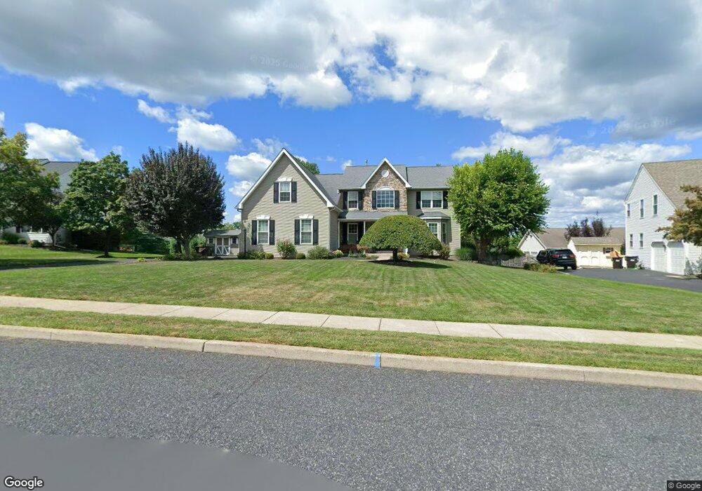
104 Michael Cir Souderton, PA 18964
Estimated Value: $597,000 - $694,000
4
Beds
3
Baths
2,754
Sq Ft
$234/Sq Ft
Est. Value
About This Home
This home is located at 104 Michael Cir, Souderton, PA 18964 and is currently estimated at $645,440, approximately $234 per square foot. 104 Michael Cir is a home located in Montgomery County with nearby schools including Franconia Elementary School, Indian Crest Middle School, and Souderton Area Senior High School.
Ownership History
Date
Name
Owned For
Owner Type
Purchase Details
Closed on
Nov 24, 1997
Sold by
Sal Lapio Inc
Bought by
Minnick Brian and Minnick Jessica A
Current Estimated Value
Create a Home Valuation Report for This Property
The Home Valuation Report is an in-depth analysis detailing your home's value as well as a comparison with similar homes in the area
Home Values in the Area
Average Home Value in this Area
Purchase History
| Date | Buyer | Sale Price | Title Company |
|---|---|---|---|
| Minnick Brian | $233,830 | -- |
Source: Public Records
Tax History
| Year | Tax Paid | Tax Assessment Tax Assessment Total Assessment is a certain percentage of the fair market value that is determined by local assessors to be the total taxable value of land and additions on the property. | Land | Improvement |
|---|---|---|---|---|
| 2025 | $9,350 | $232,790 | $64,580 | $168,210 |
| 2024 | $9,350 | $232,790 | $64,580 | $168,210 |
| 2023 | $8,921 | $232,790 | $64,580 | $168,210 |
| 2022 | $8,648 | $232,790 | $64,580 | $168,210 |
| 2021 | $8,467 | $232,790 | $64,580 | $168,210 |
| 2020 | $8,352 | $232,790 | $64,580 | $168,210 |
| 2019 | $7,623 | $232,790 | $64,580 | $168,210 |
Source: Public Records
Map
Nearby Homes
- 456 Cowpath Rd
- 486 Cowpath Rd
- 478 Smokepipe Rd
- 463 Smokepipe Rd
- 236 Indian Creek Rd
- 227 W Reliance Rd
- 115 Church Rd
- 150 Nectar Run
- 218 E Broad St
- 120 Packham Ct
- 108 Arlington Ln
- 125 Catherine St Unit 5
- 280 Country Club Dr
- 241 Diamond St
- 300 Westminster Ln
- 318 Parkview Dr
- 36 Indian Valley Ln
- 76 Hillside Ave
- 52 Hillside Ave
- 202 N Washington St
- 3473 Devlin Way
- 3476 Devlin Way
- 3497 Devlin Way
- 3455 Devlin Way
- 3419 Devlin Way
- 3479 Devlin Way
- 3431 Devlin Way
- 3437 Devlin Way
- 3425 Devlin Way
- 3444 Devlin Way
- 3456 Devlin Way
- 3407 Devlin Way
- 3449 Devlin Way
- 3401 Devlin Way
- 3450 Devlin Way
- 3461 Devlin Way
- 3467 Devlin Way
- 3484 Devlin Way
- 3491 Devlin Way
- 3413 Devlin Way
Your Personal Tour Guide
Ask me questions while you tour the home.