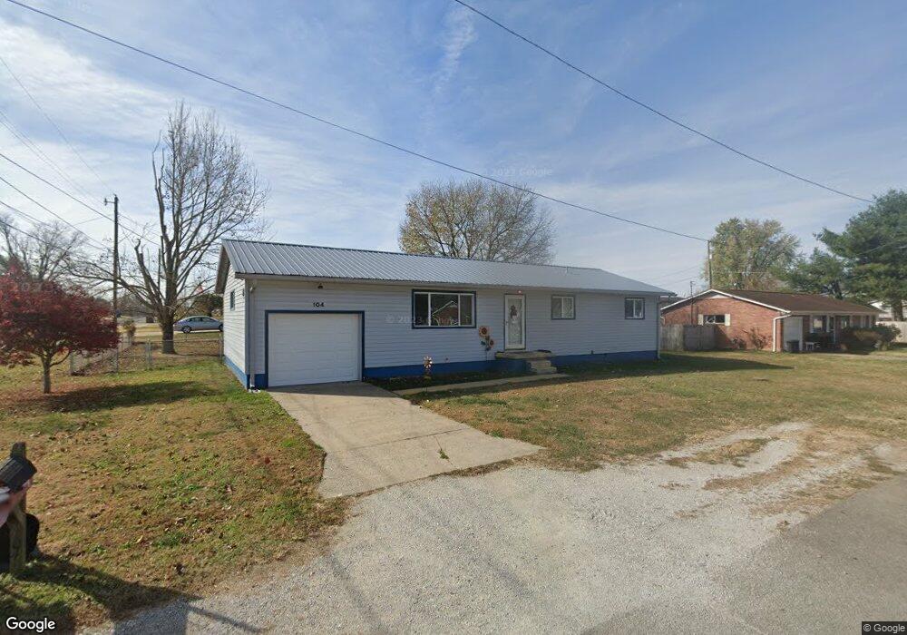
104 Michael St South Point, OH 45680
Estimated Value: $158,000 - $198,000
4
Beds
3
Baths
1,248
Sq Ft
$140/Sq Ft
Est. Value
About This Home
This home is located at 104 Michael St, South Point, OH 45680 and is currently estimated at $174,294, approximately $139 per square foot. 104 Michael St is a home located in Lawrence County with nearby schools including South Point High School.
Ownership History
Date
Name
Owned For
Owner Type
Purchase Details
Closed on
Jul 5, 2010
Sold by
Meara Dae Leigh and Jenson Dae Leigh
Bought by
Meara Dae Leigh and Meara Darren Nathaniel
Current Estimated Value
Purchase Details
Closed on
May 19, 2006
Sold by
Blevins James L and Blevins Karen L
Bought by
Jenson Dae Leigh
Home Financials for this Owner
Home Financials are based on the most recent Mortgage that was taken out on this home.
Original Mortgage
$12,600
Outstanding Balance
$4,646
Interest Rate
6.66%
Mortgage Type
Credit Line Revolving
Estimated Equity
$169,648
Purchase Details
Closed on
Nov 12, 1998
Sold by
Fende Connie J
Bought by
Blevins James L and Blevins Kar
Purchase Details
Closed on
Mar 11, 1994
Sold by
Fende Frank Joseph
Bought by
Fende Connie J
Purchase Details
Closed on
Jun 14, 1993
Sold by
Roberts David C and Roberts Daphn
Bought by
Fende Frank Joseph
Purchase Details
Closed on
Dec 3, 1990
Sold by
Adkins Ruth E
Bought by
Roberts David C and Roberts Daphn
Create a Home Valuation Report for This Property
The Home Valuation Report is an in-depth analysis detailing your home's value as well as a comparison with similar homes in the area
Home Values in the Area
Average Home Value in this Area
Purchase History
| Date | Buyer | Sale Price | Title Company |
|---|---|---|---|
| Meara Dae Leigh | -- | None Available | |
| Jenson Dae Leigh | $84,000 | None Available | |
| Blevins James L | $74,000 | -- | |
| Fende Connie J | -- | -- | |
| Fende Frank Joseph | $47,900 | -- | |
| Roberts David C | $44,000 | -- |
Source: Public Records
Mortgage History
| Date | Status | Borrower | Loan Amount |
|---|---|---|---|
| Open | Jenson Dae Leigh | $12,600 | |
| Open | Jenson Dae Leigh | $67,200 |
Source: Public Records
Tax History
| Year | Tax Paid | Tax Assessment Tax Assessment Total Assessment is a certain percentage of the fair market value that is determined by local assessors to be the total taxable value of land and additions on the property. | Land | Improvement |
|---|---|---|---|---|
| 2025 | $1,231 | $39,715 | $5,327 | $34,388 |
| 2024 | -- | $33,660 | $4,520 | $29,140 |
| 2023 | $1,161 | $33,660 | $4,520 | $29,140 |
| 2022 | $1,157 | $33,660 | $4,520 | $29,140 |
| 2021 | $1,084 | $29,760 | $3,810 | $25,950 |
| 2020 | $1,098 | $29,760 | $3,810 | $25,950 |
| 2019 | $1,092 | $29,760 | $3,810 | $25,950 |
| 2018 | $1,013 | $27,050 | $3,460 | $23,590 |
| 2017 | $1,011 | $27,050 | $3,460 | $23,590 |
| 2016 | $947 | $27,050 | $3,460 | $23,590 |
| 2015 | $874 | $23,390 | $3,460 | $19,930 |
| 2014 | $873 | $23,390 | $3,460 | $19,930 |
| 2013 | $789 | $23,390 | $3,460 | $19,930 |
Source: Public Records
Map
Nearby Homes
- 216 Michael St
- 211 Mason St
- 112 Wilson Ct
- 106 Garden Ct
- 202 Lea St
- 113 Nelson Ave
- 0 Orchard Dr Unit Old Farme Subdivisio
- 707 2nd St E
- 102 Park Ave
- 306 2nd St W
- 509 Sharon Ct
- 1907 Walnut St
- 295 Private Road 660 Unit 60
- 1524 Beech St
- 214 15th St
- 1523 Oak St
- 212 13th St
- 3120 Oakland Ave
- 1722 Poplar St
- 312 13th St
- 101 Michael St
- 103 Michael St
- 102 Michael St
- 207 Delores Ave
- 105 Michael St
- 506 Brubaker Dr
- 202 Michael St
- 205 Delores Ave
- 205 Delores Ave
- 201 Michael St
- 504 Brubaker Dr
- 208 Delores Ave
- 203 Delores Ave
- 203 Delores Ave
- 203 Michael St
- 301 Delores Ave
- 303 Delores Ave
- 204 Michael St
- 120 Billie Joy Dr
- 502 Brubaker Dr
Your Personal Tour Guide
Ask me questions while you tour the home.