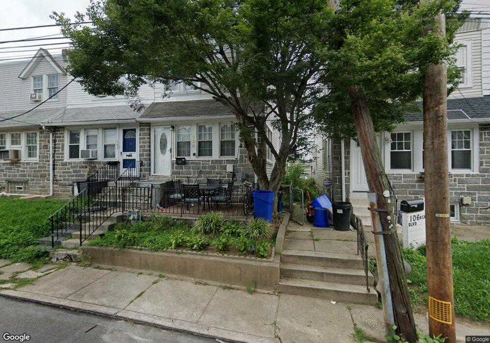
104 N Carol Blvd Upper Darby, PA 19082
Estimated Value: $177,000 - $197,000
3
Beds
1
Bath
1,168
Sq Ft
$164/Sq Ft
Est. Value
About This Home
This home is located at 104 N Carol Blvd, Upper Darby, PA 19082 and is currently estimated at $191,035, approximately $163 per square foot. 104 N Carol Blvd is a home located in Delaware County with nearby schools including Upper Darby Kdg Center, Drexel Hill Middle School, and Upper Darby High School.
Ownership History
Date
Name
Owned For
Owner Type
Purchase Details
Closed on
Dec 14, 1999
Sold by
Beck Benjamin and Lublin William H
Bought by
Bazile Junette M
Current Estimated Value
Home Financials for this Owner
Home Financials are based on the most recent Mortgage that was taken out on this home.
Original Mortgage
$62,423
Interest Rate
7.73%
Mortgage Type
FHA
Purchase Details
Closed on
Jan 12, 1999
Sold by
Keystone Bank Na
Bought by
Beck Benjamin and Lublin William H
Home Financials for this Owner
Home Financials are based on the most recent Mortgage that was taken out on this home.
Original Mortgage
$50,000
Interest Rate
6.78%
Mortgage Type
Purchase Money Mortgage
Purchase Details
Closed on
Nov 9, 1998
Sold by
Phillips Michael and Phillips Denise
Bought by
Keystone Bank
Create a Home Valuation Report for This Property
The Home Valuation Report is an in-depth analysis detailing your home's value as well as a comparison with similar homes in the area
Home Values in the Area
Average Home Value in this Area
Purchase History
| Date | Buyer | Sale Price | Title Company |
|---|---|---|---|
| Bazile Junette M | $62,500 | T A Title Insurance Company | |
| Beck Benjamin | $35,000 | -- | |
| Keystone Bank | -- | -- |
Source: Public Records
Mortgage History
| Date | Status | Borrower | Loan Amount |
|---|---|---|---|
| Closed | Bazile Junette M | $62,423 | |
| Previous Owner | Beck Benjamin | $50,000 |
Source: Public Records
Tax History Compared to Growth
Tax History
| Year | Tax Paid | Tax Assessment Tax Assessment Total Assessment is a certain percentage of the fair market value that is determined by local assessors to be the total taxable value of land and additions on the property. | Land | Improvement |
|---|---|---|---|---|
| 2025 | $3,651 | $86,320 | $23,280 | $63,040 |
| 2024 | $3,651 | $86,320 | $23,280 | $63,040 |
| 2023 | $3,616 | $86,320 | $23,280 | $63,040 |
| 2022 | $3,519 | $86,320 | $23,280 | $63,040 |
| 2021 | $4,745 | $86,320 | $23,280 | $63,040 |
| 2020 | $4,557 | $70,440 | $23,280 | $47,160 |
| 2019 | $4,477 | $70,440 | $23,280 | $47,160 |
| 2018 | $4,425 | $70,440 | $0 | $0 |
| 2017 | $4,310 | $70,440 | $0 | $0 |
| 2016 | $394 | $70,440 | $0 | $0 |
| 2015 | $394 | $70,440 | $0 | $0 |
| 2014 | $394 | $70,440 | $0 | $0 |
Source: Public Records
Map
Nearby Homes
- 131 Westdale Rd
- 105 N Fairview Ave
- 171 N Carol Blvd
- 113 Saint Laurence Rd
- 8125 W Chester Pike Unit C5
- 7755 Parkview Rd
- 105 Academy Ln
- 20 S Carol Blvd
- 103 Oakley Rd
- 46 S State Rd
- 9 Ardsley Rd
- 9 Ardsley Rd Unit 90
- 7419 W Chester Pike
- 7212 Wayne Ave
- 24 Sunshine Rd
- 7201 Wayne Ave
- 214 N Lynn Blvd
- 207 Berbro Ave
- 7209 Hilltop Rd
- 7325 Miller Ave
- 102 N Carol Blvd
- 114 N Carol Blvd
- 110 N Carol Blvd
- 112 N Carol Blvd
- 8011 Lennox Rd
- 108 N Carol Blvd
- 8009 Lennox Rd
- 106 N Carol Blvd
- 116 N Carol Blvd
- 8013 Lennox Rd
- 118 N Carol Blvd
- 120 N Carol Blvd
- 100 N Carol Blvd
- 122 N Carol Blvd
- 113 N Madison Ave
- 115 N Madison Ave
- 124 N Carol Blvd
- 117 N Madison Ave
- 126 N Carol Blvd
- 50 N Carol Blvd