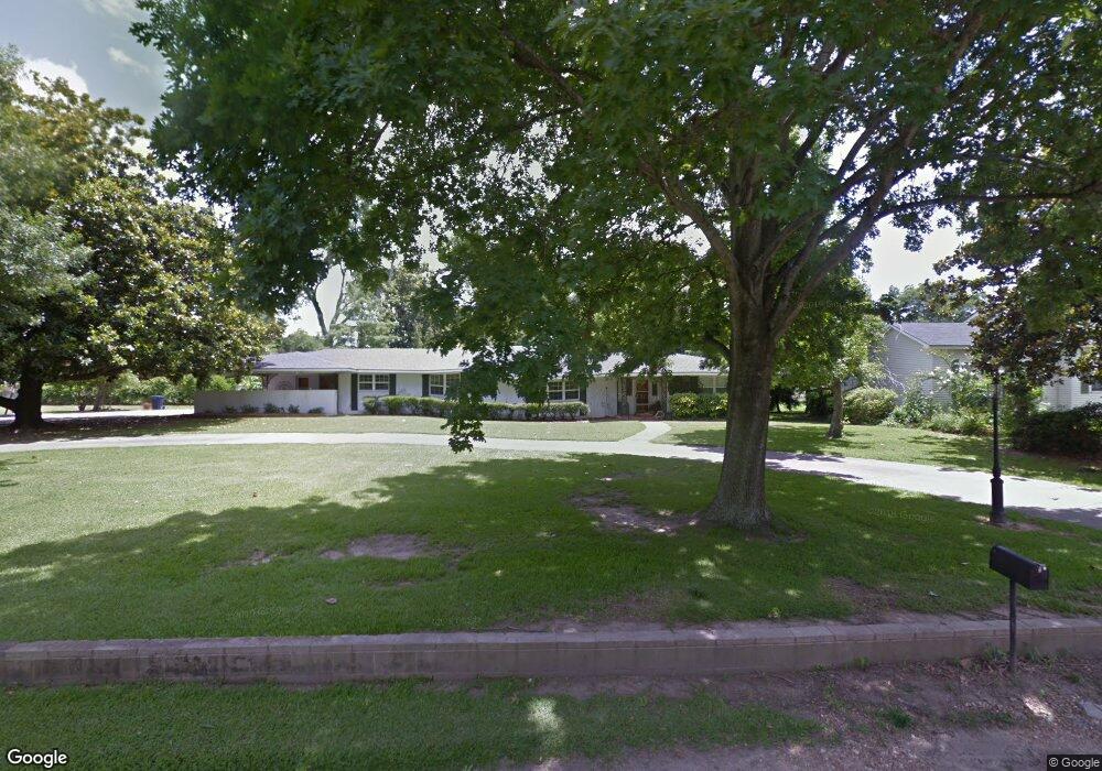
104 N Lincoln St Tallulah, LA 71282
Estimated Value: $226,000 - $364,000
--
Bed
--
Bath
--
Sq Ft
--
Built
About This Home
This home is located at 104 N Lincoln St, Tallulah, LA 71282 and is currently estimated at $292,593. 104 N Lincoln St is a home located in Madison Parish with nearby schools including Tallulah Charter School and Tallulah Academy - Delta Christian School.
Ownership History
Date
Name
Owned For
Owner Type
Purchase Details
Closed on
Jul 5, 2022
Sold by
John Rodden Jeremy and Hopkins Audrey
Bought by
Scurria Stacy and Scurria Tony
Current Estimated Value
Home Financials for this Owner
Home Financials are based on the most recent Mortgage that was taken out on this home.
Original Mortgage
$243,460
Outstanding Balance
$231,645
Interest Rate
5.1%
Mortgage Type
VA
Estimated Equity
$60,949
Purchase Details
Closed on
Jun 2, 2011
Sold by
Williams Kathryn L and Williams Wood
Bought by
Rodden Jeremy John and Rodden Audrey Hopkins
Create a Home Valuation Report for This Property
The Home Valuation Report is an in-depth analysis detailing your home's value as well as a comparison with similar homes in the area
Home Values in the Area
Average Home Value in this Area
Purchase History
| Date | Buyer | Sale Price | Title Company |
|---|---|---|---|
| Scurria Stacy | $235,000 | None Listed On Document | |
| Rodden Jeremy John | $15,000 | -- |
Source: Public Records
Mortgage History
| Date | Status | Borrower | Loan Amount |
|---|---|---|---|
| Open | Scurria Stacy | $243,460 |
Source: Public Records
Tax History Compared to Growth
Tax History
| Year | Tax Paid | Tax Assessment Tax Assessment Total Assessment is a certain percentage of the fair market value that is determined by local assessors to be the total taxable value of land and additions on the property. | Land | Improvement |
|---|---|---|---|---|
| 2024 | $2,795 | $20,450 | $1,150 | $19,300 |
| 2023 | $2,058 | $19,000 | $1,150 | $17,850 |
| 2022 | $2,632 | $19,000 | $1,150 | $17,850 |
| 2021 | $1,911 | $13,801 | $1,150 | $12,651 |
| 2020 | $1,910 | $13,801 | $1,150 | $12,651 |
| 2019 | $1,904 | $13,801 | $1,150 | $12,651 |
| 2018 | $1,917 | $13,801 | $1,150 | $12,651 |
| 2017 | $1,917 | $13,801 | $1,150 | $12,651 |
| 2016 | $1,917 | $13,801 | $1,150 | $12,651 |
| 2015 | $1,329 | $9,433 | $1,152 | $8,281 |
| 2014 | $1,313 | $9,433 | $1,152 | $8,281 |
Source: Public Records
Map
Nearby Homes
- 300 S Lincoln St
- 408 N Lincoln St
- 402 S Lincoln St
- 00 Highway 65 Unit 10.88 acres
- 0 Highway 65 Unit 5.054 acres
- 000 Highway 65
- 820 van Zelfden St
- 1200 Louisiana St
- 1204 Louisiana St
- 111 Burnside Dr
- 1504 Mississippi St
- 1222 Mississippi St
- 114 Burnside Dr
- 1104 Maple St
- 315 Garfield St
- 0 Felicia Dr Unit 14.22 acres 214011
- 0 Felicia Dr Unit 9.833 acres 214010
- 0 Felicia Dr Unit 24.05 acres
- 208 Sheri Kay St
- 105 Belle Ln
- 106 N Lincoln St
- 102 N Lincoln St
- 101 Kathan St
- 200 N Lincoln St
- 103 De Soto St
- 202 N Lincoln St
- 101 Fuqua St
- 301 N Lincoln St
- 300 N Lincoln St
- 100 Eureka St
- 300 E Bayou Dr
- 103 Rabb Ln
- 100 Rabb Ln
- 107 De Soto St
- 303 N Lincoln St
- 200 E Bayou Dr
- 302 N Lincoln St
- 103 Eureka St
- 104 Eureka St
- 305 N Lincoln St