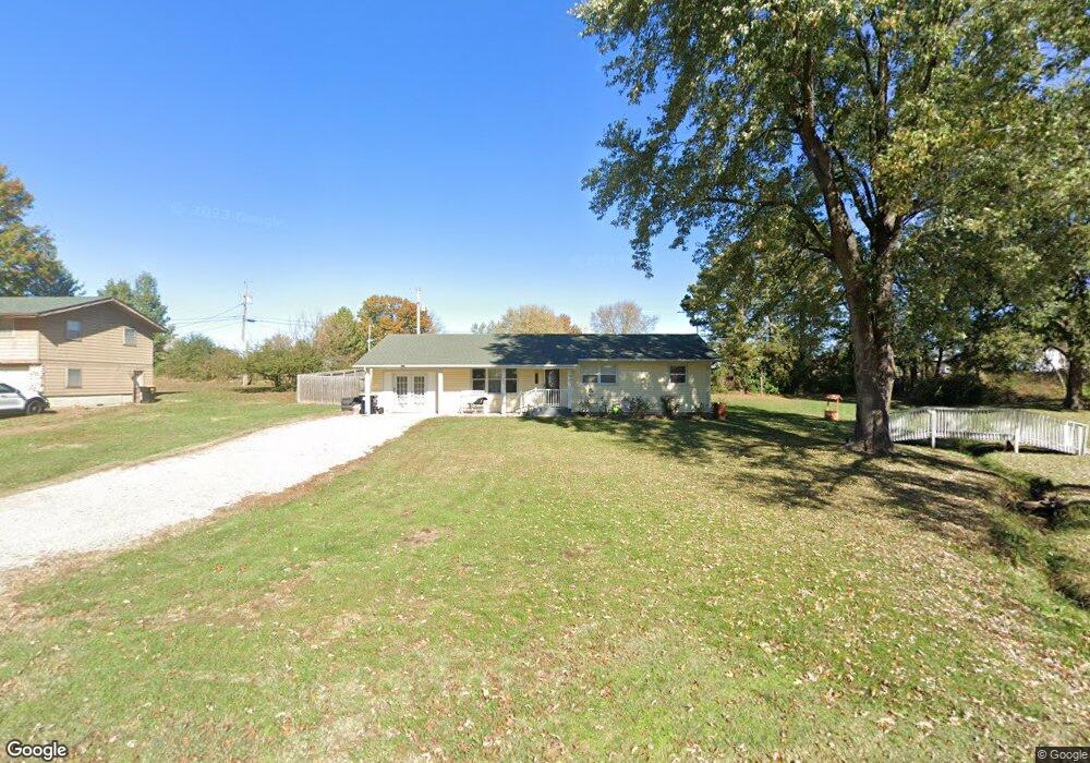
104 Northgate Dr Lebanon, MO 65536
Estimated Value: $189,618 - $216,000
3
Beds
2
Baths
1,713
Sq Ft
$118/Sq Ft
Est. Value
About This Home
This home is located at 104 Northgate Dr, Lebanon, MO 65536 and is currently estimated at $202,155, approximately $118 per square foot. 104 Northgate Dr is a home located in Laclede County with nearby schools including Joe D. Esther Elementary School, Boswell Elementary School, and Maplecrest Elementary School.
Ownership History
Date
Name
Owned For
Owner Type
Purchase Details
Closed on
Aug 16, 2013
Sold by
Bennett Teddy L and Bennett Brenda L
Bought by
Baker Kenneth E and Baker Mavis M
Current Estimated Value
Home Financials for this Owner
Home Financials are based on the most recent Mortgage that was taken out on this home.
Original Mortgage
$53,360
Outstanding Balance
$39,603
Interest Rate
4.34%
Mortgage Type
Future Advance Clause Open End Mortgage
Estimated Equity
$162,552
Create a Home Valuation Report for This Property
The Home Valuation Report is an in-depth analysis detailing your home's value as well as a comparison with similar homes in the area
Home Values in the Area
Average Home Value in this Area
Purchase History
| Date | Buyer | Sale Price | Title Company |
|---|---|---|---|
| Baker Kenneth E | -- | None Available |
Source: Public Records
Mortgage History
| Date | Status | Borrower | Loan Amount |
|---|---|---|---|
| Open | Baker Kenneth E | $53,360 |
Source: Public Records
Tax History Compared to Growth
Tax History
| Year | Tax Paid | Tax Assessment Tax Assessment Total Assessment is a certain percentage of the fair market value that is determined by local assessors to be the total taxable value of land and additions on the property. | Land | Improvement |
|---|---|---|---|---|
| 2025 | $763 | $15,050 | $0 | $0 |
| 2024 | $763 | $13,380 | $0 | $0 |
| 2023 | $786 | $13,380 | $0 | $0 |
| 2022 | $732 | $13,380 | $0 | $0 |
| 2021 | $807 | $13,376 | $2,527 | $10,849 |
| 2020 | $811 | $13,376 | $2,527 | $10,849 |
| 2019 | $776 | $13,380 | $2,530 | $10,850 |
| 2018 | $606 | $11,120 | $2,530 | $8,590 |
| 2017 | $535 | $11,120 | $0 | $0 |
| 2016 | $535 | $11,120 | $0 | $0 |
| 2015 | $535 | $11,120 | $0 | $0 |
| 2014 | $535 | $10,360 | $0 | $0 |
| 2013 | -- | $10,360 | $0 | $0 |
Source: Public Records
Map
Nearby Homes
- 231 Raef Rd
- 1540 Woodhill Dr
- 600 Hunters Creek Dr
- 605 Hunters Creek Dr
- 750 Lynn St
- 1075 Lynn St
- 100 S Bend Rd
- 328 Driftwood Dr
- 376 Sunset Dr
- 20198 Granger Ln
- 545 Woody
- 1520 Fairfield Dr
- 708 Herndon Rd
- TBD Honeysuckle Cir
- 1075 Kenoly St
- 116 Smith Rd
- 282 Brice St
- 680 Clark Ave
- 957 Wood St
- 1250 N Jefferson Ave
- 112 Northgate Dr
- 100 Northgate Dr
- 107 Northgate Dr
- 116 Northgate Dr
- 103 Northgate Dr
- 119 Northgate Dr
- 1515 Lynn St
- 108 Brook St
- 120 Northgate Dr
- 112 Brook St
- 123 Northgate Dr
- 124 Northgate Dr
- 116 Keller Dr
- 124 Keller Dr
- 116 Brook St
- 1624 Lynn St
- 127 Northgate Dr
- 132 Keller Dr
- 111 Brook St
- 107 Brook St